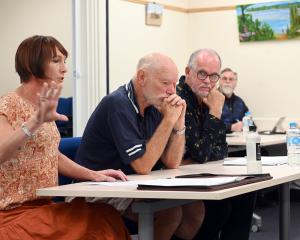
Prof Jones (80), who lives in Dunedin, spent 17 years at Otago University, including serving as assistant vice-chancellor, sciences, before retiring in 1993.
He was a key figure this week at a reunion marking the 50th anniversary of surveying at the university and the 125th anniversary of the New Zealand Institute of Surveying.
Two land information-linked conferences, including the institute's national conference, were held at the university and a reunion social event last night was named in his honour.
Prof Jones said he experienced ''very mixed'' feelings during the week, including nostalgia for previous times, pleasure in meeting old friends and surveying graduates and a sense of excitement about the future.
He was also proud of the many achievements of the Otago School of Surveying, which had long been preparing students for the growing role of geographic information systems (GIS) technology.
New Zealand was one of the most thoroughly surveyed countries in the world, and the traditional strengths of surveyors, including integrity and sound judgement over problem-solving, remained crucial for the future.
Some surveyors fear the profession could come under threat from members of the public adopting a ''do it yourself'' approach by using smartphones to photograph their property boundaries and to simultaneously call up streams of land data.
Prof Jones said he remained optimistic about the future, and said the good judgement of surveyors would not be replaced by faster, smarter devices.
Surveyors also understood about potential sources of error using any surveying approach. and realised surveying had always been heavily multidisciplinary, also requiring knowledge of the law, among other matters.
On Thursday, Land Information Minister Maurice Williamson urged surveyors to embrace the ''exciting'' world of rapid technological advances, including use of advanced electronic mapping systems.
Land Information New Zealand was already moving towards adopting such GIS mapping approaches and all Government departments were also being asked to pursue such approaches, he told the conference.
GIS combine electronic maps with many sets of other land information to create powerful new tools to improve environmental management.
Mr Williamson said tools which had already arrived included
small drone aircraft which carried out
photographic surveying and powerful GIS data available on mobile devices, including smartphones. GIS mapping
incorporated a new ''fourth dimension''- time. This enabled planners to consider, for example, the best location for a new city emergency health facility, partly by analysing city-wide traffic patterns on a 24-hour basis.
He also highlighted another dramatic revolution in three-dimensional copying, which was enabling complex pieces of equipment to be ''printed out'' in a single piece, already assembled.
This meant physical exports could now effectively be sent to the other side of the world via internet, he said.
He acknowledged in an interview that some surveyors might feel anxious about the sweeping changes ahead, but these were positive and could not be ignored or prevented.
''There's a train coming down the track.''