Otago residents are being warned to prepare for severe gales forecast to sweep the region this morning.
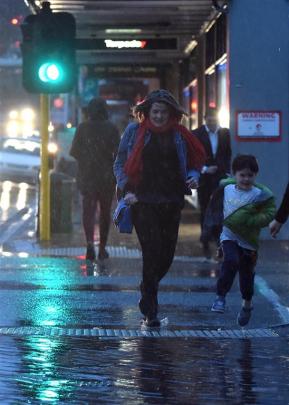
The region enjoyed a fine and warm midwinter day for most of yesterday but a late-afternoon cold snap brought on chilly winds and showers.
A cold front brought gusty winds which were expected to continue into this morning, MetService meteorologist Derek Holland said last night.
Gusts of 120kmh were expected in exposed places in the region as were showers and snow to 400m.
A cold and gusty start to the day was expected in most areas and frosts were forecast for Queenstown and Alexandra.
"We get these cold southwesterlies and the temperatures don't pick up,'' Mr Holland said.
"We're expecting a high tomorrow [in Dunedin] of about 11degC, Friday 12 and Saturday about 14.''
Showers were expected to clear before dawn and the skies would be mostly clear, in stark contrast to the darkness which descended over the region late afternoon yesterday.
Temperatures plunged between 4pm and 5pm and rain hit most of the region, with 3.2mm recorded at Dunedin International Airport and 2.4mm in Dunedin city.
Temperatures across the region should improve into the weekend, Mr Holland said.
However, by Sunday and Monday, the mercury was expected to plunge again.