Auckland is likely to be hit hard overnight by severe gales that are already causing havoc further north.
Residents in northern New Zealand are being warned to expect damage from the powerful storm bearing down on the upper part of the country.
Hurricane force winds are already battering parts of Northland, according to WeatherWatch, with reports of a boat on to rocks at Pukenui in the Far North and unconfirmed reports of a tree onto a house near Kawakawa and roofs lifting in Kaitaia.
About 4800 homes are without power in the Far North after strong winds brought down power lines across the district.
In Whangarei a tree took down a power line to Helena Bay about 9am, taking out electricity to 698 homes. The power was reconnected by 1pm, a Northpower spokesman said.
Northpower's linesmen had been sent home to rest ahead of an expected heavy workload this evening and overnight as the storm - which has brought winds of up to 160km/h in parts of the Far North - was expected to hit Whangarei from about 10pm.
Auckland Council and Civil Defence spokesman Nigel Horrocks said the storm was expected to hit Auckland after midnight and they were keeping a "watching brief" on its progress.
The New Zealand Transport Agency has reduced the speed limit on Auckland Harbour Bridge from 80km/h to 70km/h and has warned motorcyclists and drivers of high-sided vehicles to avoid the bridge altogether if possible.
Spokesman Ewart Barnsley said gusts of more than 60km/h had been recorded on the bridge today, with the wind forecast to get stronger overnight.
"We would urge people to travel only if they have to and, particularly on motorway lanes, to be aware of the vehicles around them because of the impact wind gusts might have on vehicle stability, and to lower their speed," Mr Barnsley said.
In rural parts of the country, especially during the night in Auckland, Northland and areas that were not as well lit as motorways, motorists should be aware of fallen trees and branches.
No roads were closed at present but the NZTA was monitoring its networks around the clock and staff were on standby in case they were needed.
"As in the city, in the rural areas that same caution applies in terms of lowering speed and expecting the unexpected," Mr Barnsley said.
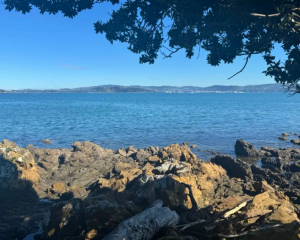
The Royal New Zealand Yacht Squadron this afternoon tweeted an image of choppy seas in Auckland Harbour, with the warning "Conditions worsening at RNZYS - Gusting 40 knots E. Stay off the water!"
Auckland Civil Defence also tweeted a picture of the sea from Takapuna, saying "Conditions getting pretty choppy out in the Gulf. Forecast to worsen as winds strengthen."
WeatherWatch said a low near northern New Zealand and a strong high to its southeast were creating a squash zone of severe gales over the upper North Island.
Head weather analyst Philip Duncan said winds would reach gale force more often this afternoon in Northland and Auckland and intensify during the night.
"It's going to be a very windy night for some parts of Northland, Auckland, Coromandel Peninsula and Eastern Waikato as this belt of gales moves slowly south".
The worst of the winds would stall over the Auckland and Northland regions tomorrow, with the highest winds expected somewhere between Whangarei and Auckland's northern suburbs.
"Great Barrier Island, all of Coromandel Peninsula but especially the northern half, and those near the western Kaimai Ranges will also be exposed to damaging wind gusts either tonight or on Wednesday".
WeatherWatch.co.nz said gusts may exceed 140km/h at some remote weather stations but most populated places in the firing line would face gusts between 100km/h and 130km/h.
"On top of the recent heavy rains in northern New Zealand the soil is saturated and strong winds may topple trees easier" Mr Duncan said.
"This may also lead to further isolated power cuts and hot water cuts".
The wet, windy, nor'easter had similarites to the system that ramped up last minute and caused wind damage last month.
"No two systems are exactly the same and this isn't a carbon copy of the June nor'easter - but it is similar and so we have similar advisories in place: Watch for very localised but heavy downpours and winds hovering around damage threshold from eastern Waikato northwards".
The Fire Service is working with other emergency agencies to prepare for the impact of the storm.
A taskforce of 16 personnel, two fire appliances, a lighting rig and four-wheel drive vehicle was sent to Northland to support the local brigades and stations, the Fire Service said.
Region manager Assistant National Commander Brian Butt said parts of Northland were often cut off by floods at Kawakawa and in the Waipu-Ruakaka area.
"We are travelling up now while it is safe and in daylight, to get ahead of the weather."
The appliances would be put where they were most needed and would be crewed around the clock by volunteer and professional personnel from Auckland and Northland.
Mr Butt said the Fire Service was working closely with Civil Defence and other emergency services to assemble resources and work on contingency plans for both Auckland and Northland