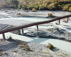
Storm-battered residents are bracing themselves for more wet weather as the clean-up continues in full-force on the east coast of the North Island.
A loitering weather system has brought torrential rain to Gisborne and the Hawkes Bay this week, with the deluge flooding properties, causing slips and closing roads.
And there is more rain on the radar through to Sunday, but it is expected to gradually ease off, MetService meteorologist Rob Kerr said.
Parts of the Hawkes Bay had seen 120mm to 150mm of rain in the past 24 hours while areas of Gisborne had clocked up to 84mm, he said.
"They've had the worst of the rain...but it's more the persistence, it's an already-saturated region. We're not expecting any kind of persistent heavy rain like they've had, it is an easing trend, but it is going to keep going.
"The situation is very slow moving so we're still going to get that southeast flow pushing rain at times onto that region right through to late Sunday, really."
Flooding closed three stretches of state highways in the North Island yesterday, including State Highway 56 from Opiki to Palmerston North, State Highway 2 between Wairoa and Napier and the Napier-Taupo Rd (SH5).
A slip also forced rural Maniatutu Rd between Otaramarae and Pongakawa to close.
Massive amounts of rain and rapidly rising rivers also forced the the Moutoa floodgates to open yesterday. The gates were expected to stay open for at least 24 hours.
Other rivers in the region were expected to reach levels seen in the June floods - with farmers saying it would cost them in repairs and animal feed but no livestock had been lost so far because of early warnings.
Water levels should recede throughout today but were expected to be high for the rest of the week.
Pakowhai Regional Park near Hastings, was closed yesterday in case emergency refuge was needed for cattle grazing the Ngaruroro River berms.
Motorists using Hawke's Bay highways should expect delays for some time as clean-up crews clear a series of slips and drop-outs along the network.
A severe weather watch was in place for Hawkes Bay last night, with heavy rain expected to continue through to the afternoon. However the heaviest rain was forecast to ease and move north to Gisborne today.
Mr Kerr said the persistent rain was being caused by a broad ridge sitting to the south, along with an area of low pressure to the northeast which was pushing the southeast flow across much of New Zealand.
He said the ridge in the south would slide over the South Island by Saturday and bring calmer, more settled weather.
Auckland was in store for showers and possible rain today but Saturday should clear up before more spots of rain arrive on Sunday, he said.
"The east coast of the North Island will catch the brunt of all that rain and it'll clear up for many other parts of the North Island over the weekend...with the southeast flow New Zealand is really exposed in this direction, and the focus of that has been in the North Island."
Weather Watch head analyst Philip Duncan said the week-long rain event was not yet over.
Eastern areas for both islands should get further rain top-ups, which might be bad news for the hard-hit regions but was good news for some farmers, he said.
He said the easing rain might "flare back up" in the next few days for some regions.
"By the end of next week we are in October and by then the westerlies should be returning, making for drier, sunnier and warmer weather in the east of New Zealand.
"[It's] a great recipe for grass growth following the rain," he said.


