
The latest climate outlook, released by the National Institute of Water and Atmosphere this afternoon, reported it was now "virtually certain" - a 99 per cent chance - that El Nino conditions would continue over the next three months.
By many measures, the current event was tracking close to the 1997/98 El Nino - the strongest since 1950 - and was expected to intensify further over the next three months.
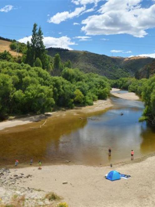
In New Zealand, the ocean-driven system typically brings cooler, wetter conditions, bringing higher rainfall to regions that are normally wet, and often drought to areas that are usually dry.
Farmers in the western, wetter parts of the country often faced significant damage to pastures from too much rainfall, and it was also harder for stock to thrive in the constant wet.
Those in the east, faced with dry conditions, needed to consider food availability for stock.
The severe drought caused by the 1997/98 El Nino was later estimated by the New Zealand Institute of Economic Research to have caused a loss to agriculture of $618 million - or close to one per cent - to GDP.
Over the next three months, NIWA said, above normal pressure was forecast to the north and west of New Zealand, while below normal pressure was expected to the east and south of the country.
This circulation pattern was likely to be accompanied by anomalous southwesterly wind flows - a signature of El Nino conditions.
Based on what happened in three biggest El Nino events since 1950 - 1972/73, 1982/83 and 1997/98 - the elevated risk for drought for parts of New Zealand was anticipated later during summer, in particular for eastern parts of both islands as well as northern areas of the North Island.
NIWA forecaster Chris Brandolino said El Nino systems accounted for around a quarter of climate and rainfall variability, "but when you get into these really intense El Ninos, they really tend to be in a class of their own".
"Because of that, we looked at the top three intense El Ninos since 1950, and they provided a much more profound impact in terms of rainfall deficit."
Federated Farmers vice president Anders Crofoot said the situation had increasingly become a hot topic among farmers.
Farmers were already looking at their options to prepare themselves, such as cutting stock numbers and, in some cases, putting summer crops in.
Mr Crofoot expected a severe El Nino would be particularly tough for dairy farmers who had already been hit by a low payout.
"A lot of them have already taken the opportunity to reduce their herd numbers, although the price of beef is still quite good, so they might not be taking too much of a hit if they cull their poorer producers."
Meanwhile, temperatures between now and December were about equally likely to be near average or below average for the whole of the country, while cold snaps and frosts can still be expected from time to time in spring in some parts.
Rainfall was about equally likely to be in the near normal or below normal ranges in the north and east of the North Island, and about equally likely to be in the near normal or below normal ranges in the north of the South Island.
Near normal rainfall was the most likely outcome for the west of the North Island, while seasonal rainfall in the west of the South Island was about equally likely to be in the near normal or above normal ranges.
Soil moisture levels were most likely to be near normal or below normal in the north and east of North Island, and equally likely to be near normal or below normal in the east of the South Island.
In the western regions of both Islands as well as the north of the South Island, soil moisture levels were most likely to be in the near normal range.
The 1997/98 El Nino
• Is generally regarded as one of the worst El Nino-Southern Oscillation events in history, causing widespread drought, flooding and other natural disasters around the world.
• In New Zealand, it was much drier than normal in the east from July 1997 onwards, with drought areas particularly pronounced from the Bay of Plenty down to Canterbury over the following summer.
• In late April 1998, the Ministry of Agriculture and Forestry estimated the likely cost of the drought on farmgate returns would be $256 million for the year ending June 30 1998, and $169 million for the following year, giving a total of $425 million.
• Given the impact on downstream value-added agricultural production, the likely total cost to the country was likely to be in excess of $1 billion.


