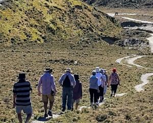


Whether you're on foot this summer or on two wheels, Queenstown and its surrounds provide tracks for all fitness levels. Otago Daily Times reporter Olivia Caldwell, in Queenstown, has supplied an A-Z guide on the area's biggest, best and hidden tracks to try out this summer.
Arawata Bridle Track.
Time: 45 mins
This track starts on the bend of Arawata Tce and travels to the Glenorchy road near 5 Mile Creek. It is part of the original bridle trail from Queenstown to Glenorchy so it has a bit of a historic feel to it with beautiful views of Lake Wakatipu. Some of the rock formations are often used by climbers and there are some good technical descents for mountain bikers.
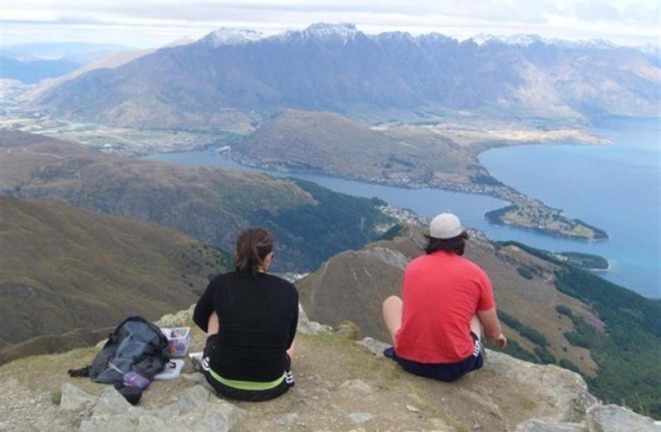
Ben Lomond Track
Time: 3-4 hr return to Ben Lomond Saddle, 6-8 hr to return to Ben Lomond Summit.
This track has such a great view I took my 56-year-old mother up for Christmas lunch. Trust me, the ham sandwiches were needed by the time we got to the top. This is a decent slog.
The track is well laid out and you don't have to fight with any wild plant life along the way. The views from the saddle are breathtaking and if you are super-keen it is so worth making the extra hour and a-half journey to the top. The first time I did this was on New Year's Day 2010 and it inspired me and two friends to form a rugby lineout at the top - simply awe-inspiring.
Cascade Saddle Route
Time: 1-2 days (17km)
This is one for the more experienced walker and will take a bit more time to do. It is between the West Matukituki and the Dart Valleys, but does not pass the saddle itself. However, it does pass within a short distance of it.
The tracks starts at Raspberry Creek, 54km from Wanaka, and from there you walk alongside the Matukituki River to reach an alpine-style stone hut and one of the best views of Mt Aspiring.
From the hut the track runs through beech forest and it is very steep climbing to reach the saddle, but when you get there, below is ''Heads Leap'' - a 1000m sheer rock face, Dart Glacier and the dominating Mt Aspiring.
Devils Creek Track
Time: 5-6 hours (walking)
This is one for the walkers, runners and mountain bikers. Starting on Coronet Peak Rd, this is a great way to see Skippers Canyon without a windscreen in front of you. It's not easy, but it's a track you can take your time on and take a packed lunch for halfway or all the way in. You get a great view of the Wakatipu Basin on this track.
Terrain varies, beginning in tussock grassland, becoming steeper towards the saddle then moving through bluffs before heading into Devils Creek and stands of grey shrublands. If you are on the bike, prepare for the steep climb up to Mt Dewar followed by the fun descent to Devil's Creek. The climb out of Devil's Creek is steep and technical.
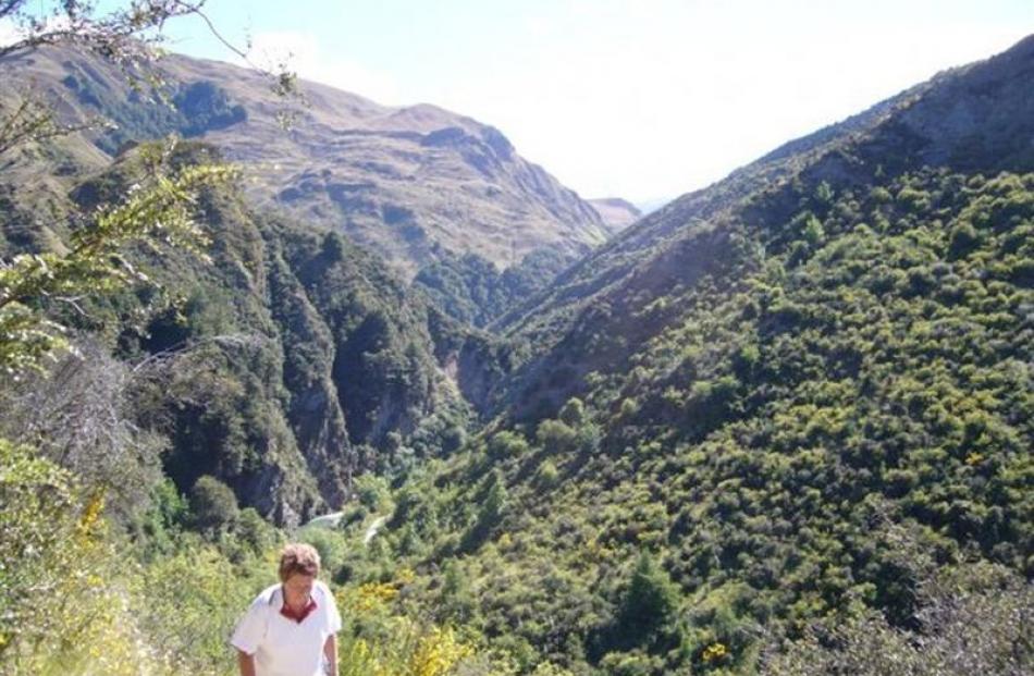
Earnslaw Burn Track
Time: 4-5 hours
This is a track you can start and complete on the spur of the moment. There is no real preparation required, just a banana, a chocolate bar and a decent level of fitness. It is possible to run, for those with energy.
Twenty minutes outside Glenorchy the track begins on gravel, but you soon find you are on medium-level climb through bush and tussock. It is well laid out and there is no getting lost.
At the top you can view an icefall on Mt Earnslaw/Pikirakatahi.
River crossing and route-finding experience is advised.
Fernhill One Mile Track
Time: 3-4 hours
If you want to get well above Queenstown, this is a great walk to take.
Another one of those pleasant walks, offering a mixture of exotic and beech forest, with alpine tussocklands at the highest sections.
Historically, parts of the track were established to help harvest beech trees to fuel the steamer Earnslaw. The portion of the track closest to Fernhill is steep, but the remainder of it is gradual and undulating.
Glacier Burn track
Time: 2-4 hours
Similar to the Earnslaw Burn Track, you do not need days of preparation for this, just a car to get there and a decent pair of walking shoes. The track begins on the Queenstown side of Kinloch and is a gradual climb to one of the best views of Lake Wakatipu I have found.
It is well marked and the track is made of only the soft forest floor and logs. Two hours into the walk you reach Glacier Basin. From there you can follow the creek further up to view the Humboldt Mountains. This is one of the best short walks I have done, as my friend and I passed only one other walker and felt a million miles away from everyday life.
Hollyford Track
Time: 4 days
It is not really Queenstown, but if you're travelling Fiordland way over summer this 56km of beauty is a must.
Beginning at the end of Lower Hollyford Rd, the track follows the Hollyford River towards the sea. I have not actually done this one myself, but they say the diversity of vegetation and wildlife along the valley is unparalleled.
During the walk you can see Fiordland's two highest peaks, Mount Tutoko (2746m) and Mount Madeline (2537m), as well as the roaring cascade of Hidden Falls, which emerges from a hanging valley through a narrow chasm of granite.
I
I searched for walks beginning with the letter I to no avail. So make this day about Investigating and proving me wrong.
Time: This will be time-consuming, be assured.
Jack's Point Track
Time: 2 hours (walking)
There is no wonder Jack's Point Golf Course is the best in the South Island .
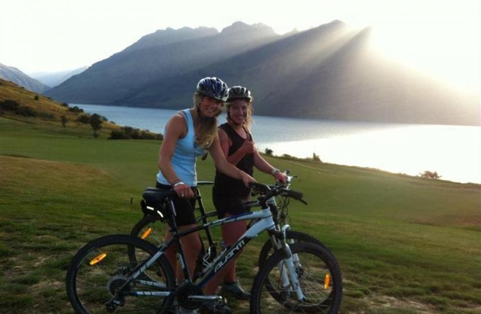
The views of the Remarkables and Lake Wakatipu are second to none. This bike ride never gets old for me as it has just the right amount of climbs and descents to reward yourself with a ginger beer at the clubhouse on arrival. If you're biking, I would suggest riding in from the Kelvin Heights end and out using the highway, as it is a steady downhill glide towards the Kawarau bridge.
Kea Basin Track
Time: 4-5 hours
This one is all about the view. To get there you travel to the end of the Rees Valley Rd, 30 minutes from Glenorchy on gravel roads.
River-crossing experience is essential and in wet weather the current can become quite swift.
It takes half a day to climb to the subalpine tussock basin beneath Mt Earnslaw/Pikirakatahi on a zigzag track which starts on the low terrace north of Lennox Falls.
Half way up is the Earnslaw Hut, which has four bunks to stay in. There is a rock bivvy just above the bush-line and the views up the Rees Valley towards Rees Saddle is just stunning.
Lake Hayes Walkaway
Time: 1.5 hours (walking)
Of all the ''lake'' walks this is one I hold dearest. For seven years I have been running, biking and walking this track and I still love it. On a still day the lake reflects its surroundings and you see double of what I think is the finest spot in the area. Autumn is definitely the prettiest time, but if you can bear the cold I would suggest a winter run. This summer, get on your bike because you can whip around this track in less that 30 minutes, so there is time to take the track clockwise and anticlockwise before you head underwater for a dip.
Coming a close second is the Lake Alta track to a glacial lake at the top of the Remarkables. It provides one of the best views in a 1.5-hour return trip.
Moke Lake Loop track
Time: 2-3 hours
After doing a half marathon and a triathlon at this lake last summer, I have fond memories of this place - truly. The water is cold, but warm enough for swimming - although it would have been better had I worn a wetsuit. The 8km loop is around the lake a great run or bike ride. It is suitable for all fitness types and recommended for visitors, as it is close to town.
North Borland Track
Time: 6-8 hours
Again I had to look further than Queenstown to find a decent walk starting with N, but this is well worth the search.
This is one for experienced trampers and runs up the Borland Valley, starting at Monowai, Fiordland. During the walk you will find limestone in places, a hut, and access for experienced trampers to Mt Titiroa or the Garnock Burn and Manapouri. The track climbs steeply above a gorge to a clearing where Mt Titiroa may be seen to the northeast.
One Mile Creek walk
Time: 1 hour
This starts from the top of town and leads you around Queenstown's beech forest. The track is home to native birds such as the bellbird, tui, fantail and tomtit. The track, which is steep in parts, follows an old pipeline up to One Mile dam, one of New Zealand's first hydro-electric power developments. You pass the old powerhouse and several interpretation panels at the foot of the hill.
Pearl Harbour to Hope Arm Track
Time: 4-6 hours
This walk near Manapouri is only 7.8km, so with an estimated time of 4-6 hours you can assume this is a technical walk for experienced trampers.
The track follows close to the edge of Lake Manapouri a few times and there are some unofficial tracks leading to the lake itself. This track was made for hunters, as there are great camping spots and excellent hunting areas here.
Queenstown Hill
Time: 3-hour return
As an Arrowtowner, I don't understand it, but this is Queenstown's favourite walk.
It is a 500m climb through pine forest to the summit of Te Tapu-nui and the reward is the view of Queenstown below. From here you also get a 360deg panorama of the Remarkables Range, upper Kawarau River, Cecil Peak, the Frankton and South arms of Lake Wakatipu and Queenstown Bay.
If you are visiting, this walk is a must, they say. I have yet to do it.
Routeburn Track
Time: 3 days
You were probably wondering when this list would hurl up a longer walk.
People come from all around the world to do this one, and there's good reason for that. The peace, the time out and the feeling of accomplishment is something visitors love writing home about.
This 32km track is one of the Great Walks of the area and weaves through beech-forest valleys and alongside clear green rivers, alpine lakes and offers breathtaking views from a mountain pass. You will feel close to nature as you cross New Zealand's Southern Alps and enjoy the landscapes of Mt Aspiring National Park and Fiordland National Park.
Sawpit Gully walk
Time: 1.5 hours (walking)
This one is another favourite of mine. You can attempt to bike it, but the steep climbs mean you will have to get off and push, so I prefer to run it in the height of summer to provide a real mental and physical challenge, because it never gets easy.
This walk starts at Arrowtown by the Arrow River and is about 10km.
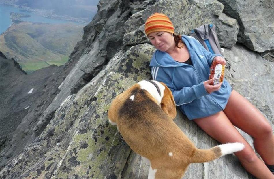
From the top you get the most amazing view of Arrowtown, Lake Hayes and both Coronet Peak and the Remarkables. Dogs are not allowed on this track, so you'll have to leave Spot at home.
Tobins Hill
Time: 25min
Short and sweet. I'm biased, but I proclaim that at the top of this hill you will find the best view of the land and all you have to do is walk, bike, run or ride your pony 2km uphill.
The second-best part, next to the view, is the quick bike or run down. The challenge is always to beat your last time. Anyone bettered my 10-minute running record?The outlook from front to back is Arrowtown, Michael Hill's golf course, Millbrook, Lake Hayes, Jardine Hill, Remarkables, Coronet Peak and the edge of Lake Wakatipu. The hills block out Queenstown itself, but if you want a view of the resort refer to the Queenstown Hill walk above.
Uptown Queenstown. Turns out the letter U stands a for an ideal day to shop and eat out.
Visitor Centre to Upukerora River Track
Time: 3 hours
I spent my last birthday doing this walk with a friend on a beautiful summer's day, Lake Te Anau never looked better. It's an easy one for all fitness types and you can take the bike, the dog or the family along.
If you are down that way, take the lakeside track and you will have views across Lake Te Anau to the Murchison Mountains and Fiordland National Park.
Wentworth Track
Time: 5-6 hours to the end, full day return.
Beginning at the Coal Pit Saddle Rd car park (reached off SH6), it's a high-altitude walk suitable for a summer's day only. Even then snow can still be present.
This is a mountain biker's paradise and a must if you're bringing your bike to Central for summer.
The track starts with a descent from Coal Pit Saddle into Doolans Creek's right branch. It then takes you through the Wentworth Conservation Area for views of the Pisa and Old Woman Ranges and Nevis Bluff. The track continues along the ridge, providing access to the alpine basins of the Doolan Creek catchment and the back of the Remarkables.
Xtreme
Time: No limit
Walks starting with X do not seem to exist, so I invite walkers to do something extreme like a trip on the Earnslaw ...
Your time
Choose whatever you wish to do on this day, because you will need a day of rest after the extreme activity of some of the options outlined.
Ziptrek
No walk start with a Z, so the Ziptrek flying fox gets a shout out here. Give it a go. They say it's fun.