Coastal erosion could undermine flood banks and roads in the lower Clutha within three decades, an Otago Regional Council report warns.
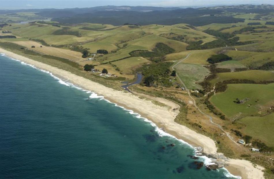
A study of the coast from Nugget Point to Chrystalls Beach (near Toko Mouth), in South Otago, showed at the historical and present rate of erosion the Lower Clutha Flood Protection and Drainage Scheme flood banks could be affected by erosion in less than 30 years.
Council chairman Stephen Woodhead said with such significant erosion it would only take a high tide to go over the banks, so in the longer term issues such as sea-level rise would have a more significant impact.
''It is something the community and our organisation needs to get its head around.''
Council natural hazards manager Michael Goldsmith said the findings of the report presented to the council's technical committee recently, set a baseline for future coastal management of the area.
The work was done as part of a condition of Contact Energy's consent for the Roxburgh Dam.
When the dam consent was renewed in 2001 there was disagreement over the primary cause of coastal erosion at Molyneux Bay but a condition requiring Contact to pay 50% of the cost of a coastal management programme was put in place by the hearing committee.
So the council had assessed the changes in the shoreline between Nugget Point and Chrystalls Beach between 1946 and 2012 using historical aerial photographs and field observations.
It found from 1946 to 2012, the vegetated shoreline eroded at an average rate of 3.3m a year between Kaka Point and the Koau Mouth of the Clutha River.
The average rate of erosion decreased between the Koau and Matau mouths of the river to 0.2m per year and then switched to a gain of 2.3m per year at Measly Beach (south of Toko Mouth) and 0.8m per year at Chrystalls Beach (north of Toko Mouth).
''If the trend of retreat continues for the coastline between Kaka Point and the Koau Mouth of the Clutha River, there will be a number of implications for the Lower Clutha Flooding and Drainage Scheme and Clutha District Council assets, including reduced drainage capacity and erosion of roads,'' the report said.
Council engineering, hazards and science director Gavin Palmer said the rate of retreat was quite significant and a project looking into the implications of it on the flood protection scheme and what mitigation measures might be needed would be factored into next year's long-term planning.
Between Nugget Point and Kaka Point, a build-up of the foredune and an increase in sand volume occurred between 2004 and 2013.
Further north, a general retreat of the foredune occurred between Kaka Point and the Matau Mouth during this same period while limited change in the dune profile had occurred between the Matau Mouth and Chrystalls Beach.