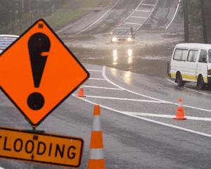
In contrast to May, when vigorous weather systems brought heavy rain to the region from time to time, the weather systems in June, with the exception of June 9-15, were much weaker and drier.
During that period, a trough of low pressure in the Tasman Sea brought a series of northwesterly quarter fronts and rain to the west for several days and once the trough moved east of New Zealand, a very cold southerly airstream brought widespread snow to much of the region, especially in the east, he said.
Half the days in June were dominated by high pressure systems, which brought dry but often cloudy weather.
At Hawea Flat, the rainfall total for June was the lowest since June 1997 while at Queenstown, the total was the third lowest for June since 1878, and one farmer reported the head of Lake Hawea had ice on it.
In North Otago, well below average rainfall figures were recorded.
Total falls at the indicator sites (average monthly totals in brackets) were:
Tara Hills 11mm (48mm), 77% below average; Waikoura 8mm (40mm), 79% below average; Oamaru Airport 10mm (40mm), 74% below average; Oamaru town 8mm (27mm), 71% below average; Kauru the Dasher 12mm (58mm), 79% below average; Islay Downs 7mm (44mm), 84% below average; Palmerston 9mm (50mm), 82% below average.
Despite the low rainfall figures, recorded river flows were close to or above their long-term averages. Rivers began the month with above-average flows due to the very wet conditions in May and some rose to above-average levels about June 13-15, but otherwise flows slowly declined to below average as the month progressed.
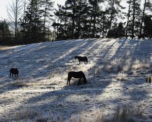
Farmers reported a very cold June, with some heavy frosts. In Central Otago, June was a very dry month and at one rain-gauge (Ranfurly), no rain was recorded.
Total falls during June were:
Lindis Crossing 12mm (average 42mm), 72% below average; Cromwell 6mm (27mm), 79% below average; Alexandra 3mm (23mm), 89% below average; Hills Creek 2mm (37mm), 95% below average; Merino Ridges 5mm (28mm), 84% below average; Ranfurly 0mm (29mm), 100% below average; Tima 8mm (49mm), 85% below average.
The only significant fall was 11mm at Lindis Crossing on June 8.
River flows were above or well above their long-term averages, mainly because of May's persistent heavy rain and the lack of drying winds in June. Flows were close to or just below average by the end of the month.
In Lakes Wanaka, Wakatipu, and Hawea and surrounding areas, well-below-average rainfall figures were recorded.
Total falls were:
Makarora Station 117mm (172mm), 32% below average; Hunter Valley Station 44mm (109mm), 59% below average; Glenfinnan 85mm (187mm), 54% below average; Hawea Flat 19mm (55mm), 66% below average; Routeburn Station 53mm (204mm), 74% below average; Queenstown 12mm (67mm), 83% below average. Halfway Bay recorded 18mm for the month.
The heaviest falls occurred between June 9-11: Makarora Station 83mm, Hunter Valley Station 38mm, Glenfinnan (Matukituki Valley) 72mm, Routeburn 39mm.
River flows were generally below their long-term averages and steadily declined further during the month.
The levels of Lakes Wanaka and Wakatipu began the month at 277.53m and 310.16m above sea level, both about 0.3m above average. In general, both lakes levels slowly declined during the month and by June 30, Wanaka was at 276.76m, 0.45m below average, and Wakatipu's level was 309.56m, about 0.3m below average.
Lake Hawea began the month just 0.34m below full. Contact Energy gradually increased its outflow to maximum by June 17 and the lake level had fallen from 345.66m to 343.93m by the end of June. The minimum level for this lake is set at 338m.
In Strath Taieri, Lower Taieri and Dunedin, low to very low rainfall totals were recorded. Total monthly falls were:
Garthmyl Middlemarch 3mm (31mm), 90% below average; Musselburgh Dunedin 17mm (68mm), 76% below average; Lee Flat 22mm (63mm), 65% below average; Maungatua 18mm (64mm), 72% below average; Dunedin Airport 13mm (49mm), 75% below average; Pine Hill 31mm (62mm), 51% below average; Sullivans Dam 46mm (105mm), 56% below average.
Other rain gauge totals included Ross Creek, 29mm, and Southern Reservoir, 18mm.
River flows were still above their long-term averages in spite of the lack of rainfall. because flows were well above their long term averages due to the heavy rain in May and the lack of drying winds and sunshine. Flows gradually declined during the month.
In South and West Otago like the rest of Otago, conditions were quite dry with rainfall totals all being below to well below average for the month.
Total falls were:
Tuapeka Mouth 24mm (57mm), 58% below average; Balclutha 21mm (62mm), 67% below average; Slopedown 72mm (114mm), 53% below average; Clarks Flat 35mm (75mm), 53% below average; Moa Flat 11mm (69mm), 85% below average.
A few significant falls occurred, mainly at Slopedown, southwest of Clinton - 17mm fell on June 4, 23mm on June 14 and 18mm on June 16. Clarks Flat recorded 12mm on June 17.
River flows were above average mainly due to the heavy and persistent rain in May and the lack of drying winds in June. By the end of the month, most flows had declined to about or below their long-term averages.


