And after quick showers to make us feel human again, we all dive into the old green family 1973 Holden Statesman and head off into the long Southland summer twilight toward the Catlins.
The area is on the back doorstep of my childhood stamping ground and many a weekend was spent there as a boy.
Whether it be a taste for history, beautiful scenery, bush walks or just plain salt air, there is more than one good reason to stop at Fortrose - the gateway to the Catlins.
It's about 35 minutes drive southeast of Invercargill and situated at the mouth of the Mataura River - a good site for seasoned fishermen and whitebaiters.
It is one of Southland's earliest European settlements, with records dating from 1834, when whalers established a station.
The name Fortrose appears to have been attributed to a Scottish drover from Inverness-Shire, near Fortrose, in Scotland, who claimed the area was similar to the Scottish Fortrose.
The settlement became a busy port from which grain, wool and logs were exported.
A 70m-long jetty was built in 1875 and a goods shed was built to accommodate the demand.
Several hotels and two boarding houses were also built.
But in 1899, Fortrose faded into the shadows of history when the Waimahaka railway line opened.
It connected the area with Invercargill, bringing an end to the boom times.
These days, Fortrose is a quaint little village, surrounded by walking tracks with boating, fishing, golfing and camping facilities.
The only remaining relic of the past is the site of the smithy - once a busy blacksmith's shop - and the Fortrose cemetery, the earliest European cemetery in the area with the first burial being in 1873.
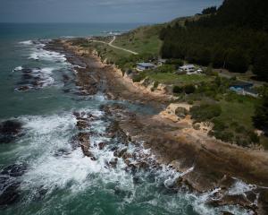
A 10 minute drive further into the Catlins is Waipapa Point, the scene of one of New Zealand's worst shipping disasters.
In April 1881, the passenger steamer SS Tararua struck Otara Reef off Waipapa Point, enroute from Port Chalmers to Melbourne via Bluff.
All but 20 of the 151 people aboard died.
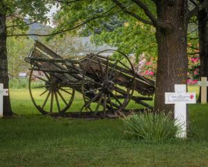
Just 300m from the main road is the "Tararua Acre", where 55 of the bodies recovered from the wreck are buried.
Three gravestones and a memorial plinth remain.
A lighthouse was built on the point in response to the tragedy. It began operating in 1884 and is one of the last two wooden lighthouses in New Zealand.
It is still active, and was automated in 1976.
Waipapa Point has a lagoon with warm, sheltered and shallow water - ideal for families with young children.
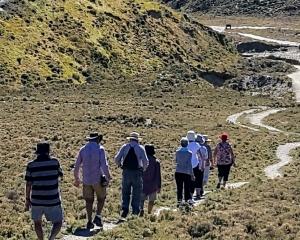
Another 10 minutes southeast of Waipapa Point is Slope Point - the most southerly point of the South Island.
Aside from an AA signpost, which shows the distance to the Equator and the South Pole, there is little sign of civilisation.
Just sheep.
Slope Point can only be reached on foot - a 20 minute walk following dilapidated yellow markers.
A short distance further along the coast is Curio Bay, where remnants of a 180 million-year-old petrified forest can be found.
Curio Bay also has a popular camping ground and visitors will find the best of every world - rivers, waterfalls, beaches and wildlife encounters.
Just around the corner at Porpoise Bay, pods of rare Hector's Dolphins can often be seen playing in the surf.
Who said the South was dull?