
It is a map that should look vaguely familiar to the people of Warrington.
The pupils of Warrington School, north of Dunedin, have spent the past term working with artist Juliet Novena Sorrel using drawing and map-making skills to explore and record parts of their environment.
The final product is a 4m x 2m "vision map" which incorporates a picture by each pupil, and provides glimpses of special places and features of Warrington and Blueskin Bay.
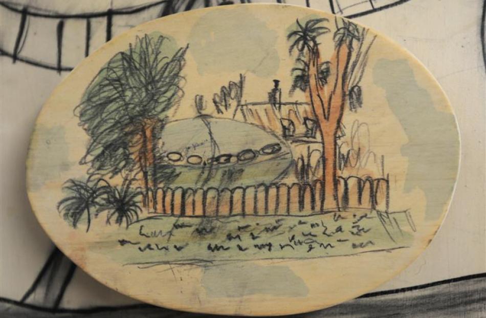
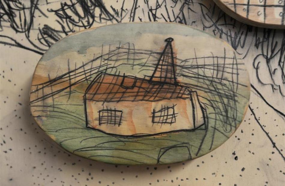
It includes roads, railway lines, trees, fences, wildlife, rocks, sandy footprints, prominent houses, such as the "spaceship house", and even the water fountain in pupil Casey Ireland's grandmother's front garden.
Otago Polytechnic School of Art student Ms Novena Sorrel said the map was detailed, but not geographically to scale.
"It's so not a Google map. But it has lots of personality.
"The map is their vision of Warrington - the way they see it.
"It's a unique vision of places seen through the eyes of children," she said.
Ms Novena Sorrel said she facilitated the project as part of research for her master of fine arts degree.
"Both the children and I learned a lot about drawing and it has been fun working with the whole school," she said.
The project was placed on a corridor wall at the school and officially unveiled on Wednesday.