MetService is warning of heavy rain and strong winds for most of the South Island.
Winds are set to buffet Otago, Clutha, Southland, Fiordland and Stewart Island from today until early tomorrow.
For Otago from 1pm today until 3am tomorrow, northwest winds may approach severe gale in exposed places at times. For the rest, winds may become severe from 9am today until 1am tomorrow.
Strong winds of up to 120kmh have been forecast for the Canterbury high country from 6pm today until 11am tomorrow. Gusts could damage trees, powerlines and unsecured structures. Driving may be hazardous, especially for high-sided vehicles and motorcycles.
Meanwhile, a heavy rain warning is in place for the headwaters of the Otago lakes and rivers. Between 1pm today and 4am tomorrow, up to 150mm of rain may fall near the divide, with peak intensities of 15mm-25mm an hour.
A heavy rain warning is also in place for Fiordland, north of Breaksea Sound. Between 9am today and 3am tomorrow, up to 200mm is expected to accumulate.
In Fiordland and the headwaters of the Otago lakes and rivers, heavy rain may cause streams and rivers to rise rapidly. Surface flooding and slips are also possible and driving conditions may be hazardous.
Heavy rain is also forecast for Westland about and south of Otira from 1pm today until 10am tomorrow. Expect 180mm to 240mm of rain to accumulate about the ranges, and 90mm to 130mm near the coast.
For Westland north of Otira, the ranges of Nelson west of Takaka and Buller, expect 70mm to 100mm of rain about the ranges, with up to 70mm possible near the coast between 3am and 3pm tomorrow.
For the Canterbury headwaters and south of Arthur's Pass, expect 130mm to 180mm to accumulate near the divide from 9pm today until 10am tomorrow.
MILFORD ROAD TO CLOSE
The Milford Road is to close this afternoon, as warm rain is set to increase the risk of an avalanche.
State Highway 94 will be shut from the Hollyford Junction at 2pm and from the Chasm at 2.30pm as warm rain was forecast to fall on snow fields.
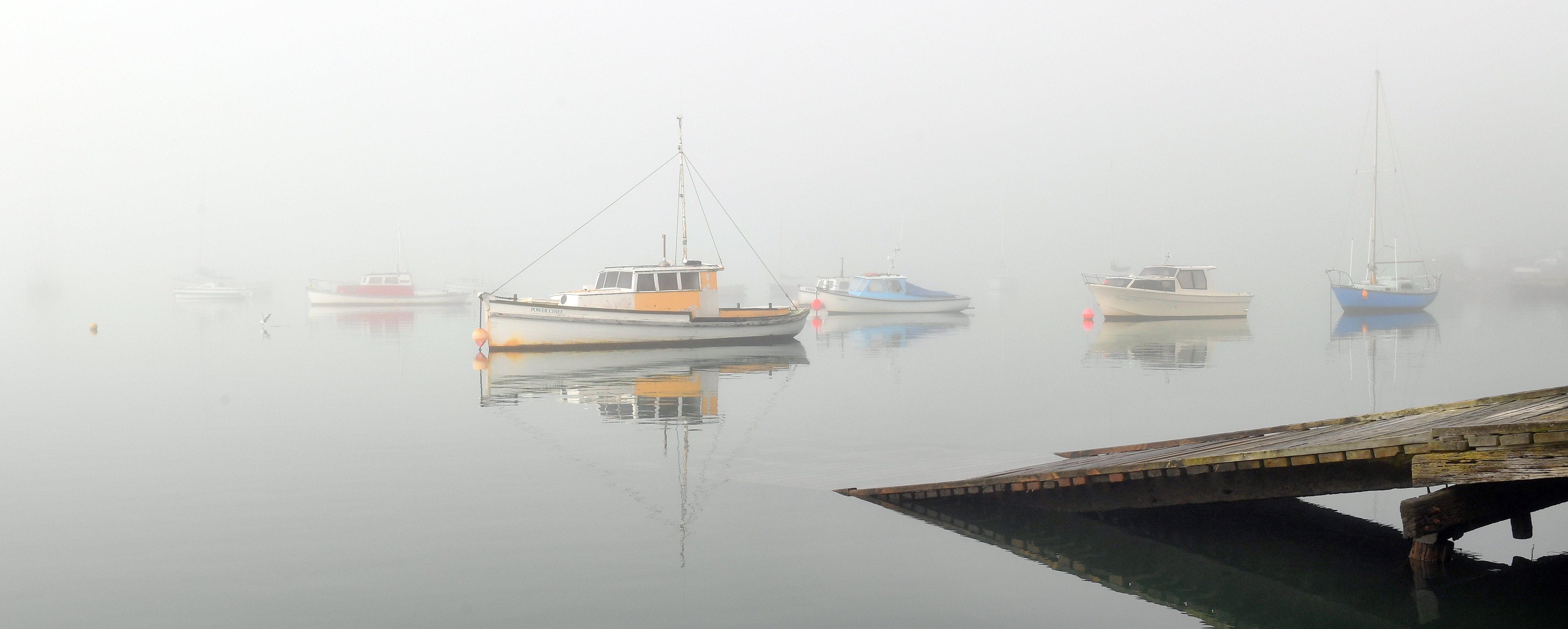
MetService meteorologist Thomas Adams said the fog covered most of the harbour and the eastern coastline as far as South Canterbury.
It was caused by a high-pressure system sitting off the east coast of New Zealand, which mixed warm air with cooler sea water, creating condensation, or fog.