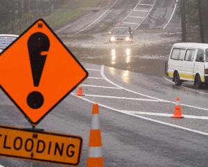
Local authorities and emergency workers were on red alert across the top of the North Island tonight in anticipation of a severe storm.
The MetService said tonight that a major storm was set to bring adverse weather to much of New Zealand and a severe weather warning covering most districts was in effect.
Worst hit was expected to be the Far North and other parts of Northland which were bracing for a deluge tonight.
Whangarei District Council strategic communications manager Pauline Rose said Civil Defence staff from throughout Northland conferred at 3pm about the situation in each district and across the region as a whole.
"We had a bit of rain through in the early part of the afternoon as expected, but nothing of any real significance," she said.
"We are now expecting that the main part of the storm will be coming through between 9pm and 6am when 80 to 100mm of rain is expected, with some high winds and possible thunderstorms."
Whangarei's central business district remained open tonight, she said.
"Tomorrow's high tide at 5.07am, combined with heavy rain overnight, may, however, lead to flooding difficulties in and around the CBD and in low-lying coastal areas," Ms Rose said.
"Obviously we'll have people on standby all night."
Ms Rose said the council's media centre would be manned from early tomorrow so any information about road closures and other problems could be quickly put out to the public.
Schools in the area closed early today, and some may not open tomorrow, depending on the weather.
Ms Rose said flood waters were accumulating in low-lying parts of the district as the ground remained water logged and rivers remained high from last weekend's storm.
Kerikeri's historic Stone Store and Kemp House were expected to be at risk from floodwaters and Far North District Council was working overtime to demolish a road bridge which causes flood waters to build up in the Kerikeri Basin.
Historic Places Trust Northland heritage destinations manager Gordon Hewston said, if need be, sandbags would be put up around Kemp House and the contents evacuated.
Transit is urging motorists throughout Northland to drive with extreme caution as rain was making driving conditions difficult.
"Storm conditions have arrived earlier than expected and the roads that experienced flooding at the weekend are being closely monitored," Transit network operations manager Joseph Flanagan said.
In Bay of Plenty regional council staff were on standby for the severe weather.
River levels would be monitored and farmers had been advised to move stock to higher ground.
Environment Bay of Plenty rivers and drainage group manager Ken Tarboton said that as part of the coordination Environment Bay of Plenty staff were speaking to Whakatane District Council to implement precautions at the spit at the Whakatane River mouth to avoid flooding in the township.
"We are also in contact with the managers of the Aniwhenua and Matahina dams to monitor flow and increase water release, which will assist with managing water in some of our catchments," Mr Tarboton said.
The MetService said a deepening low northwest of New Zealand was expected to move southwards to lie west of Taranaki at midnight on Wednesday and cross central New Zealand on Thursday.
A period of heavy rain was expected to affect the north and east of the North Island from later today and spread down the east of the North Island.
Gale force winds were expected in exposed areas, and easterly winds were likely to reach severe gale in areas west of the main ranges from Waikato down to Westland.
The easterly gales were also expected to bring heavy swells and high seas to eastern coasts of both islands. People in those areas were advised to watch out for quickly rising streams and rivers and surface flooding.


