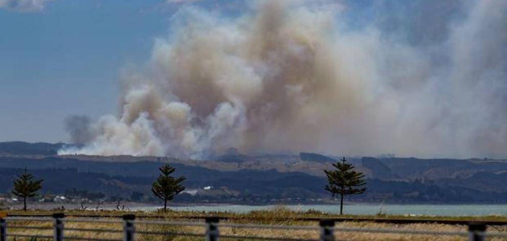
A large forest fire north of Napier is now burning uncontrolled across at least 15 hectares, with dozens of firefighters battling strong winds as it continues to spread.
Fire and Emergency New Zealand spokesman Murray Dunbar said spot fires were breaking out ahead of the main fire, which firefighters were called to shortly after 11.40am on Monday.
He said 11 appliances were in attendance, plus extra logistical support, including five helicopters and two planes.
Dunbar said at 3.45pm that air operations were possibly going to be halted due to the wind.
He said the fire was not contained but he did not believe properties were being threatened by the blaze.
There are 65 firefighters battling the fire in total.
Another fire has also broken out further south in Hawke's Bay at Fernhill near State Highway 50. Police are currently diverting traffic.
Hawke's Bay Today understands the blaze was burning out of control, with helicopters on their way.
Dunbar said five appliances and one tanker were in attendance.
He said at one stage properties were threatened by the fire, but he could not confirm whether that was still the case as at 3.45pm.
One witness, Mason Summerfield, said by 3.30pm ash was starting to fall at their bach in Waipatiki.
Earlier in the day he and his daughters Lucy and Harriet said they could see a lot of smoke, and smell the flames from the Tangoio blaze.
He said the fire looked quite far away, so while he would be keeping an eye on the situation, he was not concerned about his property.
He said the area around Waipatiki gets a lot of rain and is still fairly green as a result.
A Hawke's Bay Today reporter near the scene said at 2pm there appeared to be at least six separate fires breaking out on top of the main fire.
The fire was large enough smoke could be seen by the Japanese Meteorological Agency satellite, 36,000km above the Earth's surface.
The fire is understood to be on land owned by Forest Management New Zealand, who have been approached for comment.
A spokesperson for Pan Pac said the fire had broken out on the border of their property.
"The fire started in Forest Management New Zealand forest, so it's right on our boundary.
"I haven't had an update recently whether its on our land yet or not, but we've got land at risk."
A witness said the fire was visible from Hardinge Rd, Ahuriri.
It had started on the edge of the forest about 3km north of the Pan Pac mill, on an area that borders grassland, the witness said.
"The smoke is definitely spreading, it looks large."
MetService Meteorologist Lewis Ferris said while the wind, which gusted as strong as 196km/h at Hawke's Bay's Cape Turnagain on Sunday, would pull back from midnight, it would be unlikely to die out completely until Tuesday evening.
He said, while there were isolated showers forecast for Tuesday, there was no steady rain predicted which would help fight the blaze.


