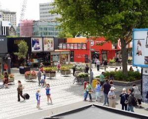
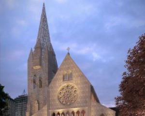
The plan, prepared by the dozens of council planners, calls for a smaller Christchurch CBD filled with mainly low rise buildings.
It does not include any geotechnical information about the state of the land following the September and February earthquakes which destroyed much of the central city, but engineers have said that the CBD is generally safe for rebuilding.
Councillors unanimously backed the plan, which will now be sent out for public consultation.
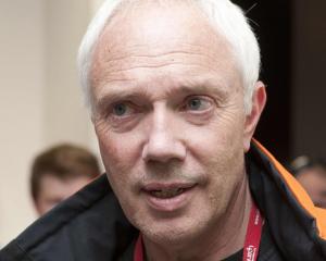
Christchurch Mayor Bob Parker dedicated the plan to the 181 people killed in the February 22 earthquake.
He said it paid tribute to the stoicism and courage of Christchurch residents and provided a pathway toward a "safe, sustainable, green, hi-tech, low-rise city in a garden".
Advanced details of the plan obtained by Fairfax Media showed it proposed light rail linking the central city with outlying suburbs.
The first stage would connect the city centre to the University of Canterbury while future lines would connect with the airport and suburban areas.
Buses would remain the main form of public transport within the four avenues.
Graduated height restrictions are proposed for an intensified business "core", with some taller buildings allowed there but low-rise elsewhere in the central city.
The Avon River is likely to play a more prominent role in the central city, after residents and experts expressed concerns about how it had been used, the paper reported.
It will have a 30m setback on each side, allowing for a green belt for pedestrians and cyclists. Cycleways are also proposed through the city.
The plan includes a swimming centre on the corner of Moorhouse and Fitzgerald Aves and a new Convention Centre.
It was put together after more than 100,000 ideas from the public, experts and other consultants.
Residential development would be based largely in the northern, northwestern and northeastern areas of the central city.
There would be specialised precincts for arts and entertainment, and there is also a proposal for an international area south of Lichfield St.
The council is expected to formally adopt the draft plan at its meeting today before it is released for public consultation on Tuesday.
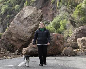
Meanwhile, a University of Canterbury geologist says about 150 houses on both sides of Christchurch's Port Hills will have to be abandoned.
David Bell said 100 houses would definitely not be reoccupied, including some at the top and bottom of collapsed cliffs in places such as Sumner and Redcliffs.
The city council has declared almost 600 houses on the Port Hills off limits while engineering consultants assess the rockfall danger.
Mr Bell, who gave a public lecture on earthquake-related rockfalls and slope stability last night, said a "goodly portion" of hillside suburbs could be at significant risk from rockfall.
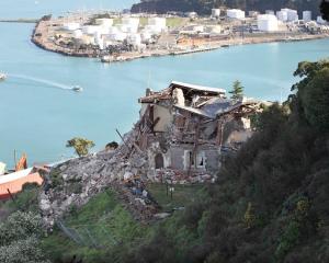
The February 22 earthquake hit the Port Hills harder than experts expected, collapsing 6000-year-old cliff faces and creating fissures hundreds of metres long, which tore houses apart.
Ground acceleration on the Port Hills during February's quake was almost 10 times greater than September, at 2.25 times that of gravity.
Mr Bell said the figure was mind-blowing.
"We did not expect 15 metres in one go to fall off a cliff face, when that cliff had been there for 6000 years and showed nothing apart from the odd rock falling off it."
- NZ Herald/NZPA