
While gusty winds are expected to ease from the south as a ridge of high pressure starts to build, showers, hail and snow will mean temperatures stay below 14C, with lows averaging around 5C.
The South was set to be the coldest place in the country - Queenstown had a forecast overnight low of -5degC, and at 8.30am many areas of Central Otago were only just above 0degC. Mid Dome, in Southland, was on a chilly -4degC.
All main highways are open in the South but there is a moderate risk of ice in some areas and motorists are urged to drive to the conditions. Grit trucks have been out in the Queenstown Lakes area and the Queenstown Lakes District Council says it could be slippery ''anywhere''.
Elsewhere, strong wind warnings remain in place for exposed coastal parts of Marlborough from Cape Campbell northwards and Wellington.
These are forecast to gust to 120 kmh at times, but should begin easing from 6pm tonight.
Gale southerlies, torrential downpours and hail are being reported in Wellington this morning.
Power lines have come down in Island Bay and harbour ferry sailings have been restricted.
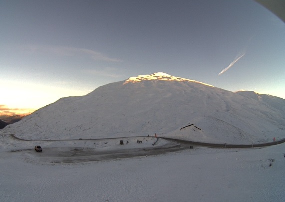
A road snowfall warning also remains in place for the Remutaka Hill.
MetService says up to 1cm of snow may accumulate about the summit of the road through until 10am.
Air New Zealand is warning of disruption for those flying in and out of Wellington Airport as wild weather hammers the capital.
At this stage, all flights are running to schedule but the national carrier says adverse weather conditions may change that.
Auckland has a chance of morning showers and fresh southerly winds - with a high of just 12 degrees.
Gale-force winds could also strike tonight in exposed coastal areas of Hawke's Bay and Gisborne, Wairarapa, and Canterbury from Banks Peninsula northwards.
While road snowfall warnings have been issued for Desert Road (SH1), Rimutaka Hill Road (SH2), Lewis Pass (SH7) and Porters Pass (SH73).
MetService meteorologist Brian Mercer said essentially it is a country of two sides.
"Starting in the South Island, the West Coast has a really clear morning and generally will have quite a nice day.
"There are a few showers around Southland and they will continue up until this afternoon.
"Moving up the East Coast, from Clutha to Timaru, there are a few showers which we are expecting to ease during the day and come confined to the coast.
"From Timaru up to the Kaikoura Coast there are showers which could be relatively heavy, with snow down to about 500m. In places like Banks Peninsula and Christchurch that snow would have eased this morning, but inland places should expect snow to this afternoon.
"Generally it is not a very nice day around there," Mercer said.
"In the north, again we have strong winds running up the east coast, and showers for a lot of the area.
"Wellington up to Taranaki, and up through Gisborne, Hawke's Bay and Wairarapa, we would expect some snow in the ranges up to about 600-700m."
"For central parts, from Taupo to Waikato, it will be a generally fine day," Mercer said.
"We are getting a few showers through Auckland, which we expect to clear this afternoon, and then it should become quite nice.
"In Northland we have quite a few showers running through with the southerlies, and they will hang around till late afternoon."
Mercer said the lowest temperatures might be felt in the Canterbury plains, with snow currently falling on Lewis Pass.
The best part of the country to be in today is the West Coast of the South Island or the Bay of Plenty.
Today's forecast
• Dunedin: Partly cloudy. A few showers becoming few and far between in the evening. Southwesterly easing morning. High 8C / Low 5C.
• Queenstown: Fine spells and early frosts. Southerlies dying out. High 6C / Low -5C.
• Auckland: Fine apart from chance morning shower. Fresh southerlies. High 12C / Low 6C.
• Hamilton: Fine with early frosts. Southerlies. High 12C / Low 2C.
• Wellington: Showers, some heavy morning. Southerlies, gale in exposed places, gusting 120 km/h until evening. High 9C / Low 7C.
• Christchurch: Cloudy with showers, easing evening. Snow possible about the Port Hills at first. Strong southerlies, gradually easing. High 8C / Low 4C.


