

Torrential rain struck south Westland late this afternoon, coming on top of 24 hours of standard West Coast heavy rain. Almost half a metre of rain is predicted to fall in parts of the South Island over the next two days as torrential rain, thunderstorms and powerful winds are forecast.
Rivers are rising rapidly, and there is surface flooding between the top of the Haast pass and Haast, but no slips as of about 8 pm.
Just a few tourists in camper vans were still on the road at that time and appeared to be travelling slowly and handling the conditions well.
MetService has described the wild weather as a "bomb low', its term for a rapidly deepening low pressure centre.
"This, combined with a strong boundary between warm and cold air, give it the energy required to start to rotate and deepen into a bomb low,'' the weather agency said.
The National Institute of Water and Atmospheric Research (Niwa) said incredible rain totals were expected for the west of the South Island over the next two days, including in the Southern Alps where almost half a metre of rain was forecast.
Up to 9am today, 17.5mm fell in Hokitika and 38.6mm in Greymouth.
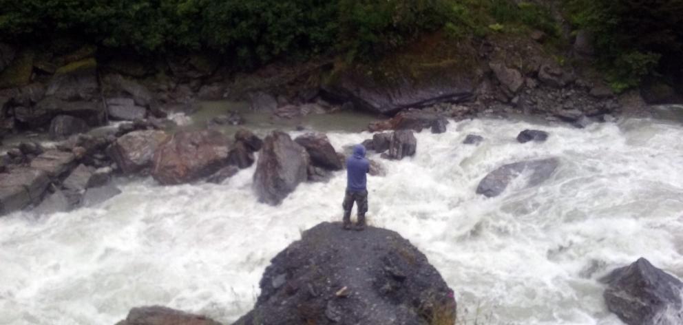
Haast in the Westland District has been given a heavy rain warning by Metservice which was expected to ease by morning.
The South Island can expect torrential rain and thunderstorms, and the wind in Wellington is expected to be extreme.
But the upper North island is expected to escape the brunt of the bad weather.
The MetService warned of gusts of up to 160km/h for exposed areas and described the pattern as "an exceptional event".
Meteorologist Lisa Murray advised people to tie down trampolines, and said the winds would show up weaknesses in loose roofs.
"Also for the likes of Wellington, where we have some buildings that are being knocked down, the debris could be caught up in winds of this strength," she said.
Metlink has also warned harbour ferry sailings could be affected.
Those flying out of Wellington today are being advised to allow extra time to travel to the airport.
Wellington Airport has posted a message on its website, advising travellers to check for any potential delays and leave extra time given the severe weather forecast.
Wellington Electricity said it also has crews on standby, should the strong winds cause any outages.
The Transport Agency is advising those with motorcycles and high-sided vehicles to stay off the roads.
Further south, the Selwyn District Council fears a repeat of the September 2013 windstorm that caused $75 million damage nationwide, damaging farm equipment, buildings and forestry plantations. Some areas in Selwyn were without power for more than a week.
Council principal rural fire officer Douglas Marshall said people should avoid operating machinery, or anything that could start a fire and to make sure previously lit fires are fully extinguished.
"Strong winds along with hot weather will create an extreme fire risk and fires will be difficult to control due to the extreme winds," he told the star.kiwi website.
He warned that people should avoid driving in strong winds or in the dark afterwards as there could be unseen hazards.
SEVERE WEATHER WARNINGS:
Westland: From 9am today until 3am tomorrow, between 200mm to 300mm of rain is forecast to accumulate in the ranges, with 60mm to 100mm about the coast. These amounts are on top of rain that has already fallen. Peak intensities of 30mm to 40mm of rain every hour from this evening, with thunderstorms possible. Heavy rain expected to ease early tomorrow.
Headwaters of the Canterbury lakes and rivers: From 9am today to 3am tomorrow, about 250mm of rain is forecast to accumulate about the main divide, with 80mm to 120mm spreading 20km further east. Peak intensities of 25mm to 35mm an hour from this evening, with thunderstorms a possibility. Heavy rain due to ease early tomorrow.
Buller: Heavy northwesterly rain forecast from this afternoon until tomorrow morning. From 3pm to 6am tomorrow, 100mm to 150mm of rain is expected to accumulate. Peak intensities of 20mm to 30mm an hour forecast from tonight with thunderstorms possible.
Wairarapa: From late this evening until late tomorrow morning: Northwest gales becoming severe, with gusts of up to 150km/h.
Wellington: From this evening until mid-morning tomorrow: Northwest gales becoming severe, with gusts of up to 160km/h in exposed places.
Marlborough: From late tonight to mid-morning tomorrow: Northwest gales becoming severe gusts of up to 150km/h.
Canterbury north of Ashburton: From late tonight to tomorrow morning: Northwest gales becoming severe gusts of up to 150km/h.
Fiordland, Southland and Stewart Island: Tomorrow morning: evere south to southwest gusts of up to 130km/h in exposed places.
Source: MetService (next severe weather warning due at or before 9pm today)


