A cold front moving towards the country is bringing a risk of thunderstorms for the upper North Island this afternoon.
While crossing the western Tasman Sea on Monday the front was incredibly active with thousands of lightning strikes detected, WeatherWatch.co.nz said.
However, as is often the case, the thunderstorms could run out of some puff by the time they reach land, they said.
Thunderstorms were visible on satellite maps now, approaching northern New Zealand from the west.
Current models suggest the front will move through fairly quickly this afternoon, WeatherWatch said.
The thunderstorms have the potential to become large but may also be fairly isolated - meaning not everyone will have thunder.
"Not all our models agree that thunderstorms are likely today. We think Northland will be most exposed with a fairly high risk of thunderstorms. At this stage Auckland and Waikato have a moderate risk for a thunderstorm as the front passes over.
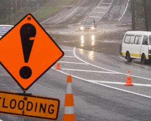
"As with any potential severe thunderstorms - which are possible in isolated areas - hail, localised flash flooding and damaging winds are possible. If you hear thunder remain indoors until the storms have passed."
MetService spokesman Dan Corbett said they were seeing some good lightning strikes out to the west of the country at the moment.
"The dynamics for the line of storms is still looking rather unstable and there's still a moderate risk of thunderstorms."
A severe thunderstorm watch is in place for Auckland. Northland, Great Barrier Island, Coromandel, Rotorua and Bay of Plenty, Mr Corbett said.
Strong, damaging "downburst winds" were also expected.
"And of course with severe thunderstorms you can never rule out that small, small possibility of small little circulations or tornadoes.
"So, an active day this afternoon across the northern parts of the North Island."
Showers to the west of Auckland were expected to come in and hit the central city this morning, he said.
"But the main meat of the front seems to push through for the afternoon. So folks might get back in from lunch and then the drive home unfortunately looks to be rather stormy, rather windy, rather mucky with a line of thunderstorms moving across that northern section extended down to Waikato."
The low was currently in the Tasman Sea, Mr Corbett said.
"Think of it like a two-legged octopus - the centre is the low, one leg is the front that's bringing in that moist, stable air generating the storms and then the other one is the one that's sitting over Canterbury."
The front sitting over Canterbury was combining cold and moist air, creating the possibility of snow above 400 to 500 metres for midland Canterbury, the Canterbury plains, the high country and spreading north to Marlborough, Mr Corbett said.
- Brendan Manning of APNZ


