Yet, for all of the damage it causes to our cities, towns and farmland, we still don't have a detailed, national picture of the threat flooding poses.
That's now about to change with a sweeping, five-year-long project to create New Zealand's first comprehensive flood risk assessment.
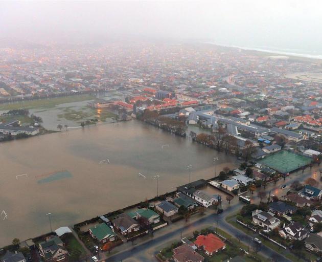
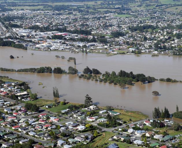
Recent years have shown the devastating impact floods can have: more than 1000 homes and businesses in South Dunedin were damaged in a 2015 deluge, two years before Edgecumbe was put under water when a swollen river burst through a stopbank and into the Bay of Plenty town.
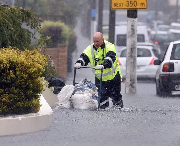
In the last four decades, insurers paid out an average $58m on flood damage, and more than $220m in 2017 and 2018 – a bill beaten only by much-less frequent earthquakes.
"Future costs will be even higher, given sea-level rise and increased high-intensity rainfall under climate change, which could be exacerbated by policies aimed at promoting urban density," said Dr Emily Lane, the Niwa hazard modeller leading the new programme.
New Zealand is now at a "pivotal point" to address that risk, with about $110b forecast to be spent by Government and councils on infrastructure over the next decade.
Lane said flood-smart decisions made today could save enormous costs in the future.
"Overseas studies suggest an average benefit-cost ratio of at least $5 saved for every $1 spent in flood mitigation," she said, adding the ratio may even be as high as 10:1 for New Zealand.
Some estimates have suggested nearly two thirds of the country's population lives in areas prone to flooding.
"But the truth of the matter is we don't even know what the flood hazard is on a national scale at the moment - let alone what it will be under climate change."
Lane's study - just awarded a $15.3m grant from the Ministry of Business, Innovation and Employment (MBIE), and bringing together a range of experts, officials and iwi – will explore the twin threats of "fluvial" and "pluvial" flooding, or those from rivers and rainfall.
"We will produce New Zealand's first consistent national flood map, showing where flooding is likely to occur, but also identify how vulnerable our assets and taonga are."
Currently, what information we have about flood risk varies from council to council.
While wealthy councils tend to have detailed maps and data, others without large rate bases have comparatively little.
"What we want to do is approach this on a national scale, and develop the methodologies and data we need to carry out flood modelling consistently."
"We need to take in factors like topography and land use. That's because if a lot of rain falls on a city, a farm or a forest, it behaves differently. In modelling, we represent this using different roughness.
"But if we can better understand our flood risk, we can come up with better decision-making processes – and we can become a more resilient nation."
Lane said that could mean deciding not to replace ageing buildings and infrastructure at high-risk locations, and constructing new ones in safer places.
"It could also help us think differently about infrastructure. For instance, when the Waiho Bridge on the West Coast was washed away, it took fibre internet cables with it.
"So, we can ask, if flooding takes out a bridge to a certain town, in what other ways is it going to be cut off?"
While the study won't have a major focus on sea level rise – something being explored in other large-scale research programmes – it will take into account coastal projections, along with future scenarios for extreme rainfall.
"We'll also be looking at future scenarios around urban growth. For instance, we can expect a lot in this in the regions between Auckland, Tauranga and Hamilton, so we'd like to see what places there might be really bad for flooding."
At a smaller scale, Lane and her colleagues have already been working with Wairewa Rūnanga in Canterbury's Banks Peninsula, to better understand flood risk from a Māori perspective.
Ultimately, her team aim to create a national assessment that can be updated every few years with extra information – and potentially in an automated way.
The resource could also prove a handy tool that Kiwis could navigate themselves.
"Ideally, we want the public to understand their own flood risk."