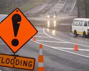
Gale-force winds and gusts of 130km/h are already battering the northern North Island this morning, as forecasters warn the region to batten down the hatches.
Severe gales with the potential to bring down trees and powerlines are forecast to hit Northland, Auckland, Coromandel and the western bay of Plenty today.
Aucklanders awoke to blustery conditions this morning, with Northland already suffering damaging gusts over night.
Winds in Cape Reinga were hitting 100km/h this morning, with gusts already reaching 130km/h - the maximum predicted by Met Service last night - after picking up around 8pm last night.
Cape Karikari has seen winds up to 83km/h with gusts of 122km/h this morning, after gales picked up around midnight, MetService said. Kaitaia had also seen gale gusts of around 74km/h.
The forecaster may have to revise its severe weather warning if wind speeds kept up, MetService meteorologist Liz Walsh said.
"[Cape Reinga] is hitting the warning .... so maybe if it goes any higher we'll be revising that figure," she said.
"Cape Reinga has been going at it since last night, but it's slowly spreading downwards now through Northland, and we would expect those speeds to lift as we go through the day."
WeatherWatch has forecast winds of up to 120km/h in exposed parts of the Far North, with gusts over that possible as far south as Auckland.
"On top of the recent heavy rains in northern New Zealand the soil is saturated and strong to gale force winds may topple trees easier," said head weather analyst Philip Duncan.
"This may also lead to further isolated power cuts and hot water cuts."
By 8am winds were gusting over 50km/h in Auckland, while gales in marine areas were already forming, he said.
Eastern Waikato and Coromandel Peninsula may also experience damaging gusts late on Tuesday and over Wednesday with the potential for some powercuts.
Heavy rain is also expected in the north by this afternoon, with between 120-160mm of rainfall predicted in the ranges of Northland.
"It's warm tropical air full of moisture and it's just going to dump quite a bit of rain," said Ms Walsh. "And because the situation is quite blocked -- there's a high pressure to the southeast of us -- it's kind of holding the low pressure that's just north of Cape Reinga in place.
"So what's happening is the front is just becoming stationary and dumping a lot of rain in one place, and it's slow moving."
- Patrice Dougan of APNZ


