A woman has suffered moderate injuries after a ute hit ice and crashed into a ditch on Dunedin's Northern Motorway as ice creates havoc on roads around the South.
Police said they were called to a crash on SH1 south of Waitati at 8.40am after reports a vehicle had hit ice and gone into a ditch.
- How to meet police this weekend
- Two injured after car and truck crash near Balclutha
- One person trapped after Dunedin crash
A reporter at the scene said a woman, believed to be from Waitati, driving a black ute lost control as she was heading towards Dunedin.
A St John spokeswoman said a 42-year-old woman suffered moderate injuries and was taken to Dunedin Hospital.
Traffic was down to one lane and stop go controls were in place after the crash, but traffic management was being removed and the ute being towed as of 9.20am.
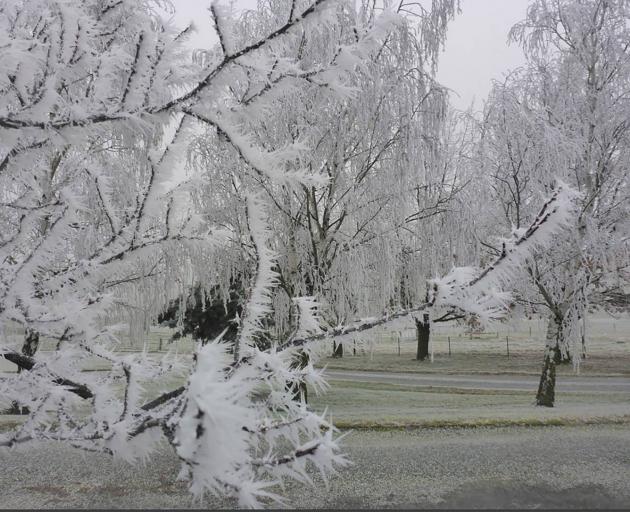
Earlier in the morning a vehicle slipped off the road and into a paddock on SH1 south of Dunedin as temperatures hit almost -6degC on the Taieri Plain and ice once again made for treacherous driving conditions in the South.
Conditions were once again freezing Queenstown Lakes District Council (QLDC) said there were temperatures as low as -7degC in the Wakatipu Basin.
In Dunedin city there were signs of frost, but it had warmed to 6.2degC just after 7.30am.
However, it was a shocking 12degC colder at Momona were it was -5.8degC.
Middlemarch yesterday broke its own record from the day before and only reached a high of -1degC, while Lauder also broke its record for the coldest day in May hitting only -2.6degC.
Police said they were called to a crash on East Taieri-Allanton Rd at 6.51am.
The driver slipped off the road due to ice and ended up in a paddock.
There were no delays caused by the crash.
A St John spokesman said the driver suffered minor injuries and did need to be transported to hospital.
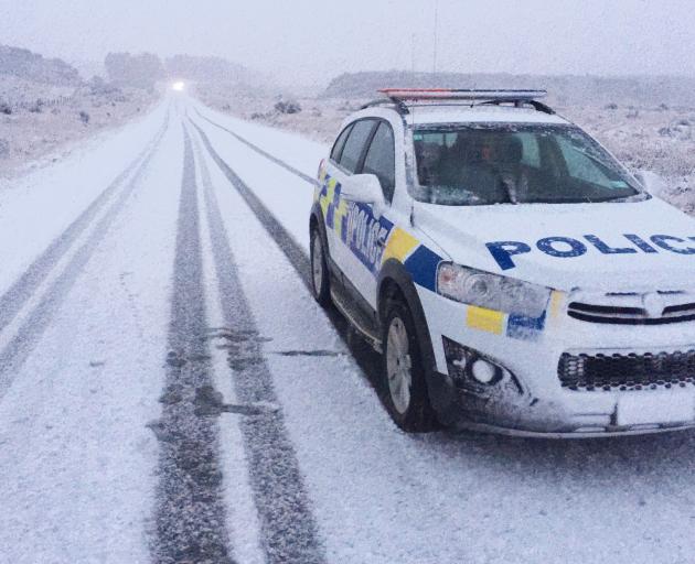
NZTA was warning of delays after a crash SH94 between Te Anau and Milford Sound.
Meanwhile, another driver crashed due to ice in Old Coach Rd between Clinton and Mataura at 6.38am.
Police said the car rolled and the three passengers all escaped with minor injuries.
QLDC said the region had once again been hit by "sharp frosts", with fog once again creating issues in places including the Cardrona Valley Rd.
"All this means take extra care, especially through shaded areas, over bridge decks, around corners and anywhere grit has been applied these last few weeks."
Danseys Pass Rd was restricted to 4WD access only.
NZTA had black ice warnings in place for SH85 from Kyeburn to Palmerston and SH94 from Mossburn to Te Anau and an ice warning for SH94 for Te Anau Downs to Gulliver River Bridge.
Meanwhile Dunedin police braved sub-zero temperatures this morning to help out Dunedin motorists with complementary ice scrapers.
Residents Abbotsford, Green Island, Kaikorai Valley and Fairfield awoke to find police and placed ice scrapers under their windscreen wipers to help slice through the thick ice that caked their windscreens.
FORECAST
The MetService has forecast dry and sunny weather from Saturday to Monday in Invercargill, Gore, Alexandra, Wanaka and Queenstown.
The east coast of Otago is expected to be cold and miserable, with rain falling in Dunedin and Oamaru for the entire three-day weekend.
Temperatures are expected to reach a high of 11degC and drop to a low of -3degC.
NZTA has warned motorists to be careful on roads, particularly Central Otago roads which may be icy.
An NZTA spokeswoman also asked drivers to be aware of localised events, including the Brass Monkey Rally at Idaburn Dam, Oturehua.
"Please take care, whether you are in a car or on a motorbike, with many more motorcyclists using the highways leading to and from Idaburn Dam this long weekend.
"Allow extra time as weather and road conditions can change in a relatively short period of time at this time of year.
"Make sure your vehicle is ready for winter driving and stocked with food, water and blankets in case of any delays.''
Niwa senior media adviser Susan Pepperell said although the past week had been colder than "the underside of a penguin'', it did not mean it would be freezing all winter.
Niwa's June-August Weather Outlook said Southland and inland Otago temperatures were likely to be near average, rainfall totals were equally likely to be below normal or near normal, and soil moisture levels and river flows were likely to be in the near normal range.
Coastal Otago temperatures were equally likely to be near average or below average, and rainfall totals, soil moisture levels and river flows were likely to be normal or above normal.
REGULAR WINTER VISITOR
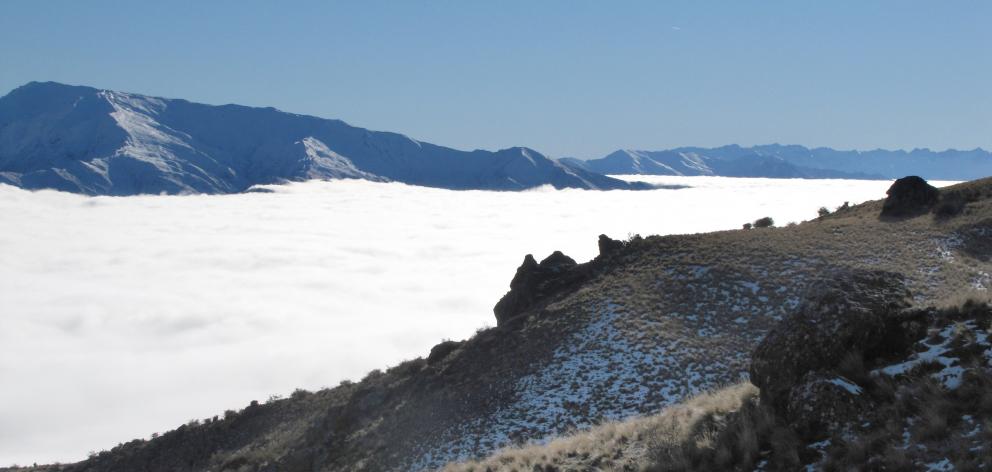
Low cloud filling the lower Cardrona Valley and the Wanakabasin over much of the last few days is nothing compared with some previous years, according to long-term locals spoken to by the Otago Daily Times.
The inversion layer has been known to be a permanent fixture for as long as three weeks, encouraging locals to make special trips to the mountains in search of sunshine.
So far this year, the cloud has been hanging around for three days, with short sunshine breaks in the afternoon. The temperature in the lower Cardrona Valley at 11am yesterday was -4degC.