Senior conservation services ranger Richard Kennett yesterday said an alternative route for trampers had been identified which would take them safely past the affected area.
A new track would now cut a route above the newly formed lake on its eastern, or true left, side, before leading trampers to the usual track over Sandy Bluff. After this point the track would descend to the eastern bank of the river.
''More changes will be required there when the landslide has forced the river to erode the bank and undercut the track,'' Mr Kennett said.
''As the realigned track will remain on the true left of the Dart River, the landslide debris will be avoided altogether.''
While the department would endeavour to clear the vegetation it would be very rough and muddy underfoot.
It would not be passable in wet weather as it crossed several streams which would quickly flood during heavy rain, becoming hazardous for trampers to cross.
Mr Kennett estimated the roughness of the track would add 1-2 hours to the standard walking time between Daleys Flat Hut and Chinamans Bluff, usually 3.5 to 5.5 hours.
Work on the track realignment would start soon and was expected to take up to two weeks to complete. Until the new track was completed the Dart Valley Track between Bedford Stream and Daleys Flat Hut remained closed.
Work could be delayed by weather or conditions on the ground and Doc was expected to make a further announcement when the new track was to be opened.
Rangers would then monitor conditions on the new route for the remainder of the summer before seeking to make improvements during the winter months.
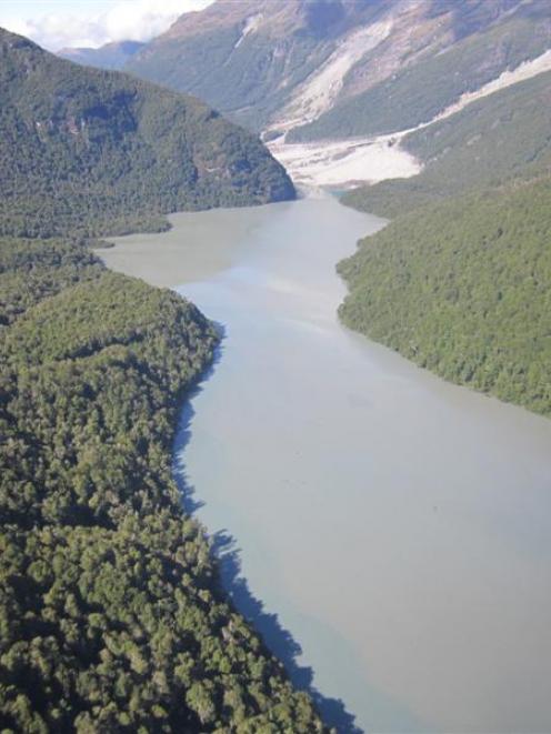
The Dart Valley landslip had formed within an existing zone of instability located in the Te Koroka/Slip Stream area. The zone had been depositing fresh material into the valley for more than a year however, heavy rainstorms led to the much larger landslip on January 4.
Further rain would continue to deliver more material into the valley. GNS considered the landslip-related debris flows and the resultant lake posed no additional hazard on the lower Dart River below the dam.