Water levels across the Clutha District are starting to drop and river levels are receding after a wild storm.
Taieri Mouth survived peak river levels and the high tide earlier on Saturday without any evacuations needed. The water level reached the road, but did not spill into any homes. The Taieri River was receding on Saturday evening.
The Clutha District Council said Kaitangata volunteers were sandbagging low-lying parts of the town, there were some self- evacuations but the welfare centre remained on standby.
The Clutha River was also receding and contractors have started clearing the mouth of the river to help with water flows.
High tide was expected again about 1am on Sunday and civil defence staff will be monitoring that.
Waitahuna River was also extremely high and there was at least one evacuation in Waitahuna.
The council advised to avoid all unnecessary travel and stay off the road if you can. Drivers should also be vigilant for any debris in flood waters.
Please also avoid driving down flooded streets or rubber necking as it creates bow waves that cause further damage to people's properties.
There would be widespread debris and damage on roads.
The Service Centres at Owaka, Balclutha and Milton were now closed and Lawrence was likely to close about 8pm. However, civil defence staff remained on standby.
Roads affected
A number of State Highways across the district were closed on Saturday and some would remain so overnight.
State Highway 1 was open between Balclutha and Dunedin, but was down to one lane in some places and care was needed. State Highway 8 between Raes Junction and Milton was closed.
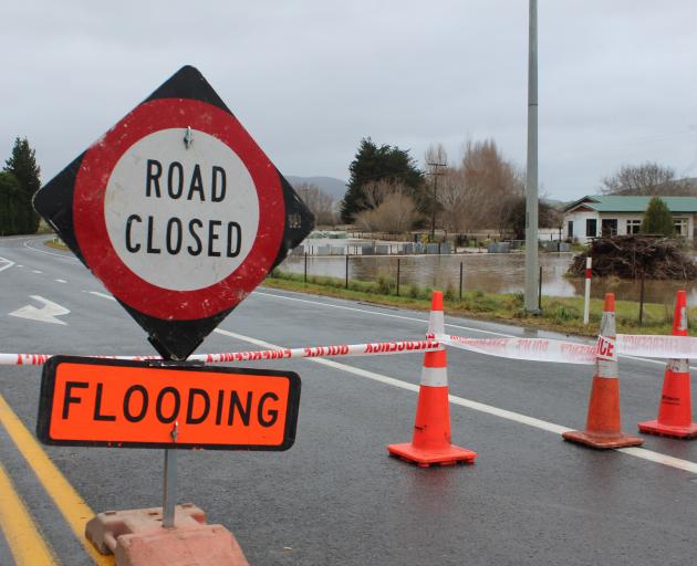
A number of local roads were also closed. Contractors have been closing roads and deploying flooding signs, but the council said it was impossible to signpost every road in such a widespread event.
Among roads closed are:
Summerhill Road
High Street Milton (near Pope and Mill Streets)
Fallaburn Road - open with care.
Kelso-Wooded Hill area including Cross Road.
Koi Flat Road - please avoid
Waitahuna Gully
Wangaloa Road
Coast Road, Kaitangata
Toko Mouth Road.
Water Notice
Due to the heavy rain and flooding, we are advising all residents to conserve their water use as treatment plants and schemes will be under pressure. This applies to both urban and rural supplies.
There have been sewerage overflows around Milton and all flood waters should be considered contaminated as a precaution.
Customers on rural water schemes that may have ongoing issues due to the rain, will be advised via the text message service.