Clutha district councillor John Herbert, of the West Otago ward, said the Pomahaka River and Crookston Burn rose rapidly with strong currents, and almost every time they spilled over their banks someone had to be rescued.
‘‘The new barriers are there to save lives.
‘‘One or two vehicles get into trouble each time there’s a flood,’’ Cr Herbert said.
‘‘I’d say there’s been half a dozen vehicles rescued in the last two years.
‘‘It’s not just the drivers pushing their luck — our local people with emergency services are putting their own lives at risk when they’re called out at 4am to do a rescue,’’ he said.
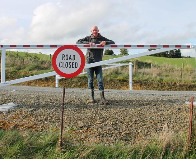
The new road barriers, engineered locally to a ‘‘very high standard’’, were installed at the end of winter following two years’ consultation.
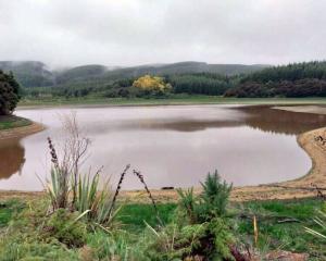
Three pairs of gates were placed, in consultation with residents they would affect, in Wooded Hill, Ardmore and Greenvale Rds, effectively enclosing the area where the township of Kelso stood for a century, before vanishing under unprecedented floodwaters in 1980.
In the event of flooding, the barrier gates could be fully closed across the roads at short notice and motorists would be forewarned with signs, protecting unwary travellers from three directions by sealing off a small Kelso triangle of about 3sqkm, Cr Herbert said.
Most of Kelso’s floods occurred over summer, when road use spiked due to a steady stream of activities and events around Queenstown, Te Anau and Wanaka, he said.
Sudden downpours, fast melts and rainfall in remote mountain ranges meant roads across West Otago were subject to closure at short notice, causing tourists and other traffic to seek alternative routes to continue their travels.
Issues arose as resources such as Google Maps offered no information on weather hazards, but indicated lesser-known routes such as Ettrick and Raes Junction through to Tapanui and Gore, leading those unfamiliar with the district directly to one of the most flood-prone areas in the country.
After long detours, some drivers confronted by their road disappearing under water were reluctant to turn back, and a gradual slope made the waters seem deceptively shallow.
‘‘A few people are always willing to take the chance, so, eventually, someone was likely to drown.
‘‘That won’t be an option now, so we’re really rescuing people from themselves.’’
The best advice when driving in the district during flooding or bad weather was to check the Clutha District Council website for road closures, Cr Herbert said.