Forest & Bird says the Manaaki Whenu-Landcare Research data, showing decreases in 12 of 13 types of native habitat over the last decade, signals the need for better policy to protect what we've got left.
The call comes as the Government is asking for feedback on a set of proposed bottom-lines for regional councils to identify and protect hotspots for nature.
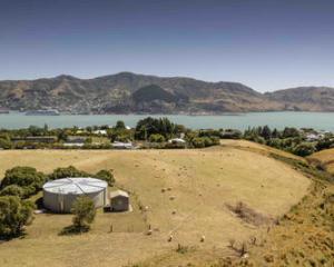
Around three quarters of New Zealand is privately owned, leaving thousands of native species outside the protections of the conservation estate.
"Our native animals don't know if their home is in a national park, a farm, or someone's backyard; and our native plants want to grow where nature designed them to," Forest and Bird's chief executive Kevin Hague said.
"Without clear guidelines for identifying and protecting important native habitat, our environment has been pushed to breaking point."
Today, about 4000 native species are considered threatened or at risk - that included 90 per cent of seabirds, 76 percent of freshwater fish and 84 per cent of reptiles, along with 46 per cent of vascular plants.
The extinction risk had worsened for 86 species in the past 15 years - compared with the conservation status of just 26 species improving in the past 10 years.
More alarming was the welfare of those species that we didn't even know about.
Due to a huge lack of data, only an estimated 20 per cent of New Zealand's species have ever been identified and documented.
Canterbury landowners wiped out 1457ha of the shrub matagouri, more than any other region, turning it into pasture.
"We now need to focus on saving the special places that remain, and reversing the trend for those teetering on the brink.
"Wetlands are at high risk on private land, and the situation is as urgent for many other types of native habitat."
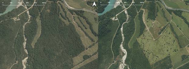
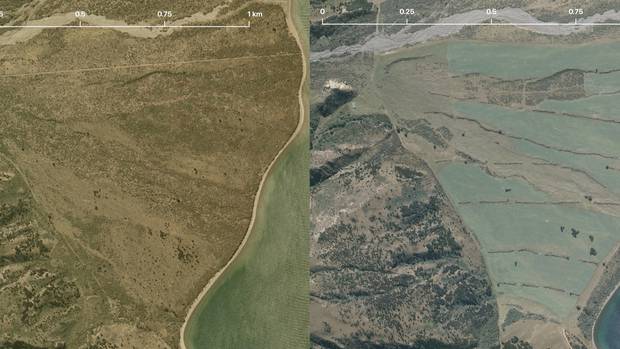
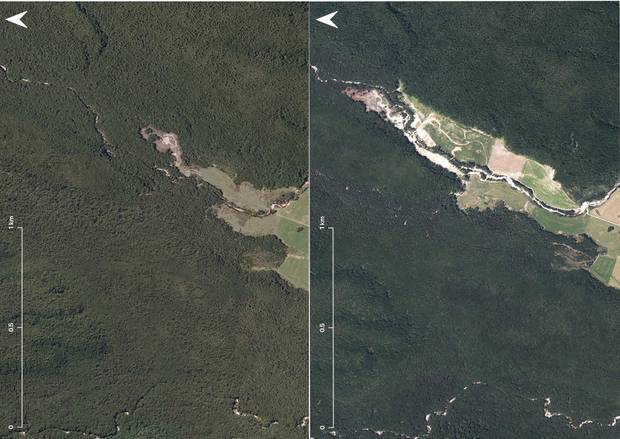
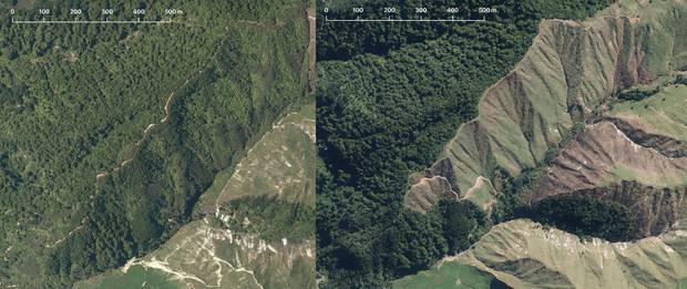
Conservation Minister Eugenie Sage said the satellite images were unsurprising, and just some examples of biodiversity destruction occurring throughout New Zealand.
"[On Friday] I was in the Mackenzie Basin," she said.
"There and on the margins of Canterbury's braided rivers there has been extensive and irreversible loss of habitat, where wetlands, riparian margins shrublands and tussock grasslands have been ploughed under and converted into irrigated farmland," Sage said.
"Great restoration work is being carried out by DoC, councils, community organisations and some private landowners, but we're still seeing substantial and ongoing loss of wetlands and native bush.
"If we are serious about turning the biodiversity crisis around, local government also needs to do much more in the compliance, monitoring and enforcement space, and enforce existing district and regional plan rules controlling indigenous vegetation and wetland clearance."
While the Landcare Research data showed there had been gains and losses across different regions, the national trend was one of steady biodiversity loss.
In Hawke's Bay, 39ha of indigenous forest and 171ha of tussock was converted to low producing grass land between 2012 and 2018.
That contributed to an overall national loss of 1471ha of tussock, and 2304ha of indigenous forest over a six-year period.
And Manawatu-Wanganui landowners contributed to a North Island trend of clearing manuka and kanuka, converting 3544ha into pasture and exotic forest.
"All native habitat is important, but some is particularly undervalued," Hague said.
"Native scrub provides important shelter, nectar and habitat for insects and birds. The small twiggy nature of manuka and matagouri make rich homes for some of our more secretive wildlife like lizards, skinks and beetles."
Currently, the level of support given to landowners to identify and protect their important natural areas depends on their regional councils' willingness to do so, Hague said.
"While many landowners are doing the right thing and protecting the special places in their trust with little support, there are also those who have destroyed these areas when there is a business case to do so."
Hague hoped a new council rulebook - the Government's draft National Policy Statement on Indigenous Biodiversity – would make a difference.
The statement, developed collaboratively between conservation and farming groups, included more consistent requirements for councils to identify and protect significant natural areas on both private and public land, as well as a raft of other measures.