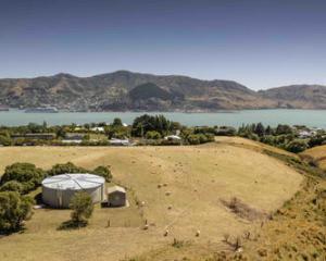
Canterbury had a fleeting taste of summer weather over the weekend, with temperatures soaring to over 30 deg C - and a "dirty high" expected to bring more of it.
A large ridge of high pressure over NZ delivered warm and mostly settled weather for most places on Sunday.
"There were a number of places that eclipsed 30 deg C yesterday, particularly around eastern and north Canterbury," Niwa meteorologist Ben Noll said.
Sunday's hottest maximum temperature - a balmy 32.6 deg C - was recorded at Cheviot. Christchurch was also still sweltering at over 31 deg C.
"As we go into the new week, however, it does look like Monday will be a rather cool day in the South Island."
Christchurch was forecast to get maximum highs of 17 deg C today and 19 deg C on Tuesday and Wednesday.
Wellington was also in for a milder few days, with highs hovering between 17 deg C and 18 deg C until Friday.Further north, the cool change wouldn't be felt quite as keenly: Auckland, Hamilton, Whangarei and Tauranga were due to get highs in the mid-20s right throughout the week.
Toward the back end of the week, another ridge of high pressure was predicted to send temperatures climbing again – but not to extremes, Noll added.
"It's what we call a dirty high. It'll have little disturbances around the edges – for instance, around Thursday in Hawke's Bay and Gisborne, we're expecting to see an easterly flow, and those places might get some showers as well.
"Usually what we look for in a high is for these to slide to the east of the country – that's when you get those really warm west to north-west airflows," he said.
"But this system is going to be parked almost over the top of the country, or maybe a little to the west, and that's going to prevent us getting that really scorching heat.
"That's certainly not the worst thing in the world – people complain about how cool it's been lately, but if gets too hot, that's no fun either, so it's what you'd call a nice middle ground."
Looking further to the end of the month and beyond, Noll predicted a generally messy and unsettled pattern, as two climate drivers that have held sway over our weather – a long-positive, but now fading, Indian Ocean Dipole and a warm pool of water in the western Pacific – jostled for influence.
"We're still getting the last remnants of that positive Indian Ocean Dipole, and that's what's been giving us these unsettled westerlies."


