Extensive rain and wind caused wide-spread disruption, with Christchurch recording 72mm of rain over 24 hours. Most roads in the city have reopened today, although parts of New Brighton Rd and Avonside Drive remained closed on Wednesday morning.
On Banks Peninsula, the following are closed due to flooding and slips:
- Pipers Valley Road ( from #118 to Summit Rd)
- Tizzards Rd
- Le Bons Bay Valley Rd, from the second bridge. Contractors are working to clear the road and hope to have it tidied up by the end of the day.
- Okains Bay Rd, from Summit Road to River Rd
- Camerons Track, from Summit Road to Big Hill Rd
A number of other roads, including Purau Port Levy Road, Little Akaloa Road, Port Levy Pigeon Bay Road, Takamatua Road, Long Bay Road, and Summit Road have flooding or slips but are open to traffic, although some are down to one lane.
Contractors are working to get them cleared as quickly as possible.
The MetService has warned more rain is expected later this week.
In Otago, between 70mm and 100mm of rain fell in the 24 hours to 10am today, much of it overnight.
Further inland the rain was manifesting as snow, causing substantial dumps on skifields and at Mt Cook.
In Otago, snow was expected to settle to 500m, possibly down to 200m in some inland valleys.Waitaki District Council roading manager Mike Harrison said the ground in the district was quite wet and localised slips were possible.
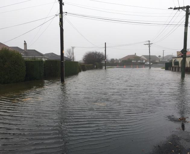
In Christchurch, where more than 50mm of rain had fallen by 5pm, localised flooding was widespread throughout the city.
Marlborough was also experiencing serious flooding.Otago Regional Council duty flood officer Eve Bruhns said the MetService had raised its predicted rainfall level for the region yesterday, which meant all flood warning systems were being closely monitored.
"There is likely to be some low-lying flooding of farmland in North Otago catchments, including the Kakanui River, and the Gordon Rd spillway along the Silver Stream near Mosgiel may be triggered into action," she said.
"In Dunedin, there is not expected to be any overtopping of the Lindsay Creek channel in North East Valley or of the Water of Leith channel, and peak flows on the Clutha River at Balclutha are not expected to go beyond 2000 cumecs," Ms Bruhns said.
The expected peak flow was significantly lower than the peak observed in the February 2020 floods, Ms Bruhns said.
In Clutha, council spokeswoman Diane Byers said flooding signs were being put up where required but the rain as not letting up.
Surface flooding is widespread in the district with Clutha Valley Rd, Blackburn Rd, Pillans Rd, High St at Kakapuaka and Toko Mouth Rd among the many affected.
"The creeks are rising and a few more roads will be affected by rising water levels within the next few hours."
There is also a large slip on Coal Gully Rd that Clutha District Council contractors are trying to check.
The Pomahaka River was rising but was still below flood alert levels.
The Waimate District Council said "quite a bit of surface flooding" was also expected throughout the district.
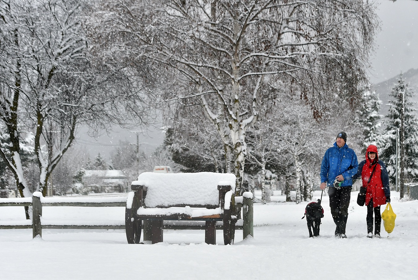
In South Canterbury, snow fell in the Mackenzie district and heavy rain throughout the rest of the region, while snow and ice caused several road closures in and around Fairlie.The Queenstown Lakes area had a heavy snow warning in place yesterday, after predictions 15cm-25cm of snow might accumulate on parts of the Crown Range Rd between Queenstown and Wanaka.
Even though the road was closed, two cars became stuck in a ditch about 12.40pm and had to be freed by a grader.
Passengers in four cars were also caught out by the closure of the Aoraki Mount Cook Highway (SH80).Wild weather
Highway closures: Crown Range Rd, Burkes Pass, the Aoraki Mount Cook Highway and Lindis Pass all closed by snow.
Dunedin road closures: Gladfield Rd to Silverstream ford, Flagstaff/Whare Flat Rd, Miller Rd to Waitati River ford, Waitati Valley ford north of Donald Rd and Miller Rd.
Damage: Rockfalls, fallen trees and slips have blocked roads; flood waters being monitored but not expected to be as severe as 2020
Outlook for today: Heavy rain expected until at least 10am, easing afterwards, but it will still be a wet day.
-Additonal reporting Geoff Sloan (Public Interest Journalism funded through NZ On Air)