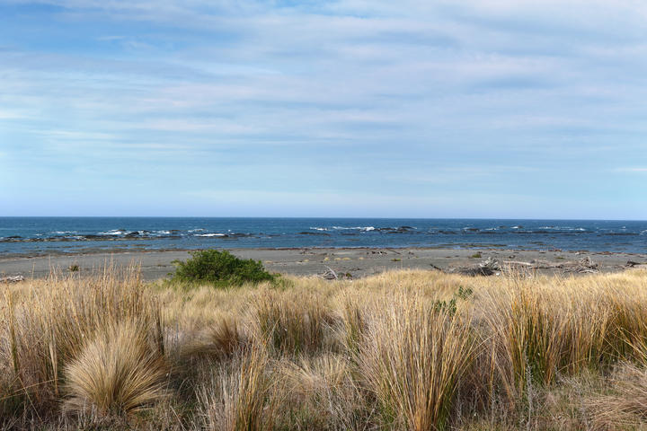
It had already drawn a line separating land and sea - and the rules for each - when the quake raised the region's coastline out of the ocean, in some places up to 6 metres.
Four years on, and almost a year after finalising Marlborough's environment "masterplan", the line had still not been changed.
Several rugby pitch fields worth of land along Marlborough's east coast is still zoned 'coastal marine' - an area where ships can legally anchor and residents can surf, sail or swim.
Council environment policy manager Pere Hawes said this month the council was now able to redefine the boundary, following aerial photographs and surveys of the east coast.
Hawes said there was some merit in rezoning the uplifted seabeds as 'open space three', lining up with most of the land beside it, but the council had yet to make a formal decision.
The change in boundaries was scheduled to occur next year, after staff cleared permission from a council committee.
The council would consult the public on change in zones.
Burkhart Fisheries lawyer Quentin Davies told a commissioner the plan required access to and along coastal areas to be enhanced from pre-earthquake levels, despite the 7.8-magnitude quake making access to the east coast worse.
"Currently, you've got dry land which is zoned as sea, but that's not a coastal marine area, it's part of the Marlborough district.
"... At the present point in time, any activity - even a walk on the beach, technically - requires a resource consent until [the uplifted coastal areas] are brought into the district as land."
The hearing centred on an application by Burkhart Fisheries to dig gravel from a corner of Ward Beach, south of Blenheim, and restore its temporary launch site so its boats could reach its fisheries. The commissioner had not yet made a decision.
University of Canterbury researcher Dr Shane Orchard said the group studying the east coast's recovery, which he was part of, was by coincidence looking at how to define the mean high water mark, used as a boundary line for coastal marine areas.
"If we can help the council with that, we will try, but if they're doing it anyway of their own accord, then that's also good.
"It's important to have a type of environment matched to its most appropriate management area. If an area is obviously a piece of land, then we don't want it managed like a seabed.
"At the moment, if the council looked at a piece of land on the old seabed, then different parts of the [Resource Management Act] would apply to it, compared to land further up the beach."
The uplifted seabed had made access to the coast easier, prompting the council to propose banning motorists from a 45-kilometre stretch to help protect it, using a bylaw. The research group had created a study to inform the new bylaw.
- Local Democracy Reporting is a public interest news service supported by RNZ, the News Publishers' Association and NZ On Air.