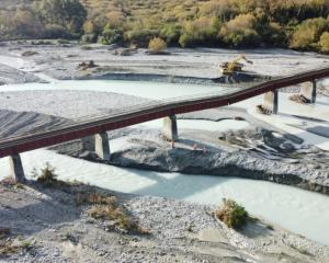
The wild weather that has been bashing parts of the South Island has left roads closed and rivers running well above their normal flow levels.
MetService meteorologist Lewis Ferris said the northern Southland region captured the bottom end of the weather system responsible for drenching South Canterbury and the Mackenzie Basin as it moved across the island on Monday.
Ferris said it was an unusual weather event as the rain had usually been dumped before it crossed the Southern Alps divide.
"Yesterday we saw huge amounts of weather piling in from the west, alongside strong north-westerly winds, made it across where the rain would normally fall. Instead of being on the western side of the Southern Alps, a lot of it made it into those headwaters," Ferris said.
However, as the heavy rain had continued to move northwards up the country, he expected things to ease off by Wednesday.
Canterbury Civil Defence Emergency Management Group controller Sean Poff activated the emergency coordination centre yesterday in response to the severe weather event.
“Several council emergency operation centres have been activated throughout the region, others on stand-by ready to activate. All agencies are monitoring the situation and liaising on potential responses needed," Poff said.
“While the wind and rain may cease (today), we’re expecting the effects of this weather event to impact our communities for much longer than that."
South Canterbury rivers
Meridian Energy started spilling water into the Lower Waitaki River on Tuesday, and flows will increase to around 1000-1200 cumecs over the coming days. Landowners adjacent to this river should continue to monitor their own situation as some out of river flows could occur across farmland at these elevated flows.
Flows have peaked and are dropping in the Ahuriri River, Twizel River, Omarama Stream, and Otematata River.
The Opihi River has peaked at Rockwood in the upper reaches, but is still rising in the lower reaches. Flows are expected to be contained within the stopbanks, however we are monitoring the river in the Milford Huts area.
The Orari River peaked around 440 cumecs at the gorge but will still be rising in the lower reaches. Staff have been monitoring the river below the gorge, and some out of river flows could occur across farmland.
The Rangitata River has peaked at 4pm at the gorge at 1120 cumecs. Peak flows will take another 10 – 12 hours to travel from the gorge to the mouth, so the river will be flowing high into tomorrow. Overflows into the South Branch are unlikely, but staff are continuing to monitor the river in this area.
Mid Canterbury riversThe Ashburton River South Branch, North Branch, Taylors Stream, and Bowyers Stream have all peaked and are dropping in the upper reaches. The main stem is still rising at SH1, but is expected to peak at around 800 cumecs this evening. Staff have been monitoring river conditions today, with overflows into farmland in some places.
North Canterbury rivers
The Rakaia River has peaked at about 2600 cumecs at Fighting Hill, and no significant out of river flooding is anticipated. The Waimakariri River has peaked at about 1000 cumecs at Otarama, and this flow will be easily contained by the stopbanks. Both rivers will continue to rise in their lower reaches overnight and flows will remain high into tomorrow.
Selwyn River
The Selwyn River peaked at about 32 cumecs at Whitecliffs and is now dropping. No out of river flooding issues are anticipated in the Selwyn catchment.
Otago/Southland
Meanwhile, further south there is flooding on a section of Riversdale Waikaia Rd between Camp Rd and Pyramid Waiparu Rd, the Southland District Council said. Waikaia River levels were dropping though.
Paddys Alley Rd at Athol is heavily flooded and not possible for vehicles to pass. Nokomai Rd is also closed.
State Highway 6 between Lumsden and Kingston was passable with care but Waka Kotahi NZ Transport Agency had reduced speeds to 30km/h in some areas and were urging motorists to take care.
The Five Rivers-Mossburn Highway was also affected by flooding, but passable with care at temporarily reduced speeds. The Milford Road (SH94) was closed.
Sections of Riversdale Waikaia Rd between Camp Rd and Pyramid-Waiparu Rd had also been affected by floodwaters.

The Environment Southland website showed the headwaters of the Mataura river at Parawa was 2.08 metres above normal and rising and 2.7 metres above normal at Cattle Flat and still rising 54 mm/hour.
At Pyramid it was 1.85 metres above normal while it was 2.08 metres above normal at Gore was 2.08 metres above normal and rising 66 mm/hour.
The Mataura River at Mataura was 1.94 metres above normal and 1.63 metres above normal and rising at Seaward Downs.
The Waikaia River at Waikaia was 1.6 metres above normal and falling 82 mm/hour, while at Mahers Beach it was 1.66 metres above normal but was now falling 88 mm/hour.
The Oreti River at Lumsden Cableway was 2.45 metres above normal and falling and 1.37m above normal and still rising at Centre Bush.
The Aparima River at Thornbury was 2.04 metres above normal and steadily rising. While the Waiau River Te Waewae Lagoon was 2.28 metres above normal and now falling.
A Southland District Council spokesperson said while rural roads had been affected by flooding, they were unaware if any bridges in the region had been affected.
Road closures
• SH6 Haast to Lake Hawea - Fallen trees
• SH8 Twizel to Tarras - Flooding
• SH77 Mt Hutt between Blackford Rd and Mt Hutt Station Rd - Washout
• SH80 Ben Ohau to Aoraki Mount Cook - Slip - This will remain closed overnight next update expected at midday Wed 20 July
• SH83 Omarama and Kurow - Flooding
• SH80 Ben Ohau to Mount Cook remains CLOSED - this closure will remain in place overnight with an update expected around midday on Wednesday 20 July.
Open caution
• SH1 Picton to Ward – Strong Winds
• SH6 Kingston to Lumsden - Surface Flooding
• SH6 Mount Pisa to Cromwell – Flooding
• SH6 Arrowtown Junction to Cromwell (Kawarau Gorge)
• SH6 Lowther to Lumsden, at the Lowther Road intersection - Surface Flooding
• SH7 Hanmer Turnoff to Springs Junction (Lewis Pass) – Strong Winds
• SH73 Springfield to Arthur's Pass - Strong Winds
• SH79 Fairlie to Geraldine - Strong winds
• SH94 Te Anau to Milford - Avalanche hazard - Carry chains from 6pm
• SH97 Lowther to Mossburn, at the Lowther Road intersection - Surface Flooding
- Toni McDonald and Star News


