In what is forecast to be a potentially destructive weather bomb, huge gale-force winds and heavy rains and snow are all on the cards.
People in Clutha, Central Otago south of Alexandra, Southland, Fiordland and Stewart Island are all being told to stay up-to-date with the weather conditions as there is currently a heavy snow watch in place.
The watch is in place from 6pm Sunday to 10am Tuesday. Snow is expected to lower to 300m on Sunday evening and to near sea level during Monday morning. The heaviest snow fall is expected above 300m at this stage where accumulations could approach warning criteria.
Snow showers are also expected in other parts of the South on Monday and Tuesday, including Dunedin and Queenstown.
A heavy rain watch is in place for the headwaters of Otago lakes and rivers from 6pm tomorrow to 10am Sunday and wind watches are also in place for large parts of the South.
The severe weather warnings and watches issued by MetService just after 11am show nearly every part of the country coloured either yellow or orange.
Weather authorities are dubbing it to be a "significant weather event" for the whole of the country - as an active and complex low-pressure system moves to the east of New Zealand this weekend.
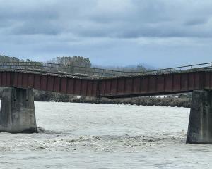
Heavy rain warnings are in place for Westland about and south of Otirā, where people are being told to expect between 100mm to 130mm of rainfall to accumulate near the ranges and 70mm to 90mm near the coast. There is also the possibility of thunderstorms.
Locals are being warned that the heavy rain may cause streams and rivers to rise rapidly and that surface flooding and slips could happen as a result.
"Driving conditions may be hazardous," an alert said.
Strong wind warnings have been issued in the Wairarapa - not including the Tararua District, Wellington - where northwest gales are forecast to reach up to 130km/h.
WeatherWatch said a weather bomb is likely to form this weekend over the Southern Ocean, as air pressure plummets from around 980hPa on Saturday to 930hPa on Monday.
MetService has released a graph detailing exactly how bad the weather is forecast to be - with the average forecast models for Sunday looking to be one of the worst storms since at least 2014.
The weekend's weather bomb falls just above a storm in November 2018, when roads were closed on the West Coast due to flooding.
It falls just under another huge weather event in May 2014, when 4500 homes were left without power and there was massive amounts of snow in Queenstown.
Winds should be early on Sunday morning, MetService said.
Canterbury High Country is also on alert for a strong-wind warning and gusts are expected to get up to the 120km/h mark.
Meanwhile, heavy rain watches are in place for the areas including the ranges of eastern Bay of Plenty, Mt Taranaki, Nelson about and west of Tākaka, Buller, Westland north of Otirā, Tararua Range, Richmond Range including the Rai Valley and Fiordland.
While a strong wind watch has been issued for parts of the South Island including Christchurch, Central Otago, Southern Lakes, Fiordland, Southland and Stewart Island, North Taranaki across to East Cape and northwards, Hawke's Bay south of Hastings and Tararua District and Marlborough.
With Otago Daily Times