The findings show that groundwater flow and seepage can form large gullies along coastal cliffs in a matter of days and are outlined in a recently published research paper.
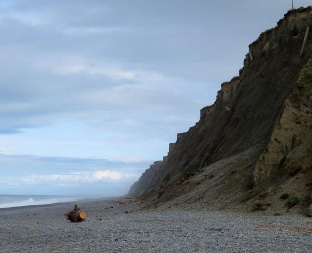
The study area was a 2.5km long stretch of cultivated coastline 16km to the southeast of Ashburton.
The coastline within the study area consists of a 15m thick exposure of poorly sorted and uncemented matrix-supported outwash gravel, capped by up to 1m of post-glacial loess and modern soil.
The cliff face is punctuated by thick lenses of sand or clean gravel.
Field observations and numerical models show that groundwater plays a key role in forming these gullies, by either eroding tunnels or triggering landslides.
Some 315 gullies, also known as dongas, were mapped along a 70km stretch of coastline.
The majority of the gullies are located between the Rakaia and Rangitata rivers, particularly in the vicinity of the Ashburton River.
Gullies are an important coastal hazard and their formation leads to the loss of precious agricultural land.
When and where coastal gullies form can be partly predicted, says the study, which shows gullies are formed when more than 40mm of rain falls per day and preferentially located above buried, old river channels.