Widespread storms experienced by much of the country over the weekend "continue to be a significant weather event", and are expected to be chased by a series of cold fronts travelling up the country, MetService says.
Forecasters have issued a series of heavy snow watches and road snowfall warnings. In lower parts of the South Island snow could fall to sea level today - the lowest this year.
Road users are urged to take care, particularly on alpine and high roads, and drive to the conditions.
Many high roads and passes across the South Island could receive heavy snow, disrupting traffic.
In particular snow is expected at the Crown Range Rd, the Lindis (SH8), Lewis (SH7), Haast (SH6) and Arthur's (SH73) passes, and the Dunedin to Waitati highway for Monday.
The Lewis Pass is closed due to snow this morning and road users should use SH1 for travel through to Tasman/Marlborough.
Chains are essential for Arthur's Pass due to snow and the road is closed to towing vehicles. A strong wind warning also remains in place for this route.
About 50 centimetres of snow is expected on the Milford Road (SH94) through Monday, possibly to sea level. The state highway is closed from Park boundary due to heavy snowfall and potential tree fall hazard.
Snow is falling lightly in Shotover Country in Queenstown.
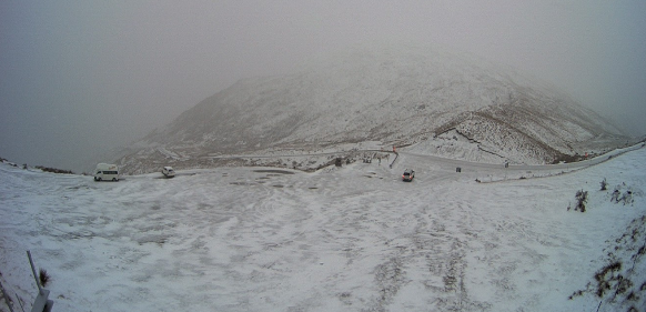
MetService warned that snow was also expected to fall at the summit of Dunedin’s Northern Motorway early today, and the Queenstown Lakes District Council said the Crown Range Rd, linking Queenstown and Wanaka, was closed from 10pm last night.
The council said this morning the Crown Range Rd has reopened and light snow that fell overnight has been cleared and the road gritted.
"We're still expecting a potential fall of 10cm of snow later this morning, so please carry your chains with you on your commute or your travels.:"
State Highway 6 between Wānaka and Makarora has had a bit of snow also, with chains to be carried just in case, the council said.
"If you're heading further afield to Haast from Makarora, you'll have to fit chains to your vehicle due to heavy snow on the road.
We've had snow falling in the Wakatipu Basin overnight, but it hasn't settled as of yet due to warm ground temperatures. Once again, we're still expecting more snow to fall today, peaking around mid-morning."
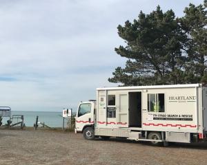
Police reported one motorist had got into difficulties at 8.50am yesterday. A car had slid off the road and chains had been provided.
After one commenter complained on QLDC's council’s Facebook page of "chaos" and "mayhem everywhere" on that road early yesterday, a council spokesman apologised online and said snow had arrived in the morning, earlier than forecast.
MetService forecasted "possible thunderstorms for Stewart Island" this morning and "strong southwesterlies, gale about the coast at times" today, with snow showers eventually easing late tomorrow.
The Dunedin City Council Facebook page passed on a MetService snow warning, and said snow showers were expected to affect the Northern Motorway from last night until tomorrow.
Between 4am today and noon tomorrow, 1cm-2cm might occasionally settle near the summit, with 4cm-8cm possibly settling tomorrow afternoon.
MetService forecaster Paul Ngamanu said strong northwesterly winds in Dunedin were expected to switch to the southwest, bringing more snow, about noon today.
Bad weather would persist in the city tomorrow but would gradually ease later in the day.
The snowy, windy conditions would "most definitely" pose hazards for travel, including for people in high-sided vehicles, and any upland livestock in exposed situations could also be at risk from "these wintry conditions", Mr Ngamanu said.
- additional reporting RNZ