Snow is expected to fall in the North Island this morning as a bomb cyclone barrels up the country, bringing storm-force winds and sending temperatures plummeting below zero in the far south today.
For the second day running snow will fall across the far south, with highways closed and other roads restricted to four-wheel-drive vehicles and wind chill making for a bitterly cold day outdoors.
State Highway 7 Lewis Pass remains closed due to snow this morning and SH73 Arthur's Pass is open but closed to towing vehicles. Chains are essential for travel on this pass.
Heavy snow warnings and watches have been issued for Southland, Stewart Island, Dunedin, Clutha and Central Otago. Snow is also expected to fall further up the island, with Nelson, Buller and Westland included in a watch.
Gales are now surging over a number of regions with blizzard-like conditions in far south and the threat of power cuts and trees toppling this morning.
MetService is forecasting even more snow to fall across much of the deep south until later this afternoon after regions were coated in some of the heaviest snow seen in years.
The New Zealand Transport Agency is warning motorists in southern regions to avoid all non-essential travel as the wintry blast coats roads in snow, making driving conditions treacherous.
Invercargill is expected to dip to a frigid -10C, according to Niwa.
Today the North Island is also in store for a spell of polar weather, with snow expected to fall on the Central Plateau in the coming hours. A road-snow warning has been issued for the Desert Rd.
Potentially damaging gales of up to 120 km/h are set to howl through eastern regions, with Hawke's Bay and Tararua District under a strong wind warning.
Strong winds are also barrelling through Auckland today, causing the Auckland Harbour Bridge to close during morning rush hour, though there are no weather alerts in place.
MetService forecaster Dan Corrigan said the city was in for a blustery day, with winds remaining strong and not expected to ease up until later in the day.
While snow hadn't fallen yet on the summit of the Desert Rd, snow showers were expected this morning.
"By far today is the more major day, before it starts getting better," said Corrigan.
He said it was unusual for Buller to see snow down to such low levels, though it wouldn't necessarily be down to the coast.
In the North Island, gale-force winds with the potential to cause significant damage and be hazardous to motorists would batter Hawke's Bay south of Hastings and the Tararua district until 9pm.
Weatherwatch.co.nz said gales might be damaging in Auckland, Otago and Southland for a time but southerners would have the additional impact of blizzard conditions and sub zero wind chill.
It follows a day of travel chaos across the South Island that saw airports close and motorists stranded.
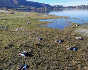
With the southern regions turning into a winter wonderland, farmers were keeping a watchful eye on lambing ewes while orchardists prepared to ward off frosts this morning in a bid to save their budding fruit crops.