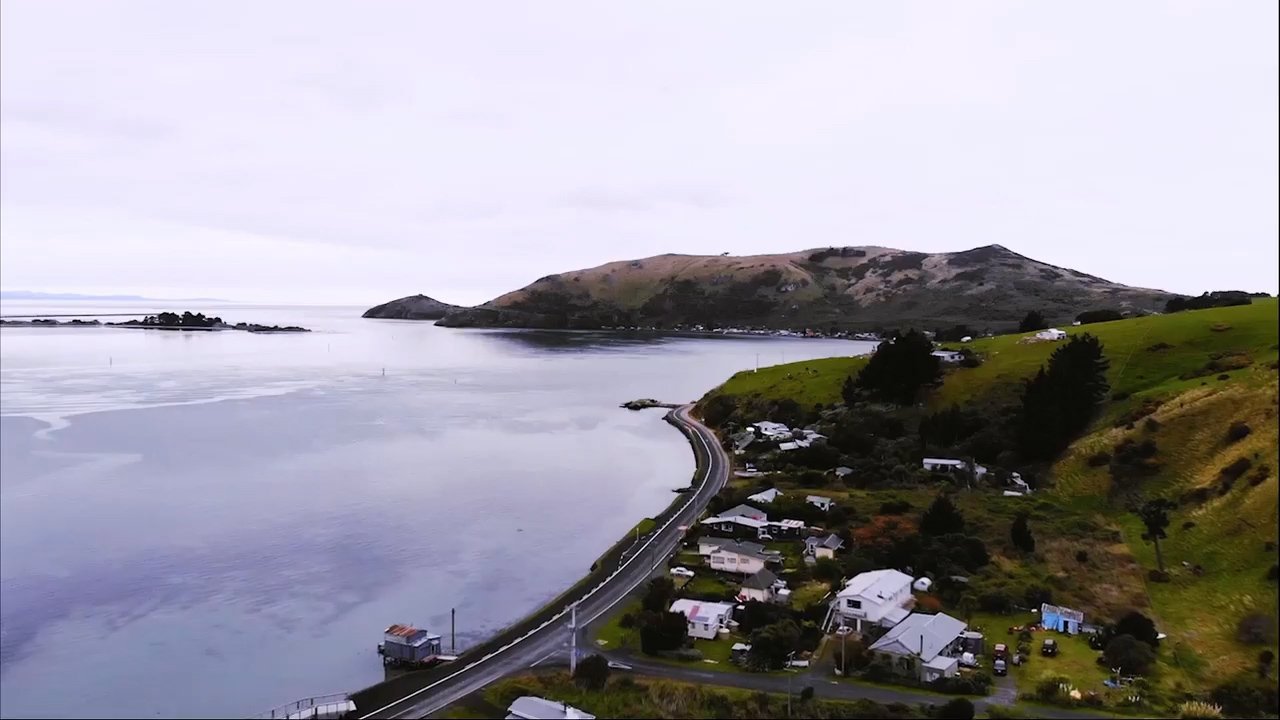
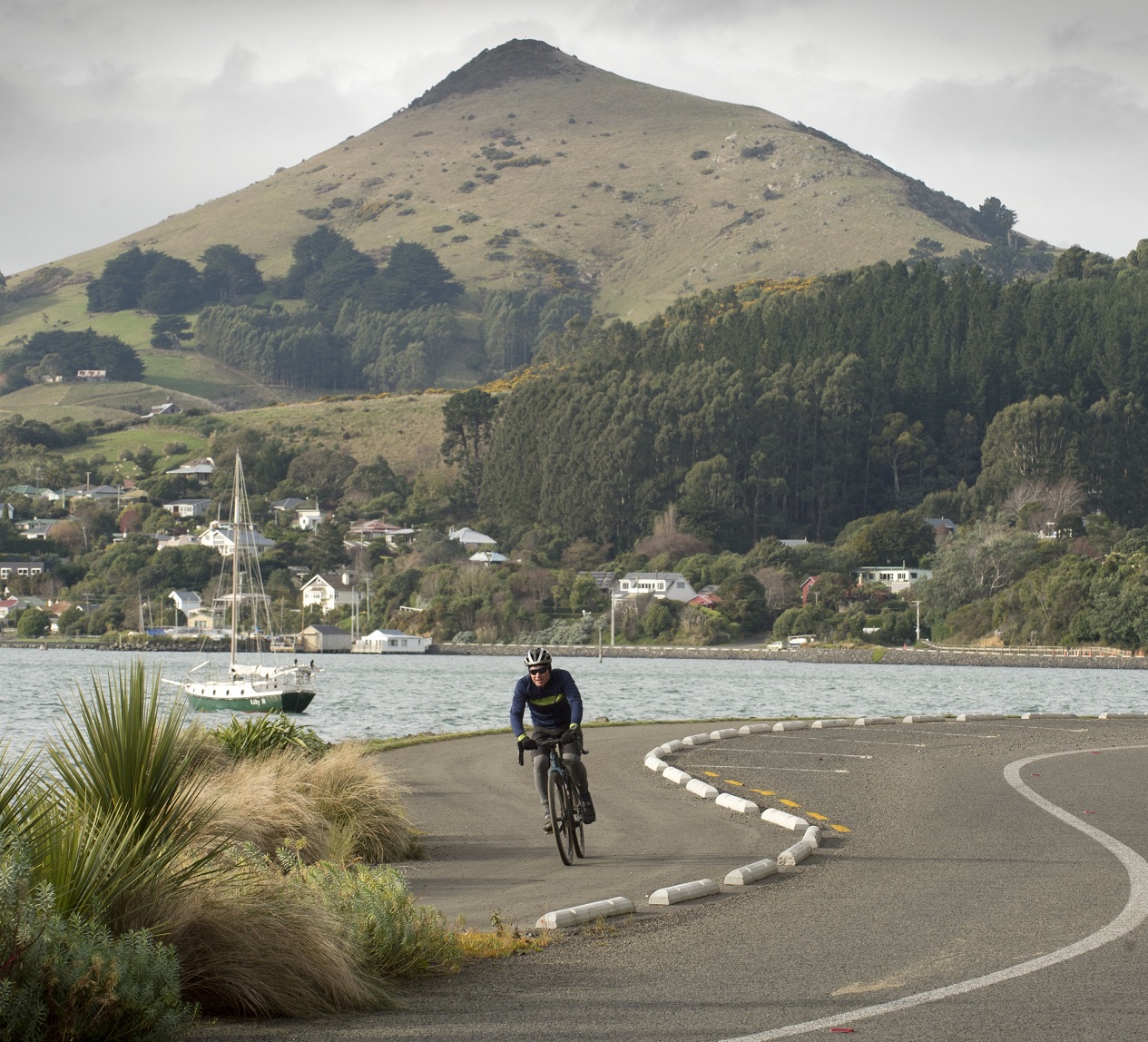
A circuit of Otago Harbour following the newly completed cycle paths, Te Aka Ōtākou, winds past boat sheds, boat ramps, boating clubs and moorings of every kind.
The distribution differs between the peninsula path, Te Awa Ōtākou, and the West Harbour cycleway, Te Ara Moana, but each provides points for leaving the land — or arriving upon it.
In the couple of centuries since the appearance of Europeans, the harbour has been developed to afford access for all sorts of water users — wind surfer, rower and yachtie, fisher, merchant sailor and cruise ship passenger.
Each of these access points is a tauraka waka, a landing place, so in one way or another, continues much earlier traditions of the waterway.
As is commonly the way, some of this development has occurred over the top of earlier uses. In the case of Ōtepoti Dunedin, one of the best known is probably the tauraka waka in the upper harbour where the city’s long buried Toitū stream once found the water’s edge.
"Tauraka" simply means a landing place, confirms Paulette Tamati-Elliffe, the kaiwhakahaere, or manager, of the Ngāi Tāhu language programme Kotahi Mano Kāika, and an Ōtākou Rūnaka member.
In pre-European times and at contact there were many kāika, or settlements, of various sizes around the harbour, occupied by different hapū, so the tauraka waka were equally numerous.
The Toitū tauraka waka was right in the Exchange area, where the Toitū stream, at that time, would have run down to the foreshore, Tamati-Elliffe says.
"That was a well-known tauraka waka in traditional times, but especially during those first encounters with the first Europeans coming into and establishing themselves in that Dunedin City area.
"So our whānau would come from our various settlements and kāika around the Otago peninsula, and they would come into Ōtepoti or what's known today as the township and draw their waka into that exchange area."
There, using barter exchange, they supplied food and provisions for those early Pākehā settlers.
"There's some early accounts describing our whānau coming up the harbour, bringing makā or barracouta and other resources for exchange.
Visits could be more than fleeting.
"They would come in and set up camp, if you like, and they would overturn their boats, or the waka, and sleep underneath the waka."
As for the name Ōtepoti, there’s a link to provisions there too.
There's been a lot of debate around what that name means, Tamati-Elliffe notes.
Some have suggested it means "of the boats", but another possibility is suggested by the geography of the area, at least at that time.
When we look at the shape of the bay, it almost has corners, she says.
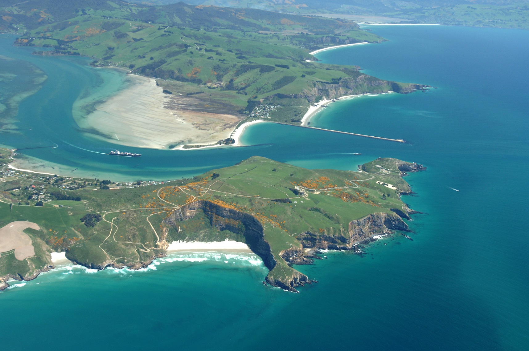
Some of this coming and going would have used the harbour channel known to mana whenua as Ōtākou.
As the Ngāi Tahu atlas, Kā Huru Manu, describes it: "Ōtākou is the channel that runs down the eastern (southern) side of the Otago Harbour from the mouth to Harwood Point. Aramoana is the channel that runs down the western (northern) side through to Kōpūtai (Port Chalmers)."
There have also been competing suggestions of the origins of the name Ōtākou, including that "tākou" is a reference to red ochre — but that doesn’t make a lot of sense to Tamati-Elliffe.
"So, kou is to come to a point and if you look at that channel, it sort of comes to an abrupt end," she says.
That’s apparent when viewed from the hills of the peninsula.
"It was known as an awa or a channel in the harbour," she says.
And, indeed, the word awa covers both meanings, river and channel.
Over time the name came to be applied to the land around Ōtākou Marae and the kāika there.
Another of the named features near the Ōtākou settlement is Huikaau, the channel at the mouth of the harbour where ocean currents run into one another between Harington Point and Kā Pukepuke-o-Te-Waiparapara (The Spit).
"So, ‘au’, again, it's like a current," Tamati-Elliffe says.
It pops up also in the naming of the Mata-au, the Clutha River.
"And so it may be a place where those currents converge," she says of Huikaau.
"The naming of places followed that sort of convention in many cases, picking up on a particular attribute. They can be named after particular events, or descriptors or activities that happen there."
On the other hand, there are also names for which local Māori cannot, hand on heart, provide an explanation, she says. They are likely to be old names.
"They come from an ancient homeland, perhaps our people bought them to this place, or they may have reminded them of those other places."
It’s a real mixture.
"Tā Tipene likes to remind us they’re yet to find a person who could tell you what London means."
It’s another old name, a traditional name, as are many of the names carried by the land in this place.