

The final determination for Christchurch’s representation arrangements was released by the Local Government Commission, with some small changes to the final proposal adopted by Christchurch City Council on June 18.
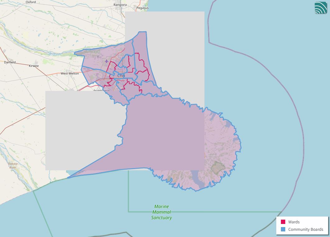
The council’s 2021 Representation Review resulted in a proposal for Christchurch to continue to be represented by a mayor, 16 councillors, and 37 community board members, representing 16 wards.
The mayor will be elected ‘at large’ by the whole city, and each ward will elect its own city councillor and community board members.
"When drawing up the ward boundaries, we had to make sure that, wherever possible, the population living in each one was within 10 per cent of the population in every other ward.
"That way, each elected member is representing roughly the same amount of people.
"The Local Government Commission’s final tweaks are in line with our original vision, and the result is an arrangement that keeps communities together, in a way that makes sense.
"The biggest change to the status quo is that come 2022, Christchurch will be represented by six community boards, rather than seven.
"The Linwood-Central-Heathcote Community Board has been divided up, and each of those wards will join a nearby community board with common interests – the Linwood ward will join Waitai Coastal-Burwood, the Central ward Waipapa Papanui-Innes, and the Heathcote ward Waihoro Spreydon-Cashmere," Dalziel said.
Although its population is significantly smaller than other wards, Banks Peninsula will continue to have its own ward and subdivisions due to its unique nature and geographic isolation.
The Local Government Commission’s final determination largely upheld the council’s final proposal, with the exception of two minor changes to ward boundaries.
Your ward’s new boundaries can be found on this this summary map or view the Local Government Commission’s final determination here.


