The Dunedin City Council says it will need to have ''serious conversations'' with some Ocean View homeowners covered by a proposed ban on new development in the area.
However, the possibility of a reprieve has also been floated again as council staff continue to stress the stricter approach - which aimed to protect against natural hazards - is not yet ''set in stone''.
The proposed changes, unveiled on Tuesday, would result in a variety of new hazard zones and planning restrictions included in the council's second-generation district plan.
That would include new ''extreme risk'' zones, where the threat of natural disasters - including flooding, landslips, tsunamis and sea level rise - was considered so significant new development would be banned.
That was expected to have a ''significant impact'' on the owners planning to develop vacant sites and who would be prevented from doing so in future, council policy planner Sally Dicey said.
''We recognise that and that's why this is a draft process. We're emphasising that and urging those people to come and talk to us. This is not set in stone.''
The comments came as Ms Dicey confirmed there were 26 vacant residential sites across the city on which development would be prohibited under the proposed extreme risk hazard zones.
If subdivided, those could be split into 104 sites, adding to the theoretical lost development potential.
Another 86 vacant sites would be covered by the new high-risk hazard zones, the next level down in risk, which could be subdivided into 258 sites, she said.
Under the proposed changes, the high-risk zones would still make new homes a non-complying activity requiring resource consent in future.
However, Ms Dicey said the figures reflected only the theoretical development potential, and not the likely demand, which was influenced by a wide range of factors.
Some of the vacant sites would also only be partly covered by the new zones, and the new rules that came with the zones would only apply inside the areas covered, she said.
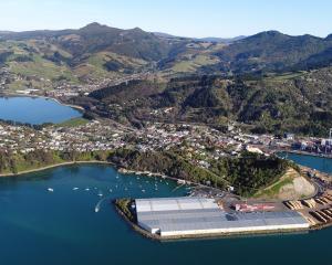
Ocean View was ''the most dramatic'' of the areas affected by the proposed changes, but the boundaries of the hazard zones remained ''very draft'', she said.
They had been taken straight from Otago Regional Council maps, but could yet be changed as a result of public consultation and in discussion with ORC staff, she indicated.
''We're happy to take input from people, and we're going to have to have serious conversations with those people out in Ocean View.''
However, under the existing proposals, those planning to demolish old houses and build bigger new homes would be prevented from doing so in the most at-risk areas, she confirmed.
To do so, they would need existing use rights, which depended in part on making no ''significant'' change to the size of the home, she said.
''It does depend a little bit on how much they were going to increase the size. For those people ... they would be better to do an extension, and for that extension they would have to apply for a consent.
''But if you knocked down entirely, then they're at risk of falling under that prohibited activity status,'' she said.
Public consultation on the natural hazards proposals will run from June 24 to August 1 and include 11 public meetings.
Extreme risk zones
- The Dunedin City Council is proposing hazard overlay maps and new planning restrictions for second-generation district plan, which controls development across city.
- Changes would include ''extreme risk'' zones, including for coastal threats (tsunamis, storm surges, erosion and sea level rise), prohibiting new development.
- Existing beachside homes in Ocean View among those covered by proposed coastal ''extreme risk'' zone.
- Existing use rights would apply, meaning existing homes would remain.
- New homes on vacant lots, and demolition/complete replacement of existing homes with bigger homes, would be prohibited.
- Concerns changes could lower property values and affect insurance cover/premiums.
- Proposals yet to be confirmed; subject to public consultation (June 24 to August 1) and changes possible.
Risk zone maps: www.odt.co.nz/news/dunedin/306317/city-faces-facts-risk