Roxburgh Gorge Trail trustees and chairman StephenJeffery respond to criticism about the cycle trail.
Campbell Live's item (3.5.12), while revealing Central Otago's autumnal beauty to TV3's national audience, also implied that the Roxburgh Gorge is a pristine environment, largely untouched by the hand of man, and that the trust and its contractor are damaging it as we create our trail.
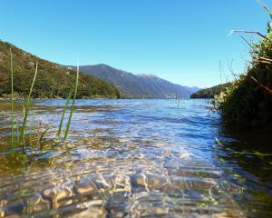
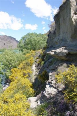
Nothing could be further from the truth. The Roxburgh Gorge has a long history of human impact: tracked, trailed, terraced for irrigation, fenced, stocked, inhabited by woody weeds and pest animals, mined and flooded; this has been a working landscape for 150 years. Indeed, the most significant attraction that critic Steve Toyer promotes to his tourist clients is the Doctors Point mine - many hectares of quarry, schist stone mounds, large boulders, tunnels, water races, dams and tracks.
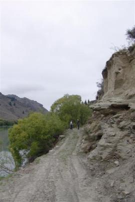
The trust has been accused of "bulldozing a trail over original roads and through original huts".
The first photograph clearly disputes that. This section of old road remains intact, the stacked stone work is in good order and no damage was caused to an adjacent old Cobb & Co building.
Signage will be erected at heritage sites to explain their significance; no site will be compromised during the construction of this trail.
Claims that opening a trail into this area would "provide access to a valuable archaeological site", and that items of historical significance would go missing, are also wrong. The trust works closely with its archaeologists, the Historic Places Trust and the Department of Conservation. A few recovered items now reside in the Central Stories Museum and taonga tuturu (Maori artefacts) have been advertised for claimants. Very little that could be removed is left. Boat access since the damming of the Clutha at Roxburgh has ensured that.
What about land access and Mr Toyer's oft-repeated assertion that "they'll never finish it"?
Of the total 34km of this trail, the trust has agreed access or support in principle over more than 30km and the rest will follow in due course. Until finished, a central section will be "bridged" by boat - an attractive option providing revenue-earning opportunities for the trust and commercial operators.
Individuals can still do spectacular 20km round trips at either end of the gorge.
The trust halted progress near Alexandra during preferred alignment negotiations with Bruce and Leigh Johnston. The original plan was to follow an old haul road on the margins of the Johnston property but negotiations failed and the many concessions offered by the trust were rejected, so a more costly riverside option will be used.
That delay has been expensive and frustrating.
Claims made about land instability were exaggerated and unfounded. A photograph shown as an example of a "landslide" was, in fact, taken at an early construction phase, following rock blasting and before the contractor could clear the debris.
Misleading claims have been made regarding the trail's design and construction. In August 2010, all landowners signed an agreement to grant right of way easement in principle. Meetings occurred with the trust at which all landowners received feasibility documentation fully outlining New Zealand Cycle Trail's specifications: a nominal 2.5m to 3m width with gradients not exceeding three in 40. The objective of the trail is to safely accommodate amateur and competent cyclists and walking groups, rather than technical mountain bikers and trampers, hence the width and gradient constraints, and all appropriate resource management consents are in place.
The trust recognises that much of the gorge seems isolated - that's a significant attraction of this trail. Mobile phone coverage is as good as much of the Rail Trail and will improve. VHF radio coverage will also improve, once a planned portable repeater for local LandSAR, Clyde Coastguard and helicopter rescue operations is installed.
The decision to place the trail on the true right of the gorge was, in part, to enable emergency access to the state highway up farm tracks. It is also the more sheltered side in nor'westers and southerlies, and is more shaded in the midday heat. The need to navigate three difficult, long and near-vertical rock bluffs, with unstable boulder fields above them, also counted against the true left. It was never a viable option.
Rockfall risk confronts every back country hiker and biker.
Many tracks, like the Milford or Routeburn, would be off-limits if risk of rockfall was a prohibiting factor. The trust plans to mitigate this risk by removing loose rock, installing signage, encouraging trail users to cross high-risk areas with minimum delay and closing the trail during adverse weather.
The trust makes a plea for patience and common sense as we construct this exceptional trail. The visual effects of construction will ultimately blend into the countryside, as the many historical tracks have done, and long stretches of the trail will barely scratch the surface.
Revegetation and reseeding is planned and landowners will be encouraged to restore indigenous vegetation.
This trail will boost the local economy, as the Otago Central Rail Trail has done. There will be benefits in community health and social wellbeing. The whole region will benefit from the increasing national and international exposure this trail will bring, as indicated by the Prime Minister in the Otago Daily Times (11.5.12).