This is part of the still a work in progress redesigning of the Octagon. I'm not sure why it needs to be redesigned since the present layout, features and furniture were only put in place in 1989. How often do they redesign Trafalgar Square?
This reminded me of the image on the cover of the relevant report which shows a diagonal, paved thoroughfare extending from the Municipal Chambers clearing a viewshaft to the Ra Bar and Regent.
There was a loss of lawn in the upper Octagon and some compensating grass in the lower where the area at present is paved. But really, why would you do that?

It reminded me of something the late Hardwicke Knight wrote or said that it would be good to clear the buildings intervening between the Municipal Chambers and First Church since they are aligned.
It would produce quite a magnificent viewshaft but unfortunately would require the demolition of a substantial part of the Regent, which I wouldn't support. But it focused my mind on viewshafts.
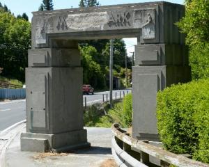
Not long ago it was reported the council has put a bridge back into the long term plan to link the central city and the harbourside.
The proposal was for a bicycle and pedestrian bridge this time and I don't believe its location was mentioned. But the previously discussed vehicle and pedestrian bridge was meant to cross the railway tracks at Rattray St.
This is a bad idea and I've inveighed against it before. Here it is returning like the proverbial bad smell. It's a bad idea because it would close the last remaining viewshaft between the central city, the waters of the harbour and the peninsula beyond.
There were once many, and these views were a key feature of Charles Kettle's plan for the city whose encircling crescent, the Town Belt, was its inland, balancing counterpart.
It's worth going through the tally to see what's been lost. Princes St and George St is the town's spinal axis. At its southern end, the Oval, effectively the southern terminus of the Town Belt, there was a view east where the water could be seen.
It's been blocked by buildings and embankments for a long time. Next is Jervois St where the same is true.
In Kettle's day the harbour started on the east side of Bond St. Land has been reclaimed where Crawford, Vogel and Cumberland Sts run, as it seems he expected it would.
Many of his streets were extended so the views down their shafts remained even after the railway was built and moved east of Cumberland St. But progressively those views have been lost.
The next north is along the line of Police St. This remained quite a long time but was blocked by buildings east of Roberts St fairly early in the 20th century. Next is Jetty St which was definitively blocked in the 1970s by the overpass to Portsmouth Dr.
Then there's Liverpool St where no extension was made past Crawford St and the view was lost in the 1880s. There was a clear view along the line of Water St where the view disappeared only in the late 20th century when railway land was sold and retail premises built west of Cumberland St.
Then there's Rattray St and here you can see the whole way through, while standing in Princes St. Because of reclamation you have to advance some distance before you can see the water in the Steamer Basin. If there's a ship moored there you can't but a ship means water anyway.
Despite the elevation of Princes St at Dowling St, you can't get the view because the old bus station intervenes. At Moray Pl it's Burns Hall and at the Octagon it's the Railway Station. It's a fine vista and this view shouldn't be blocked, but it's not the same.
Moray Pl east of George is blocked. So is St Andrew St and has been since the early 20th century. Hanover St's been blocked longer, Frederick St since the 1920s when the Anzac Ave railway overpass was built.
The view east at Albany St was eclipsed probably sometime in the middle of last century by buildings now used by the Otago Polytechnic.
All the further northeastward views are blocked from the harbour by natural features and were in Kettle's time. There is now only the one, at Rattray St. It would be a great shame to lose it.
Peter Entwisle is a Dunedin curator, historian and writer.