Brace yourselves - snow is coming. Residents across Otago and Southland would be wise to stock up on firewood, dust off their winter woollies and have hot-water bottles at the ready.
Temperatures are predicted to drop tomorrow, as a cold front sweeps across the southern South Island, bringing snow to low levels.
The MetService yesterday issued a special weather advisory for Fiordland, Southland, South Otago and alpine passes, warning snow was likely to near sea level in the deep South tomorrow.
The series of cold fronts were expected initially to affect higher roads and passes today - particularly the Milford road - and ''significant accumulations [are] likely'' tomorrow.
Snow would fall to lower levels tomorrow and was expected near sea level in the far South by tomorrow night.
The MetService said ''significant snowfall accumulations'' were possible on Sunday over higher parts of Fiordland, Southland, South Otago and Dunedin hills and inland Southland, but particularly about the Catlins.
The snow would be accompanied by ''strong to gale-force southwest winds'' adding to bitter temperatures and possibly leading to ''blizzard conditions'' about the hills.
''People in these areas should prepare for winter driving conditions and possible travel disruptions. Farmers may wish to move vulnerable stock to sheltered areas,'' the MetService said.
Meteorologist John Law said the ''southern South'' could expect ''everything coming at you from all angles'' in the next few days.
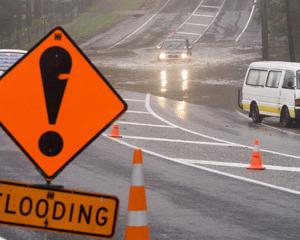
A week of heavy rain, particularly in Fiordland, had caused streams, rivers and lakes to rise. In the 24 hours to 1.30pm yesterday another 200mm of rain fell at Milford Sound, while Lake Wakatipu had risen to 310.371m above sea level by 5pm yesterday, a metre below Queenstown's possible flood level.
The Dart River at the Hillocks peaked around 950cumecs, dropping to just over 723cumecs by 1.45pm yesterday, while the Shotover River at Peats Hut was running at 116.743cumecs by 1.45pm yesterday, having peaked earlier in the day about 150cumecs.
Mr Law said while the rain would ease, people now needed to be mindful of the forecast snow.
''It's definitely one of the things to flag. If you're planning on going across the passes, snow will affect them''.
Mr Law said while ski areas across the region would get a welcome snow base to start preparing for the 2014 season, snow was unlikely to amount to much in Queenstown and Central Otago. Temperatures in those areas would plummet tomorrow and an overnight low of -6degC was predicted.


