PHOTO

The latest data from Earth Sciences New Zealand shows just how wet and cool it was at some points this summer for parts of the South Island and lower North Island.
Chester Lampkin from Earth Sciences New Zealand told Morning Report although it may not have seemed like the best summer, overall the 2025/26 summer was about average, he said.
"Essentially we had a warm start to the summer, December was nearly 1C above what is considered the average and temperatures were near average for January and then it just got a little bit colder."
The data shows Christchurch was the driest of the six main centres this summer.
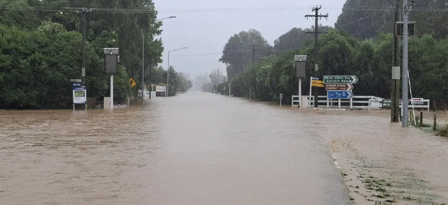
Yet Akaroa saw 563 mm of rain, which was 333% of its normal summer rainfall, driven mostly by the Valentine’s Day storm.
Akaroa and Little River were temporarily cut off during the February storm when flooding and slips closed State Highway 75 and Banks Peninsula was put under a local state of emergency.
Most of Canterbury's rainfall occurred during the storm or the January tropical low event.
Auckland was the warmest of the centres, Tauranga was the wettest and sunniest, and Dunedin was the least sunny and coolest.
Kaikōura matched its hottest day on record with 34.5 deg C on January 11.
Summer rainfall was well above normal (>149% of normal) for most of the Canterbury Plains from Timaru north, including Banks Peninsula and the Kaikōura district.
Temperatures were below average (0.51 deg C to 1.20 deg C below average) in the Southern Alps through South Canterbury and Otago.
Across New Zealand in February, temperatures were half a degree below average, with low pressure and more southerlies, Lampkin said.

"As a result this is going to end up being an average summer, people won't remember it that way but statistically that's how it played out."
The summer was dominated by lots of high pressure but there were three very unsettled periods, he said.
It was unsettled from Christmas to New Year holiday period with many places getting a lot of rain and wind, he said.
From around January 20-22, it was also unsettled and that was when record rainfall in Coromandel and Bay of Plenty saw the tragic incidents that occurred there, he said.
"We have the storm that occurred around Valentine's Day that brought heavy rain to Gisborne and rain and wind to the Wellington region and parts of the South Island and continued all the way down to Banks Peninsula and Otago."
Parts of the South Island and lower North Island, such as Canterbury, Dunedin and Wellington, had above normal rainfall and below or near normal in terms of temperature, he said.
The weather pattern in autumn is expected to be similar to that of summer, he said.
"That means the possibility of some tropical intrusions or some tropical air seeping southwards from the tropics across the North Island and perhaps the upper South and temperatures will likely be reflected in that if we get more tropical lows that'll keep temperatures down, at western areas, particularly the South Island will be a little warmer than average but maybe you won't notice it because it'll be cooler autumn air."
Lampkin said it would be difficult to predict how much sunshine there would be but his best guess was that "a lot of New Zealand would be in the cloud for much of the autumn as well".
-RNZ with Allied Media