PHOTO
Controlled burn research up the Rakaia Gorge is a project that has taken scientists and fire and emergency crews working alongside staff from Department of Conservation and Environment Canterbury more than a year to prepare.
And once the wind conditions were just right and each of the fires were set the tinder-dry metre-high gorse-land along Double Hill Run Road went up in flames in minutes.
It’s an impressive sight, marred only by thick black and grey smoke billowing off into the atmosphere.
The project, led by Crown research institute Scion, who specialize in research, science and technology development for the forestry, wood product, wood-drived materials and other biomaterial sectors, has included a group of researchers from the US Forest Services, Missoula Fire Sciences Laboratory, San Jose State University and University of Canterbury geography department.
There have also been Fire and Emergency New Zealand (FENZ) crews from Mid Canterbury, Canterbury, West Coast and Otago getting invaluable on-the-ground operational training experience, and a chance to network with other fire crews during a co-ordinated response.
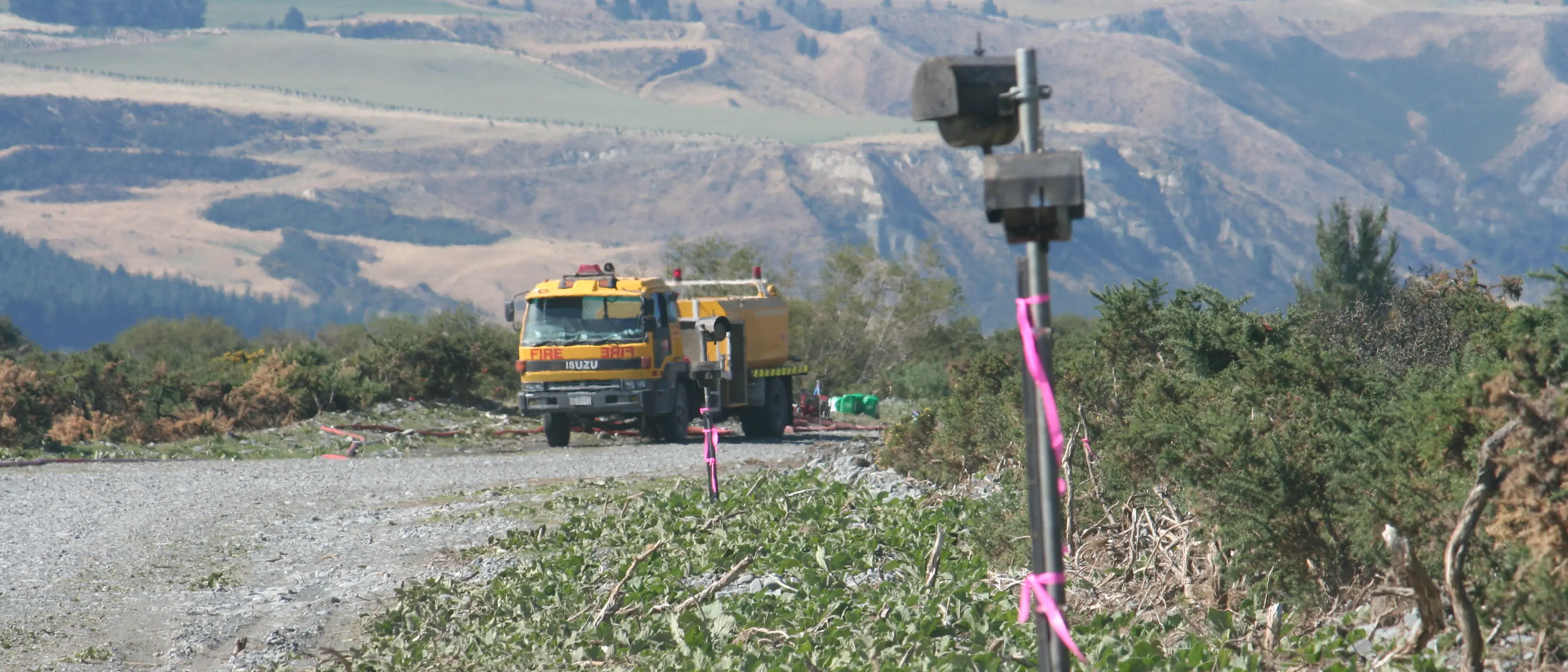
But the hundreds of man hours to get permits and approvals, to prepare the 80 hectare site with burn-off grids across six burn plots, complete with 10-metre wide firebreaks and buffer zone, as well as the ground work done on burn days by fire crews were worth it.
There was valuable insight in to how “free-running fires” behave in gorse scrub fuels to add to existing knowledge from other experimental burns done around New Zealand.
Scion Rural Fire Research Group fire scientist Grant Pearce said the focus was on the ‘fine scale dynamics happening right in the flame zone” and, among other things, to investigate a US Forest Service theory about how heat was transferred from flames to unburned fuels ahead.
He said it meant the movement of heated air (convection) was “much more important than previously thought” and it was hoped the burns would prove it.
Using a series of instruments within the burn sites, including 30-metre towers, video recordings and drones to capture the fire spread, measurements were being taken on everything from flame temperatures, to the turbulence happening within the flame zone, right out to the turbulence above the fires and in the atmosphere.
Lidar was also being used to track particles in the smoke produced.
The information will help improve models for predicting how fires will spread and how hot they will burn. Information that can be used by firefighters.
“The research collaboration with these international and local partners allows us to tap in to all that expertise and really add to the experiments in New Zealand,” he said.
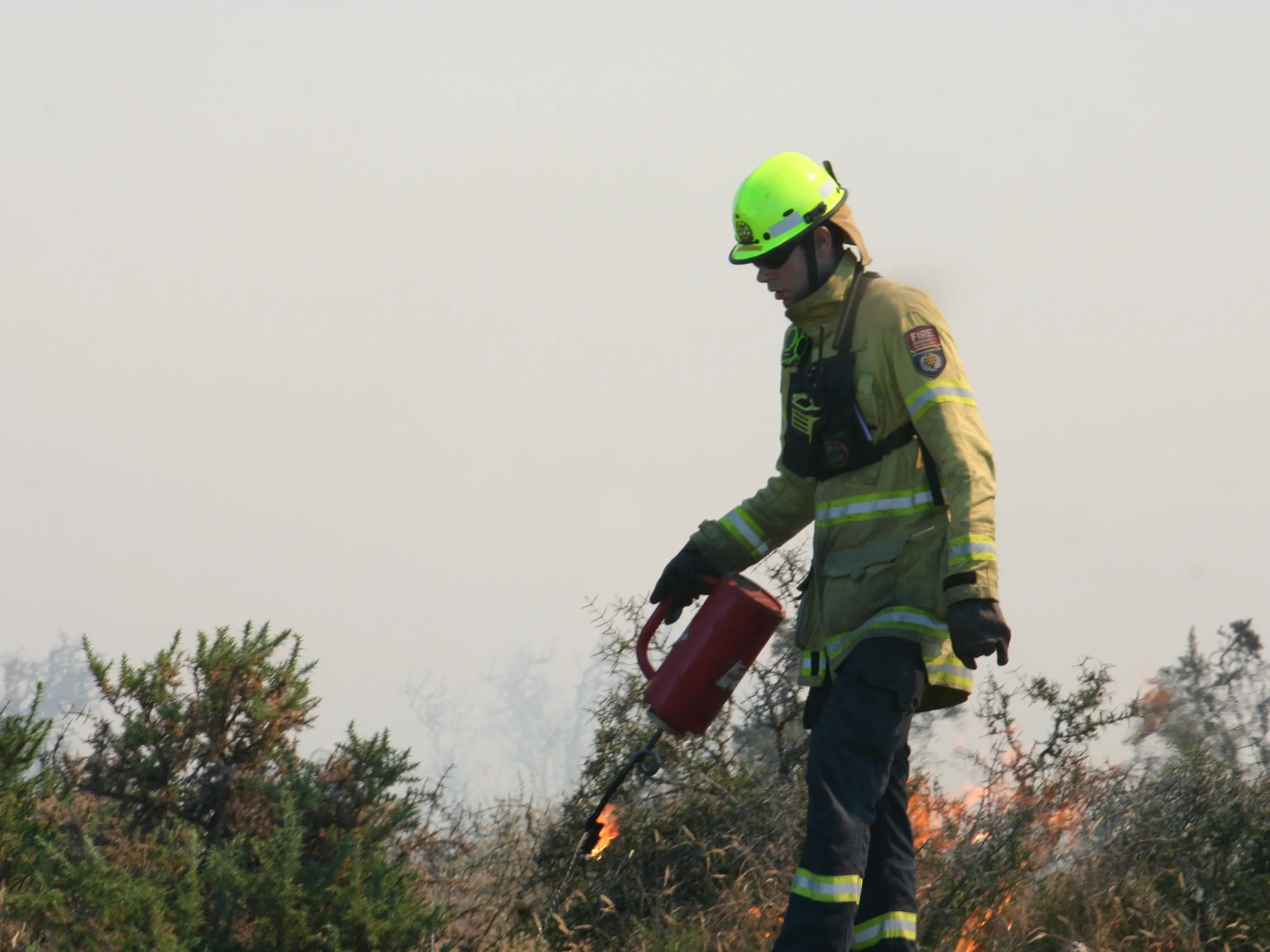
The fires only took place under specified weather conditions, had a helicopter on standby, and with the final approval of Fire and Emergency New Zealand. Water was collected for fire trucks and water storage tanks from an on-site stream. Prior to the burns it was used to douse the dry spots neighbouring the fire zone to prevent fire spread.
It was also used to mop up the fire, and prevent flare ups, once the burn-off had burnt through.
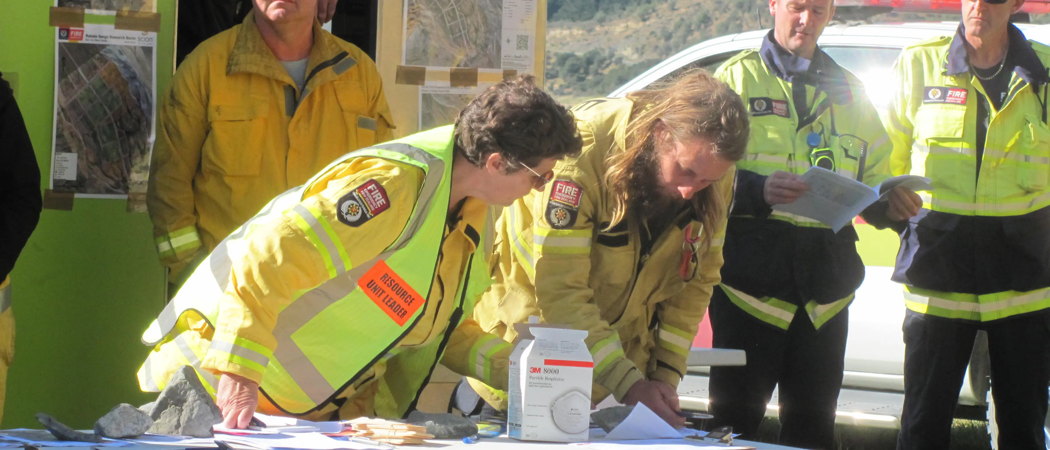
On the morning of burn days, fire crews signed in at the operations site and gathered for meetings which included burn plot information, weather updates and on site conditions. They were supplied a packed lunch and bottles of water, which along with the portable toilets on site, were able to sustain them for the day.
The location of everyone on site was identified using a co-ordinated incident management system and placed on card on a central management board. The cards were removed as each person cleared the site.
The effects of wild fires and bush fires can be devastating and every year New Zealand has around 3000 wildfires which burn around 6000 hectares of rural lands. It’s an annual cost to New Zealand of $100m, which includes firefighting response and readiness costs, and immediate damages to property. It does not include indirect losses such as damage to rural lands or conservation resources, personal property or lives.
“As our climate changes and extreme fire conditions become more common, our research findings will hopefully help prevent loss of life, property and our native vegetation and wildlife.”
The fire burns will help fire managers predict where fires are likely to occur, how severe they will be, how they are likely to behave based on vegetation type and other conditions, and what resources are needed to control them and put them out.
Information such as fuel loadings, fire spread rates and smoke behaviour for gorse vegetation, a highly fire-prone fuel-type common across the country, will aid understanding of fire behaviour to improve training information and prediction tools for firefighters and rural land managers.
The Rakaia Gorge burn follows earlier experimental burns done in crop stubble fields and would look at standing wild pine fires in the future.
Mature gorse was considered particularly interesting as it can contribute a heavy fuel load to fire and burn intensely.
“The economic, social and environmental costs of wildfire are growing, and will continue to grow as communities increasingly spread into rural and forested areas, and as the changing climate results in hotter, drier conditions and an increasing number of extreme fire-risk days.”
Scion’s rural fire research is done to provide FENZ and other rural fire and emergency response agencies with the knowledge and tools to prevent fires from occurring and to put wildfires that do occur, out more quickly and safely. The team as completed over 140 similar burn experiments in different vegetation types.