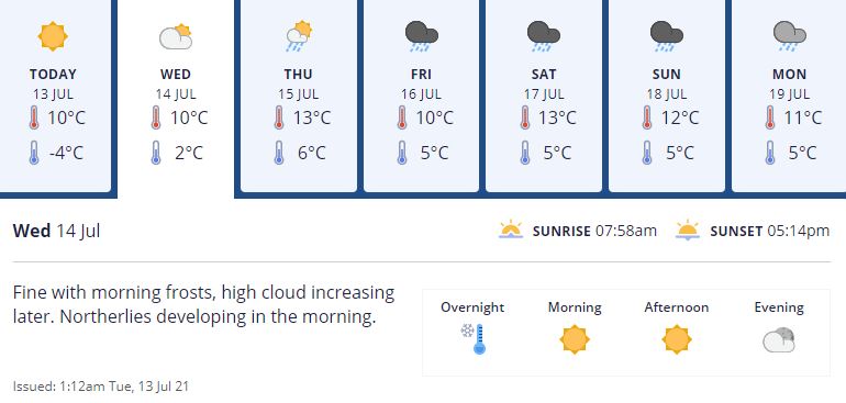
But first rug up tonight for another chilly and frosty start tomorrow in Christchurch.
Places dropping to negative figures will include inland parts of the South Island, such as Canterbury, Otago and Southern Lakes, as well as popular North Island holiday spots like Taupo, which will drop to a minimum -3 deg C, and -1 deg C in Rotorua.
The temperatures will then warm up as the day progresses before the wind and rain hits the South Island in the afternoon and the North Island on Thursday.
MetService shift meteorologist Mmathapelo Makgabutlane said from tomorrow rain will fall over the southern and western parts of the South Island before moving up the country and landing in the North Island on Thursday and Friday.

Strong winds are also set to batter the central parts of the North Island, picking up Friday and Saturday with the possibility of severe gale winds in exposed places.
Makgabutlane said if people were thinking about what to do with the kids for the school holidays it would be wise to do indoor activities.
"So far, it's definitely looking like an indoor week."
However, after tomorrow morning's cold snap, the temperatures for most of the country, especially the North Island, are set to warm up and hit double digits with places like Wellington moving from 10 deg C to about 15 deg C.


