PHOTO
A state of emergency has been declared in Selwyn and several roads have been closed across Christchurch as heavy rain lashes Canterbury.
Selwyn Mayor Sam Broughton said on Thursday morning emergency services and Civil Defence volunteers are working to help people evacuate at Selwyn Huts due to rising river levels and the likelihood the access road will be cut off.
A heavy rain warning remains in place for parts of Canterbury until 6pm on Thursday.
Darfield High and Ellesmere College have closed for the day due to flooding and road safety concerns. The schools told students to stay home.

Some 250 sandbags have been delivered to households in West Melton, Doyleston and Leeston.
Community sandbag stations were set up at community centres in Sheffield and Glentunnel last night.
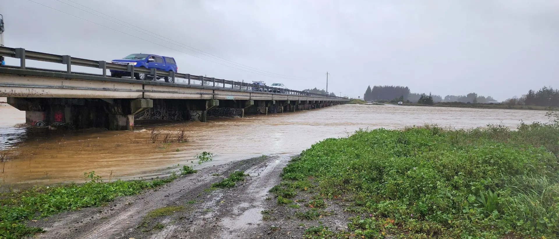
Fire and Emergency NZ and NZTA are currently assessing the conditions of the SH1 bridge over the Selwyn River.
Data from Environment Canterbury shows the Selwyn River at Coes Ford is flowing at 73.222 m3/s compared to the normal rate of about 1 m3/s.
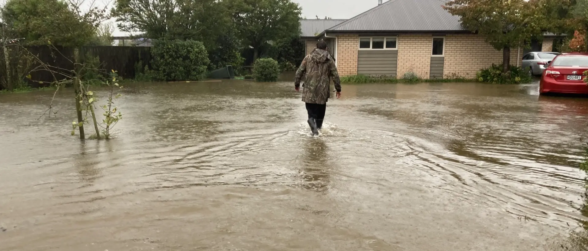
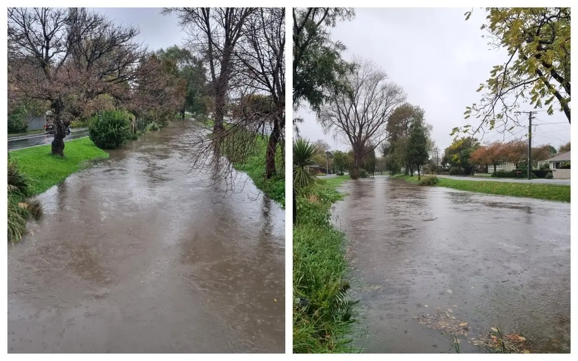
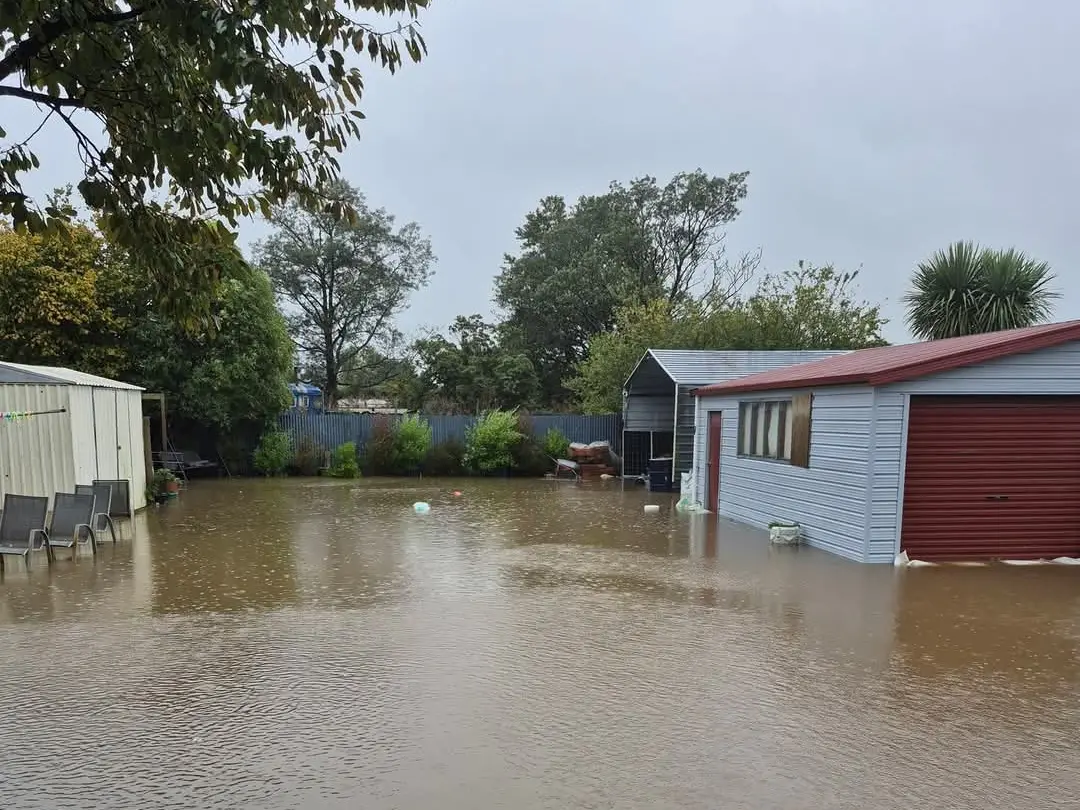
Doyleston has been particularly hard hit with many properties under several centimetres of flood water.
Residents across Selwyn are being asked to conserve water.
"Although precautionary, we are asking that residents in Selwyn Huts self-evacuate from the area due to concerns of flooding from the Selwyn River," a district council spokesperson said.
"Several schools across the district have closed, including Darfield High, Lincoln High, and Ellesmere College. Please check-in with your child’s school to see if they are open or not.
"There is significant surface flooding including on several roads, with several now closed.
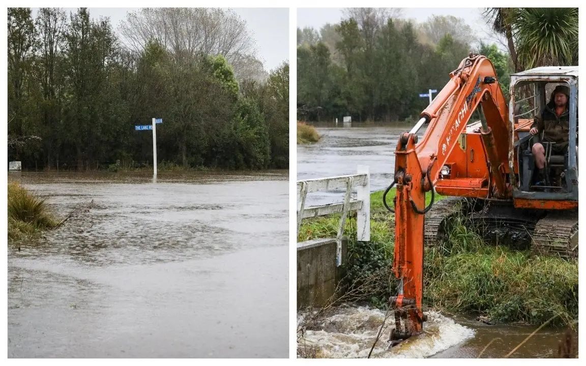
"Coes Ford and other fords across the district have also been closed.
"Sandbags have been distributed in West Melton, Doyleston and Leeston, while Community Sandbag Stations are in place in Sheffield and Glentunnel, Ladbrooks and Leeston. Sand and bags are available, though you will need to bring your own spade.
"Conserve water notices remain in place for the Acheron, Arthur's Pass, Dalethorpe, and Hororata Water Supplies.
"We are encouraging Selwyn residents to conserve water until the supply can be restored.
"We also ask that you try and minimise water usage in Prebbleton and Lincoln as our wastewater network is becoming overwhelmed, due to the sheer volume of water."
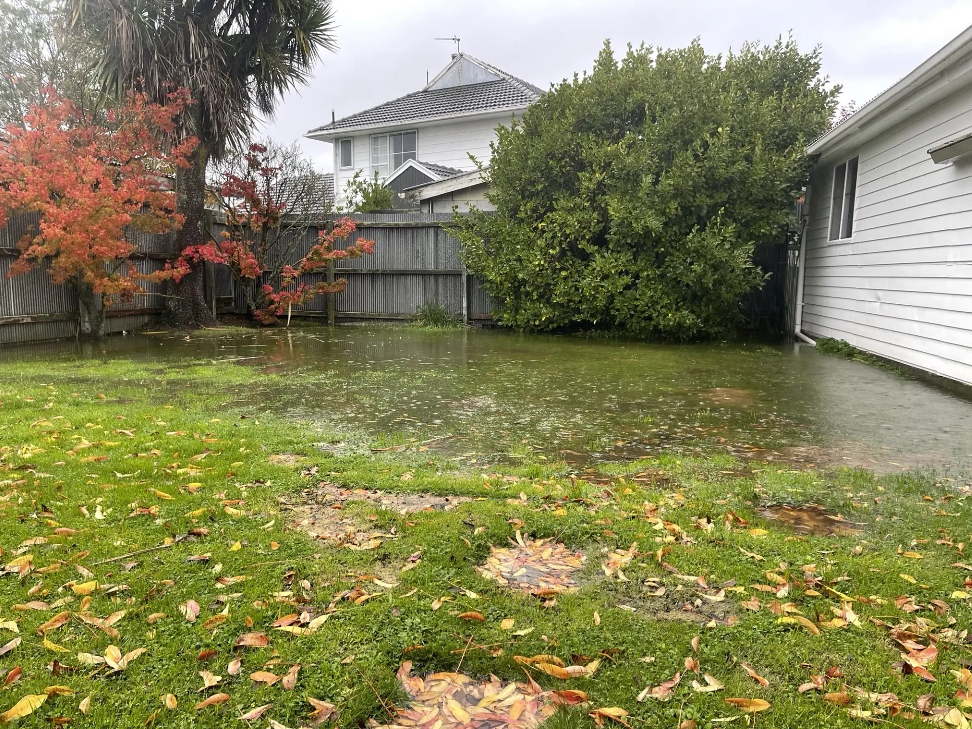
In Christchurch, part of Fitzgerald Ave near the bridge has been closed, New Brighton Rd between Rawson St and Pages Rd is closed and Avonside Drive between Wainoni Rd and Kerrs Rd is also closed.
Hoon Hay has also been hit hard with a section of Gainsborough St under water.

Potholes on Deans Ave due to the heavy rain and road renewal works are also causing issues for motorists.
A contractor has been notified to fix the issue.

A Christchruch City Council spokesperson said it is monitoring the wastewater network as heavy rainfall can cause it to become inundated with rain and flood water.
"This can affect the mains, meaning that in some areas people may be experiencing 'slow' or 'no' service.
"Toilets, showers and sinks may empty slowly or in the worst cases not at all. If this was to happen the council will arrange any clean up to property or the environment following being notified of overflows."
On Banks Peninsula, part of State Highway 75 has been closed due to the high tide.
SH75 was closed from Birdlings Flat to Little River at 11pm on Wednesday. It is unlikely to open before lunchtime today.
Residents with flooding or roading concerns are urged to contact the city council on 03 941 8999.
Large parts of the country are being hammered as torrential rain and gale force winds set in for the next few days.
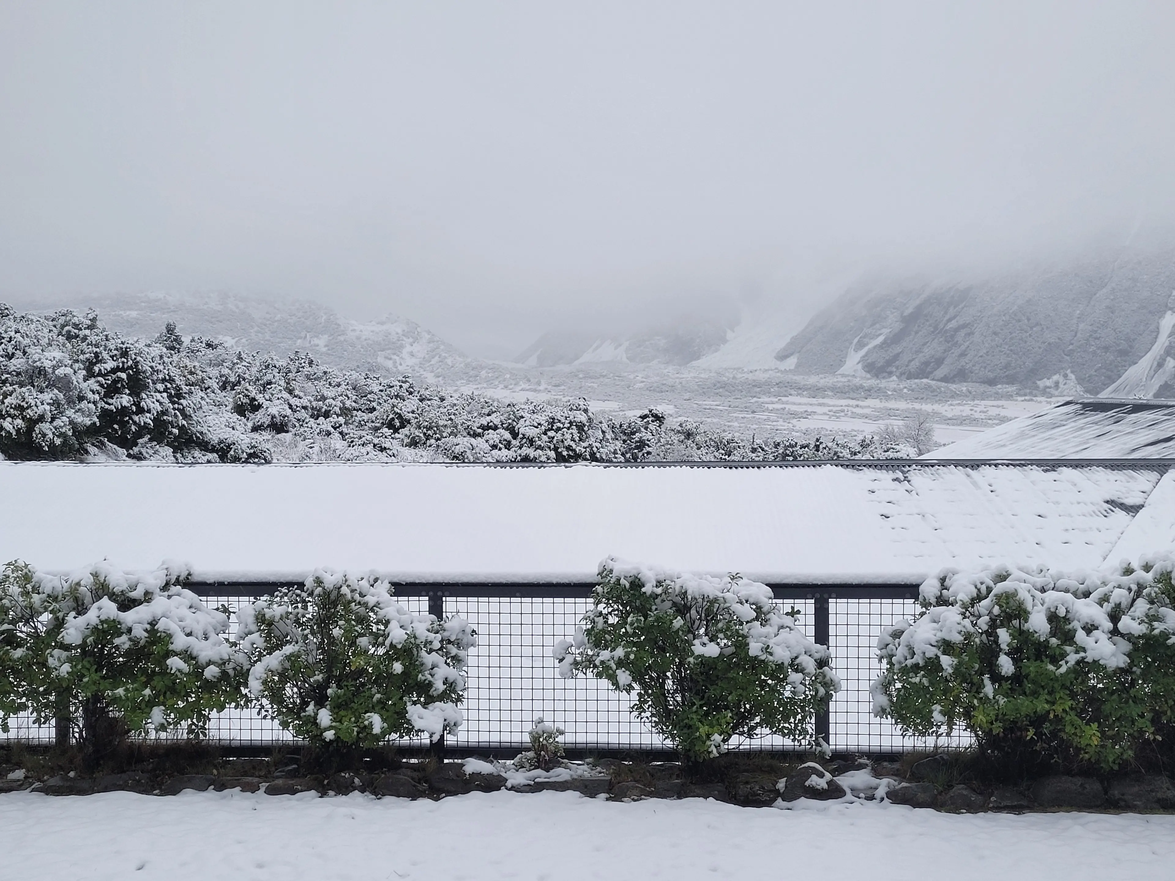
They include snowfall warnings around Christchurch, the Canterbury high country, as well as Porters, Arthurs, Lindis and Lewi passes from Thursday.
MetService says there is a high chance an orange heavy rain warning will be upgraded to red in North Canterbury and Kaikōura, with the regional council warning that the torrential rain could result in flooded roads and rivers breaching their banks.
Meteorologist Mmathapelo Makgabutlane says it has been a wet night in eastern parts of the South Island, especially Canterbury, and for parts of the North Island.
The Canterbury region has already had 100 millimetres to 150mm of rainfall over the last 24 hours with more to come, she says.
Red warnings are still a possibility. "We'll be keeping a very close eye to see how things develop."
April has been an "extremely interesting" weather month, she says, seeming to pack three months of events into just the four-week period.
"This year has been okay for the Canterbury region, however, this rainfall is falling on extremely sodden ground and I think at any time of year this amount of rainfall would possibly cause issues."
Snow fall warnings continue throughout the day for the Canterbury High country and alpine roads Porters Pass and Arthur's Pass (both State Highway 73) and the Lewis Pass (SH7).
A warning for the Lindis Pass (SH8) in Otago was expected to be lifted about 8am today.
Here are the latest road closures in Christchurch:
- Fitzgerald Avenue between Kilmore Street and Cambridge Terrace
- Cambridge Terrace from Barbadoes Street to Churchill Street
- New Brighton Road between Rawson Street and Pages Road
- Avonside Drive between Wainoni Road and Kerrs Road
- Avonside Drive/Swanns Road between Retreat Road and Woodham Road
- Empire Road from Main North Road
- River Road
- #278 Gardiners Road
- Ernlea Terrace closed at Colombo Street
- Hunter Terrace
- Riverlaw Terrace
- Clarendon Terrace
- Richardson Terrace
- Eastern Terrace s
The following roads are closed on Banks Peninsula:
- SH75 from Tai Tapu to Akaroa
- Gebbies Pass Road from SH75 to Charteris Bay Road
- Kinloch Road from Okuiti Valley Road to Bossu Road
- Reynolds Valley Road from Okuiti Valley Road to Bossu Road
- Governors Bay Teddington Road from Gebbies Pass Road to Bamfords Road
- Bossu Road from #220 to Lands End Road
- Port Levy Pigeon Bay Road from Pa Road to Little Pigeon Road
Stony Bay Rd is closed from the first cattle stop
For updates on Selwyn road closures visit https://www.arcgis.com/apps/dashboards/662754c63d3745509137adbb2b426106
Strong winds and swells in Wellington
The lower North Island, and the top of the South, are expected to be lashed with gale-force southerlies over the next day, moving up from the West Coast overnight and hitting Wellington with some of the strongest winds seen in a decade.
Wind speeds are now picking up in the Wellington region.
The wind which is also being experienced at the top of the South Island will have "a flow-on effect for the wave conditions", Makgabutlane said.
Wave heights have hit 6 metres by 7am today and with high tide in about two hours they will get higher, she says.
Cook Strait ferry crossings have been cancelled until early Friday because of the high swells in the Strait.
The Interislander and Bluebridge say extra sailings will be put on over the weekend to clear the backlog of services.
- additional reporting ODT Online
