PHOTO
Roads are closing, flights are cancelled and lakes are approaching flood warning levels as the wild weather hits parts of the South Island.
It was still reasonably calm in Christchurch city at about 10am but the wind has been building. The temperature in the city has already hit 25 deg C.
MetService is warning of possible threats to life as an extreme weather system packing winds of up to 150km/h bears down.
The forecaster is warning of damaging gales and significant heavy rain for southern and central New Zealand, and have issued a rare red strong wind warnings for parts of Canterbury.
Northwesterly wind speeds of 150km/h are possible for exposed parts of the Canterbury high country, and 130km/h for the Canterbury Plains and Christchurch.
Rain has been falling heavily in Queenstown and Wānaka this morning, with thunder and lightning reported in Queenstown
Lake Wakatipu is at its first flood warning level at Queenstown and approaching it at Glenorchy.
Lake Wānaka has almost reached its first flood warning level.
Some 88mm of rain fell north of Glenorchy overnight, and 25mm at Wānaka.
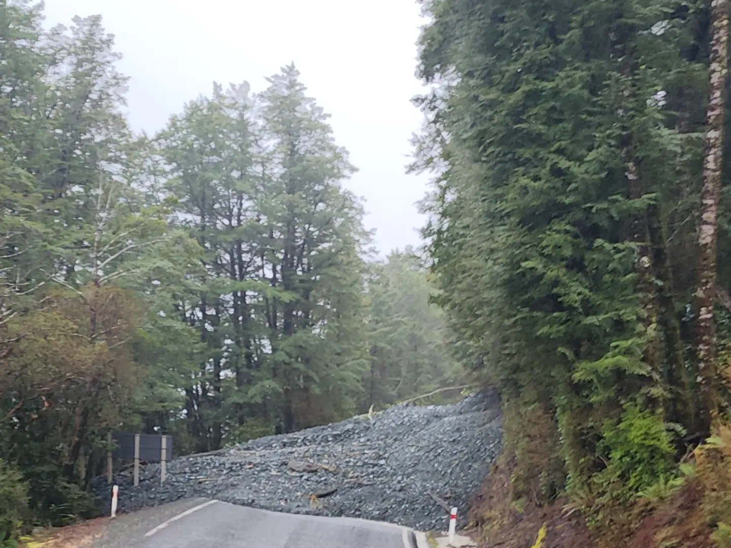
NZ Transport Agency Waka Kotahi advised about 9.30am that Haast Pass (State Highway 6) was closed owing to a slip, while the Milford Road (SH94) is closed from Cascade Creek due to landslides and fallen trees covering the road.
The Central Otago District Council says there are "a number of areas" across the region with surface flooding, and heavy rain is continuing to fall.
The council said Clyde, Alexandra, Lowburn and Pisa Moorings were the worst-affected areas.
It advised motorists to travel only if it was essential, and to "please stay off roads if you do not need to be out there".
The whole of the South Island is being lashed by the wild weather, which has cut power to tens of thousands of people and caused scores of flight cancellations.
A slew of flights at both Dunedin and Queenstown airports have been affected.
- Allied Media