A mild start to the week looks set to take a turn for the worse from tomorrow, with more snow on the way for parts of the South.
Niwa meteorologist Ben Noll said a hybrid low-pressure system would hit the South Island tomorrow before moving on to the North Island on Thursday.
“It does look like the weather is going to go downhill as we go into Wednesday and then especially Thursday,” Noll said.
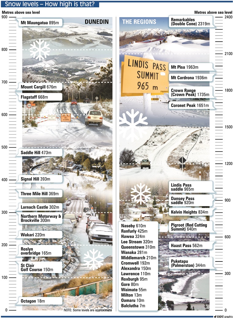
MetService has heavy rain watches in place for Fiordland and southern Westland from tomorrow into Thursday, and the forecaster said cold southeasterlies behind the front could bring snow as low as 300m in Otago and Southland.
“That is certainly going to be impacting some towns across the inland portions of those regions,” Noll said.
“Some snow could accumulate on the roadways in those regions, especially in the pass roads.”
Noll advised motorists to be mindful of the conditions.
MetService said snow warnings might be issued for parts of Otago and Canterbury on Thursday.
As the system moves up the country heavy rain is expected to strike Northland on Thursday evening before moving into Auckland and, potentially, the Coromandel Peninsula.
“The intensity of the rain could be enough to cause localised, surface flooding for the likes of Northland and maybe northern Auckland,” Noll said.
“The winds will also be quite strong, I think for especially east coast areas of Northland and northern Auckland.”
MetService said it was moderately confident that warning levels of rain would fall across those regions.
- additional reporting ODT Online