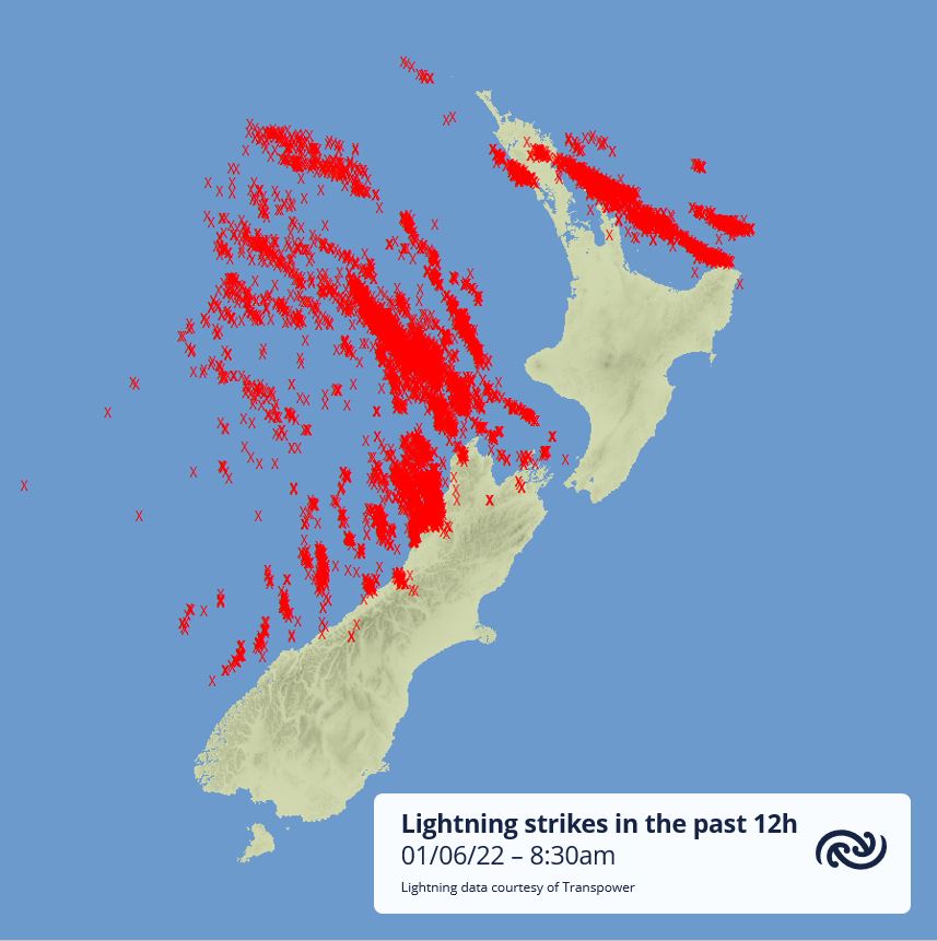
MetService said the lightning strikes were detected over land in the 12 hours leading up to 8.30am on Wednesday.
Gusts of 120km/h and hourly rainfall of 44mm was seen in Northland, Auckland and Bay of Plenty overnight and early this morning as an active front crossed the area.
The risk of thunderstorms has decreased over the upper North Island, but they will continue in western regions south of Waitomo today, a MetService spokesperson said.
"As each line of showers passes over these regions it will bring another possible flash of lightning, period of flooding and damaging gusts," the spokesperson said.
"If you are heading out best to take a look at the current rain radar and, if you have to head out during one of these showers, be prepared for hazardous driving conditions."
Updates on road conditions can be found here.
"It’s a turbulent start to winter but not a cold one," the spokesperson said.
"As the low bringing this active weather moves east of the country on Friday, not only will it signal the start of a slow easing trend in the weather but it will bring in cooler air in from the south.
"As always, keep up to date with the latest forecasts which our meteorologists are monitoring 24/7 at metservice.com."