Storm-force gales, snow and monster seas are set to batter the country in an onslaught of wild weather.
Dangerous 9m waves or even higher are predicted to pound western coastal regions of both islands, with WeatherWatch.co.nz warning of a potentially damaging storm surge.
"These are exceptionally large waves and people should avoid being too near the water," said WeatherWatch head forecaster Philip Duncan.
On top this, snow is falling across inland Canterbury, Otago and Southland. It's expected to worsen tomorrow, descending to near sea level in the deep south.
Bitterly cold flurries are also expected to bring up to 2cm of snow on the central plateau today.
MetService said significant swells would pound west coast beaches of both islands for the coming two days.
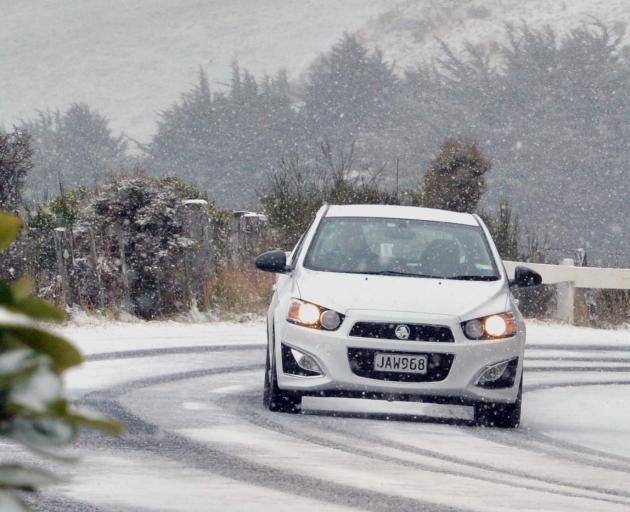 Road snowfall warnings have been issued for the Crown Range and alpine passes as a strong "southwest change” is set to also bring rain across the regions from today.
A heavy snow watch is in force for Fiordland, south of Dagg Sound, and Southland, south of Mossburn, and Clutha, with periods of snow above 400 metres from 2pm today until 4pm on Thursday, MetService said.
The cold temperatures will also bring the possibility of snow in Central Otago and the Queenstown Lakes.
"As the front moves through, it is likely that most places will see a pick-up in the winds," MetService meteorologist Tahlia Crabtree said.
Tonight would also bring more rain and, possibly, thunder to Fiordland, Southland, Clutha and Stewart Island. Heavy rain, small hail and squally winds gusting 90 to 110 km/h could also be expected in these areas.
More showers were set to arrive for the regions tomorrow, along with the cold southerly wind and subzero temperatures, MetService meteorologist Lewis Ferris added.
"Those cooler temperatures do tend to hang around through the rest of the week as we maintain a general southwesterly flow over the country."
This was also likely to be followed by fine weather for the weekend across the regions, he said.
ROAD SNOWFALL WARNINGS
• Dunedin to Waitati Highway (Northern Motorway SH1)
Snow showers are expected early tomorrow morning. Between 2am and 7am on Thursday, up to 1cm may accumulate on the road above 200 metres.
• Crown Range Road (linking Queenstown and Wanaka)
Snow showers are expected tonight and much of tomorrow. Between 10pm tonight and 6pm on Thursday, 1-3cm may accumulate near the summit, with lesser amounts down to 200 metres.
• Milford Road (SH94)
Snow showers are expected to return this afternoon, then become persistent tonight and continue through much of Thursday. Between 8pm tonight and 7pm on Thursday, 20-25cm may accumulate about the summit, with lesser amounts down to 200 metres.
• Lewis Pass (SH7)
A period of snow is expected tomorrow morning and afternoon. Between 7am and 4pm on Thursday, 3-4cm may accumulate about the summit, with lesser amounts down to 500 metres.
• Arthur's Pass (SH73)
Snow is expected tonight and for much of tomorrow. Between 10pm tonight and 6pm on Thursday, 5-8cm may accumulate about the summit, with lesser amounts down to 400 metres.
• Haast Pass (SH6)
Snow showers are expected tomorrow afternoon. Between 1pm and 6pm on Thursday, 1-2cm may accumulate about the summit, with lesser amounts down to 300 metres.
• Lindis Pass (SH8)
Snow showers are expected at times tomorrow. Between 3am and 8am,and again between 3pm and 8pm on Thursday, 1-2cm may accumulate about the summit, with lesser amounts down to 300 metres.
• Desert Road (SH1) Central North Island
Showers are expected to turn to snow about the summit of the road for a time this afternoon. Between 1pm and 5pm, 1-2cm may accumulate about the summit. Further snow showers are possible about the summit of the road on Thursday night and Friday morning, when 1-3cm could accumulate about the summit.
- Additional reporting NZ Herald and ODT Online