
Roads in Christchurch are flooding, amid heavy rain and snow forecasts for parts of Canterbury and the cancellation of some Cook Strait ferries.
Orange heavy rain warnings are in place today for Kaikoura, Banks Peninsula and Canterbury, while a heavy rain watch is in place for Canterbury south of Amberley, and north of Timaru.
Snowfall warnings have been issued for Canterbury alpine roads the Lewis Pass (State Highway 7), Arthur's Pass and Porters Pass (both SH73), and the Lindis Pass in Otago. Porters Pass is set to get between 10 and 15cm.
In the North Island, heavy swell warnings are in effect for the Wellington and Wairarapa coasts.
MetService said there was a high chance of an upgrade to a red heavy rain warning in Canterbury, north of Amberley, covering the period from 10am today until 9am tomorrow.
The forecast is for 160mm to 210mm of rain, on top of what has already accumulated, with snow gradually lowering to 700 metres tonight.
That means dangerous river conditions, flooding and slips are likely. Dangerous driving conditions and road closures are also expected.
An orange warning also covers the Kaikoura Coast and ranges, expected to get 150mm to 200mm of rain from midday today until 6am on Friday.
MetService meteorologist Mmathapelo Makgabutlane said conditions should start clearing up by the weekend.
"It is expected to be at least a couple of days. And so today, Wednesday, we're expecting everything to really start kicking off. Tomorrow, Thursday, will be another day to keep a close eye on, as well as Friday.
"But it does look like as we head into the weekend, most of the country should be rid of that weather and by Sunday, things are looking pretty good across the country."
Snowfall warning for alpine roads
Periods of heavy snow down to 700 metres is forecast for the Canterbury High Country, south of the Rangitata River, from 6pm today until 10am tomorrow. Snowfall amounts may approach warning criteria.
The snow would be welcome news for ski fields, Makgabutlane said.
"At this early stage, I'm sure we'll definitely take any snow that we can get. However, it is quite unseasonal, so in terms of the ski fields, we'll definitely be crossing our fingers for more snowfall as the season goes on."
Lewis Pass (SH7)
Valid: 15 hours from 9am on Thursday until 12am on Friday
Snow expected to affect the road near the summit, where 2 to 5cm is likely to accumulate.
Arthurs Pass (SH73)
Valid: 21 hours from 9pm on Wednesday to 6pm on Thursday
Snow forecast to affect the road near the summit, where 1 to 3cm of snow may settle at times. Lesser amounts likely lower down.
Porters Pass (SH73)
Valid: 18 hours from 9pm on Wednesday until 3pm on Thursday
Between 10 to 15 cm of snow expected to settle on the road near the summit, with lesser amounts to 700 metres.
Lindis Pass (SH8)
Valid: 12 hours from 8pm on Wednesday until 8am on Thursday
Snow set to affect the road near the summit, where 1 to 3cm is likely to settle. Lesser amounts likely lower down.
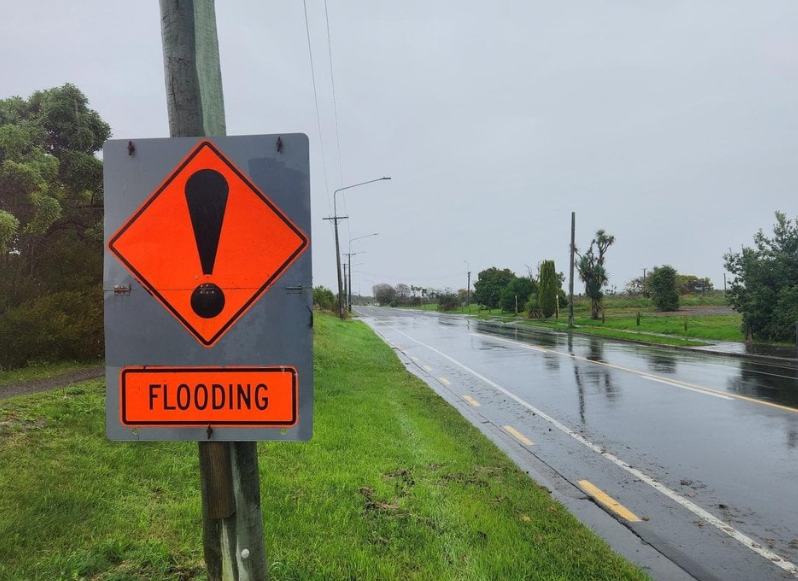
Christchurch roads closed
Christchurch City Council contractors had been preparing ahead of the downpour, clearing gutters, sumps, stormwater grates and beach outfalls.
New Brighton Rd between Rawson St and Pages Rd, and Avonside Dr between Wainoni Rd and Kerrs Rd, were closed due to flooding from late this morning.
The heaviest rainfall was expected in the western Port Hills and the southern part of Banks Peninsula, the council said.
"It's a good idea to clear your rain guttering and drains and if you know there are leaves blocking sumps or drains by your property, it would help us if you could remove them, and put them in your green wheelie bin.
"Our stormwater network is designed to cope with heavy rain and our road network is also part of our stormwater network playing an important role during wet weather events. In most parts of the city our roads have been designed as secondary flow paths for stormwater so in heavy rain its normal to see some flooding on our roads."
The council was also managing water levels in the Ōpāwaho Heathcote River.
"Residents along the upper and mid-reaches of the river can expect fluctuations of water levels at any time before, during and after the rainfall event, even during periods of dry weather. This is to reduce peak flood levels during the rainfall event by maximising the use of the storage volume in the basins."
Time to hunker down: Hurunui mayor
Hurunui District mayor Marie Black said rain had been falling steadily in the region today.
"It is very much a watch and wait situation. The prediction is for heavier falls, but from a district perspective - there are no issues that we can't manage at this point, and we've got our teams ready to go to support the community as if and when that's required."
The worst of the rain was expected north of Amberley, which encompassed most of the district and she said preparation was under way should the warning be upgraded to red.
"If it does eventuate, we've had good warning by the MetService and obviously we will manage that accordingly."
Black said people should take care on the roads and take the chance to check in on friends and neighbours. "This is really the time when we need to hunker down and look after each other."
Ferries cancelled
Strong wind watches have been issued for the Buller, Grey, Westland and Nelson Lakes districts, the Marlborough Sounds in the South Island and and Wellington, along the south coast, including Wairarapa north of Castlepoint, in the North Island.
Southeast winds may approach severe gale in exposed places.
MetService has issued heavy swell warnings for the 33-hour period between midday tomorrow until 9pm on Friday.
Waves of 6 metres were forecast off Wellington - Cape Terawhiti to Turakirae Head from 3pm tomorrow until noon on Friday, while swells rising to 7 metres were expected off Wairarapa - Turakirae Head from midday tomorrow until 9pm on Friday.
"This weather system that's bringing all of this weather that we're expecting is also going to be generating some large swells, but also the wind's generating some large waves on top of that and causing all sorts of problems and disruptions," Makgabutlane told RNZ's Morning Report programme.
Interislander said it had cancelled crossings from 8.30pm today 2.30am on Friday, and there would be extra sailings put on over the weekend to accommodate passengers. More cancellations were likely on Friday if conditions did not improve.
Bluebridge was cancelling sailings from 1.30pm today and all of tomorrow.
Homer Tunnel closures
The Homer Tunnel on the Milford Road (SH94) in Southland is closing from 6.30pm to 3am for maintenance works from today until May 2, then from May 3-23 from 6pm until 3am.
"No public access during these closures due to heavy equipment operating in tunnel."
- APL and RNZ


