PHOTO
The brakes have been put on the carving up of rural land in the Waimakariri district in the council’s proposed District Plan, which was notified on September 18.
The council has hit pause on small rural subdivision, mainly in the west of the district, to ensure the district’s rural character is maintained, and there is enough productive farmland for future generations.
It has introduced a 20 hectare minimum in a general rural zone, and 4ha minimum in a rural lifestyle zone.
The Proposed District Plan, a 30 year strategic guide, specifies new and expanded areas for development, protects environmental features, ensures productive use of farmland by creating two rural zones, and aims to enable the community to grow in a managed and appropriate way.
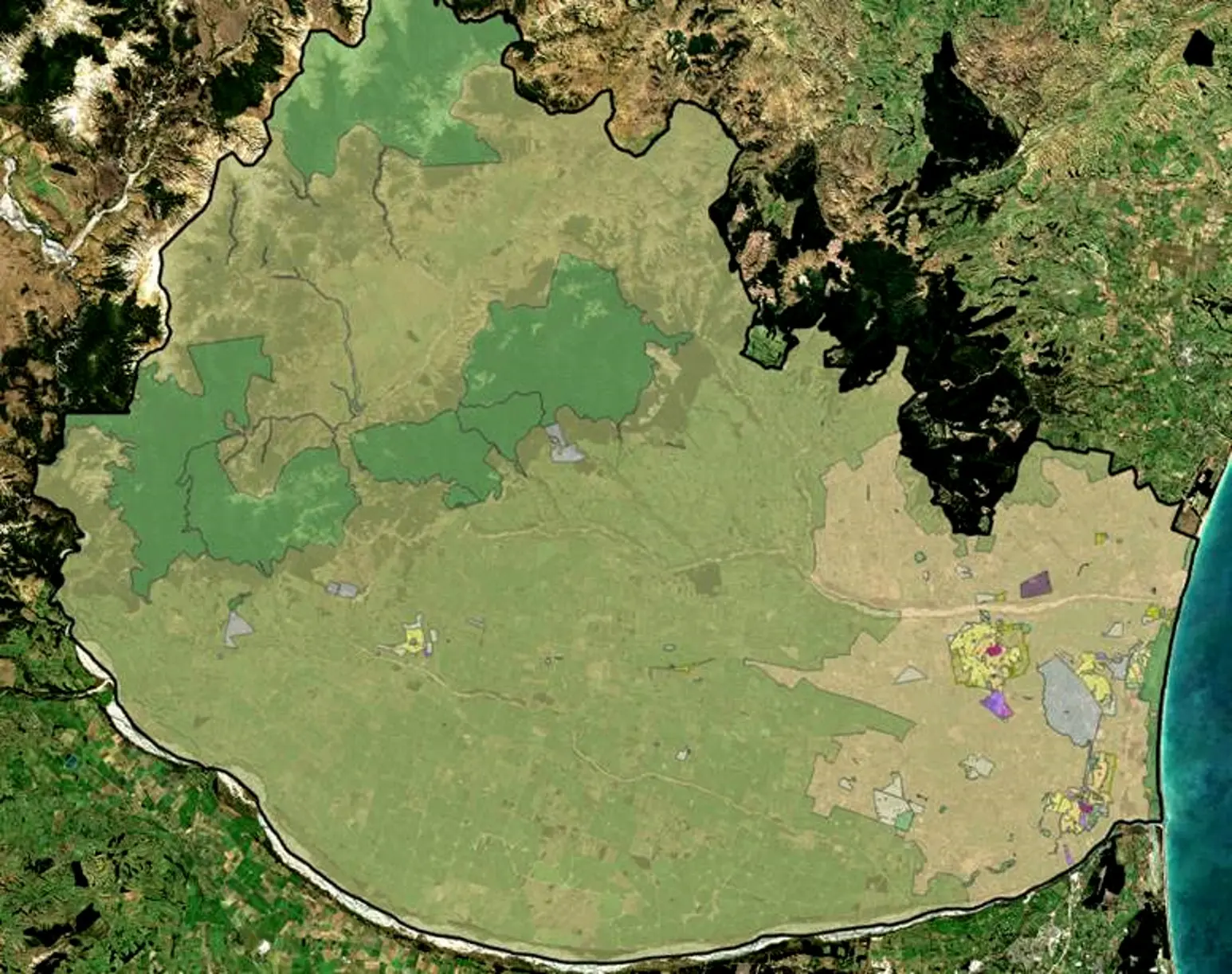
Interactive maps on the council’s website allow residents to enter their address to see what zone they fall in, and provides details of other features in the plan such as natural hazards.
The 20 hectare minimum in the general zone, which is mostly confined to the west of the district, is likely to be the biggest talking point of the plan.
It makes up the majority of the rural area within the district with a focus on retaining the productive potential of land for primary production and rural activities.
The 4ha zone, focused in the east of the district, is an area comprising of the densest residential unit and development site pattern in the rural areas of the district.
The rural changes come into immediate effect, which means some applications may be “stuck” between the operative and proposed District Plan.
The council, which is assessing the impact of the proposed plan on these applicants, will be contacting them to discuss a way forward.
There are five rural residential zones, providing large living areas of 5000 square metres on the fringes of the district’s large urban areas, with one of the more significant locations being Loburn.
The second generation District Plan is designed for online use, and includes proposed zones tailored to be consistent with the Selwyn District and Christchurch city councils.
Waimakariri Mayor Dan Gordon says staff have listened to residents and incorporated their aspirations into the proposed plan.
“We’re one of the fastest growing areas in New Zealand and expect up to 15,000 houses may be needed to accommodate our population which will near 100,000 over the next 30 years.
“Because of this, there are some changes the community have asked the council to make to ensure the district continues to grow in a suitable and sustainable way.
“We expect that the proposed District Plan will become operative within two years following the hearings and appeals process. Until then, current rules apply those in the proposed plan that have immediate legal effect.”
■ Residents can view the proposed District Plan online to check for any changes that might affect their property and make a submission at letstalk.waimakariri.govt.nz. Council staff will also be available to answer questions at the Rangiora Service Centre during business hours or at several ‘Talk to a Planner’ drop-in sessions being held around the district. Submissions close at 5pm on November 26.