Ironically, tomorrow is officially the first day of spring.
MetService meteorologist Peter Little said rain would spread up the South Island tonight and tomorrow, and snow would lower to 300m in the south and east.
Temperatures will reach a high of just 7 deg C.
The heaviest snow is expected to fall in the Canterbury foothills and inland ranges about and south of the Rakaia River, between 4am and 7pm tomorrow.
Up to 20cm was forecast to accumulate above 500m, and lesser amounts down to 300m.
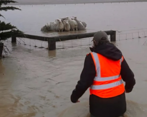
It may disrupt travel in affected areas and could damage trees and powerlines. Cold conditions may also cause stress for livestock, he said.
Snow is expected to affect the Lindis Pass (SH8) road from early Tuesday morning to Tuesday afternoon.
Between 4cm and 8cm of snow may accumulate on the road above 500m, with lesser amounts elsewhere.
On the Crown Range Road, snow is expected to affect the road during Tuesday morning, with 2cm to 4cm of snow on the road above 500m and lesser amounts elsewhere.
Snow is also forecast to affect the Milford Road (SH94) during early Tuesday morning. Between 1cm and 3cm of snow may accumulate on the road above 500m.