MetOcean Solutions, which is part of the New Zealand MetService, has been awarded $500,000 for a two-year project to develop a predictive tool using machine learning that will help southern farmers and contractors make harvesting decisions, and keep forestry workers safe.
Raglan-based MetOcean technical manager Dr Dave Johnson and his team are developing a hyper-local and precise forecasting system, which will analyse the huge amounts of data sent from satellites, and identify potential and immediate, rapidly developing, localised convective (ie thunderstorms, squalls, hail, heavy rainfall) weather events.
He said traditional weather forecasting using experienced humans was resource intensive and had limited accuracy, so MetOcean and its partners wanted to develop a system of machine learning - algorithms - that would allow a computer to look at massive amounts of data from the satellite and analyse it quickly and accurately.
'`'`It would '`learn' to predict a weather event developing in a particular spot and in what timeframe,'' he said.
'`'`The application of machine learning to satellite imagery for forecasting hyper-local, convective weather events with a greater degree of accuracy, is world-leading.''
He said it was the '`'`next big paradigm shift for local and immediate weather forecasting''.
The fully automated system would not get tired, always be objective and eventually reduce costs.
Human forecasters would not be replaced, but would be free to work on more interesting projects.
He saw the technology eventually being transferred to consumers as a smartphone app.
The research project is being run in collaboration with the Auckland University of Technology's Knowledge Engineering and Discovery Research Institute, and MetService.
Funding came from the Ministry of Business, Innovation and Employment's Endeavour Fund last year.
The tool would be useful to advise trampers of extreme weather events on mountain tracks, so they would have time to get to safety, or warn residents of possible heavy rainfall in the hills above a town, which would likely cause a flash flood (as happened in Roxburgh last year).
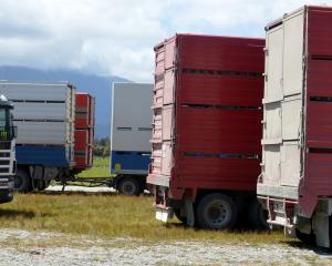
It could also warn farmers at a specific location, of heavy rain that would occur on that spot in the next hour or two, so they could move their stock to higher ground, or postpone contractors who had been booked in to cut silage or hay.
The tool would also be useful for commercial fishermen off the coast of New Zealand, as it would warn them of predicted rough seas in the next hour so they could move to shelter.
In addition, the tool would be useful for logging contractors working in a tinder dry forest as the app could warn about potential lightning strikes.
During the first year of research, Dr Johnson said they were likely to develop a system, which had the ability to identify significant weather features.
After two years, they would also have the predictive capabilities.
-By Yvonne O'Hara